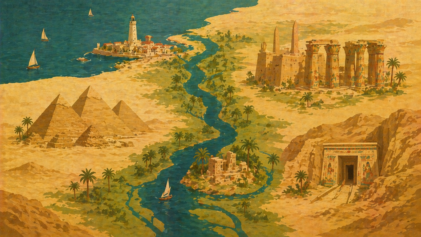
Major Sites & Geography
The places where three thousand years of civilization unfolded — and where the biblical narrative meets the archaeological record
Egypt is the Nile. Without the river's annual flood depositing rich silt across the floodplain, the civilization that built the pyramids, produced the Book of the Dead, and shaped the biblical narrative could never have existed. A narrow ribbon of green cuts through the eastern Sahara — rarely more than a few miles wide — and along that ribbon, one of humanity's greatest civilizations flourished for three millennia.
Understanding Egypt's Geography
Upper and Lower Egypt
Egyptian geography seems backward to modern readers: Upper Egypt is in the south, Lower Egypt is in the north. This is because the Nile flows northward — from the highlands of East Africa to the Mediterranean Sea. "Upper" and "Lower" refer to elevation, not compass direction.
- Upper Egypt — The narrow Nile valley stretching from Aswan (the first cataract) to just south of Cairo. Major cities: Thebes/Luxor, Edfu, Elephantine. This is the land of temples, tombs, and the Valley of the Kings.
- Lower Egypt — The broad Nile Delta, where the river fans out into multiple branches before reaching the Mediterranean. Major cities: Memphis, Alexandria, Avaris/Pi-Ramesses, Goshen. This is the land of agriculture, trade, and — in biblical terms — the land of Israel's sojourn.
The Double Crown of the pharaohs combined the White Crown of Upper Egypt and the Red Crown of Lower Egypt, symbolizing the unity of the two lands — a unity that was always somewhat tenuous and that broke apart during each intermediate period.
The Nile's Cataracts
Six cataracts (stretches of rapids and shallow water) interrupt the Nile between Aswan and Khartoum. The first cataract at Aswan marked Egypt's traditional southern border. Elephantine Island, site of the Jewish military colony, sits at this first cataract — literally at the edge of Egypt.
The Sites
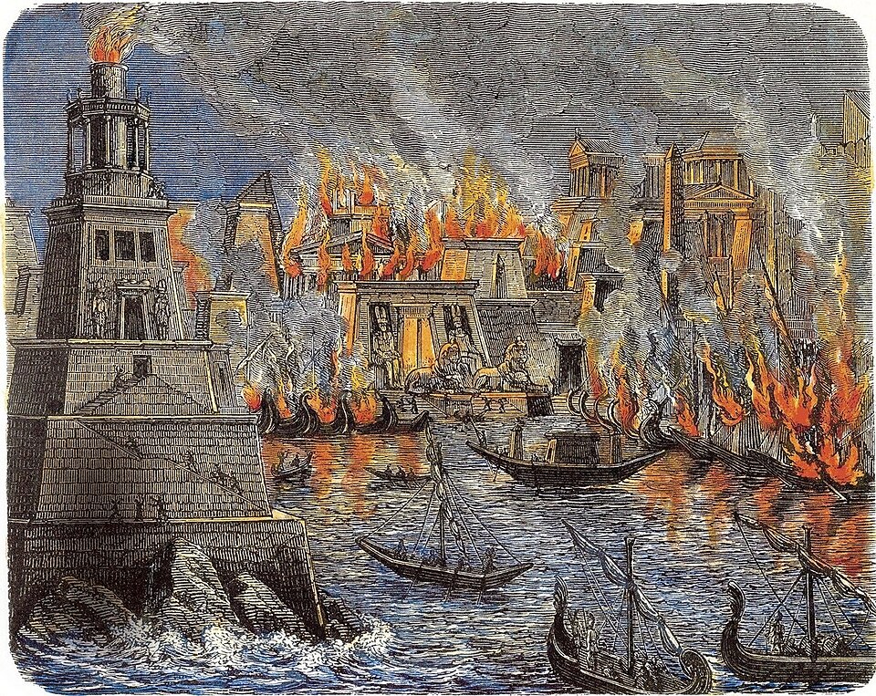
The Burning of the Library of Alexandria — 19th-century engraving depicting the destruction of antiquity's greatest repository of knowledge. Wikimedia Commons.
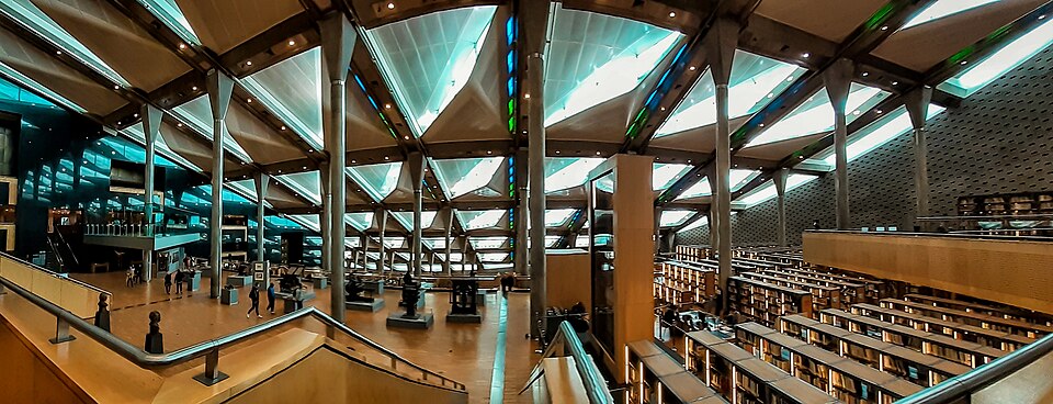
The reading hall of the Bibliotheca Alexandrina (opened 2002). Wikimedia Commons, CC BY-SA.
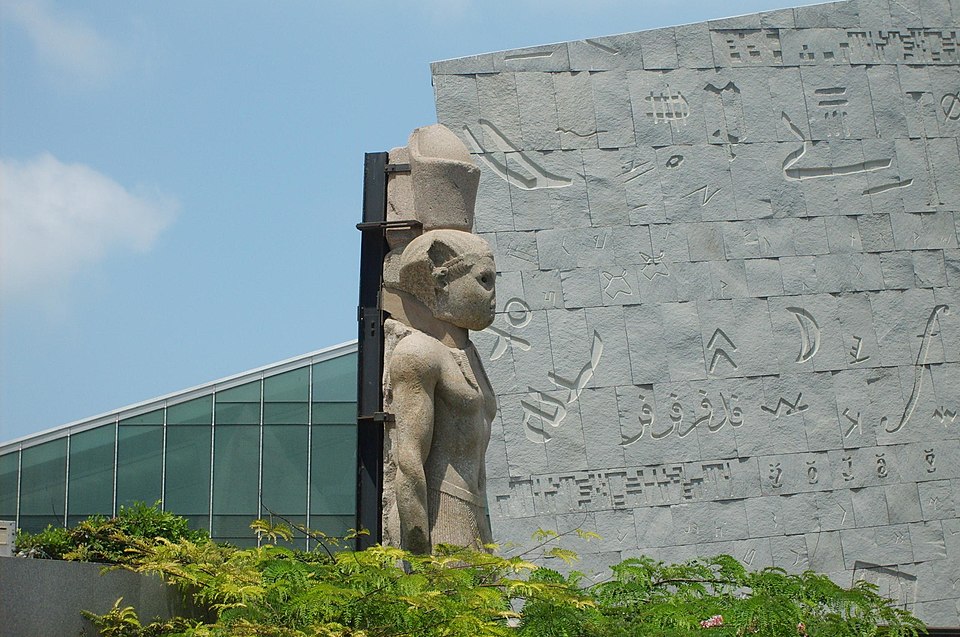
The Bibliotheca Alexandrina's exterior wall, carved with characters from writing systems around the world. Wikimedia Commons, CC BY-SA.
The Bibliotheca Alexandrina from the corniche. Wikimedia Commons.
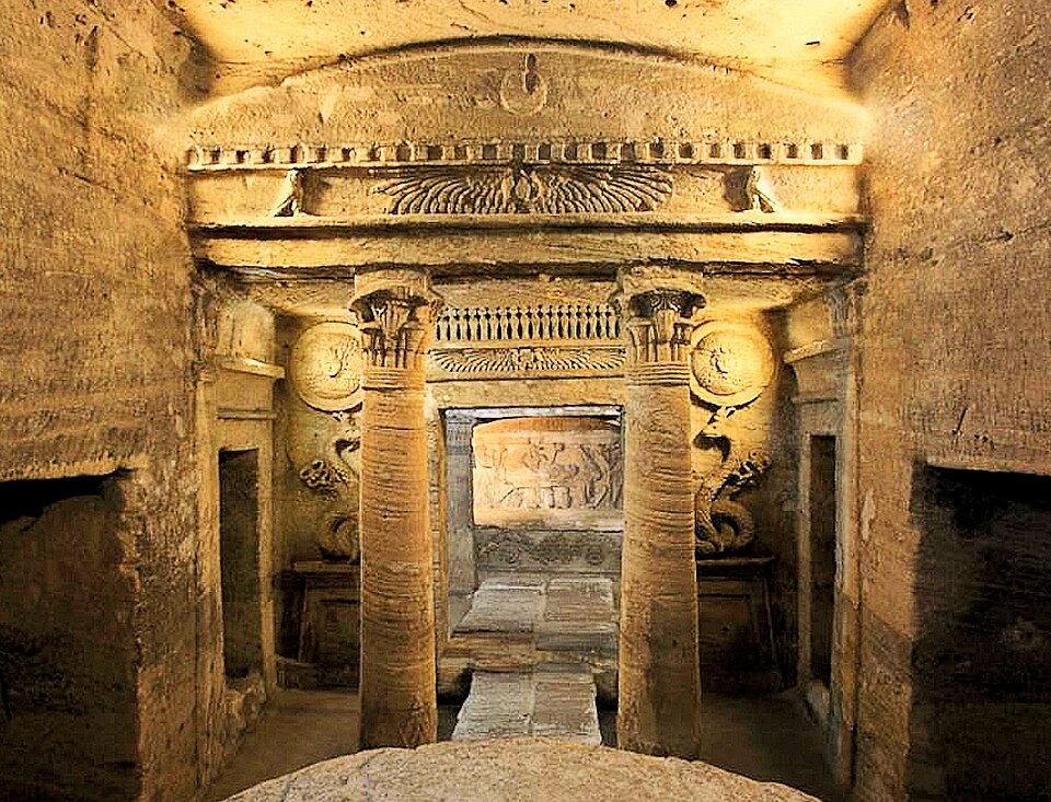
The main burial chamber of the Catacombs of Kom el-Shoqafa — blending Egyptian, Greek, and Roman funerary art. Wikimedia Commons.
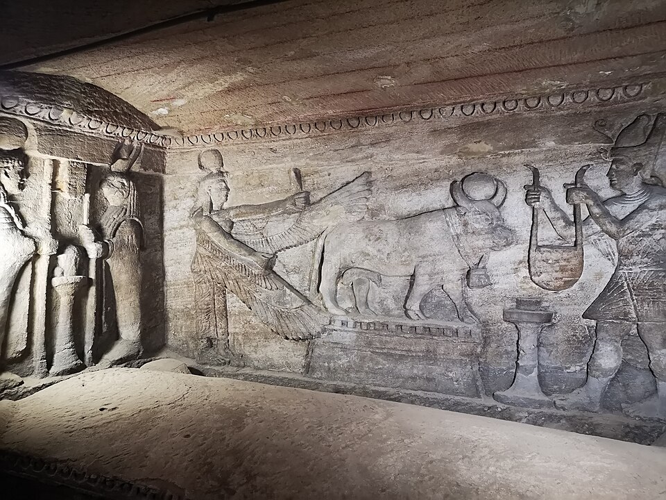
Egyptian-style relief inside the catacombs — Roman-era artists working in pharaonic tradition. Wikimedia Commons.
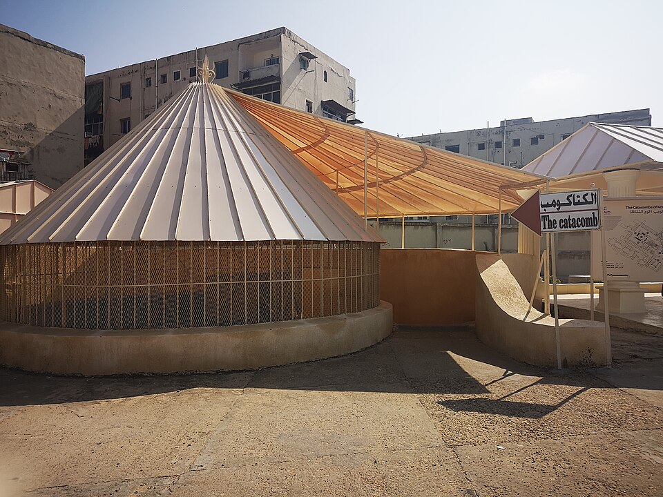
Entrance to the Catacombs of Kom el-Shoqafa. Wikimedia Commons.
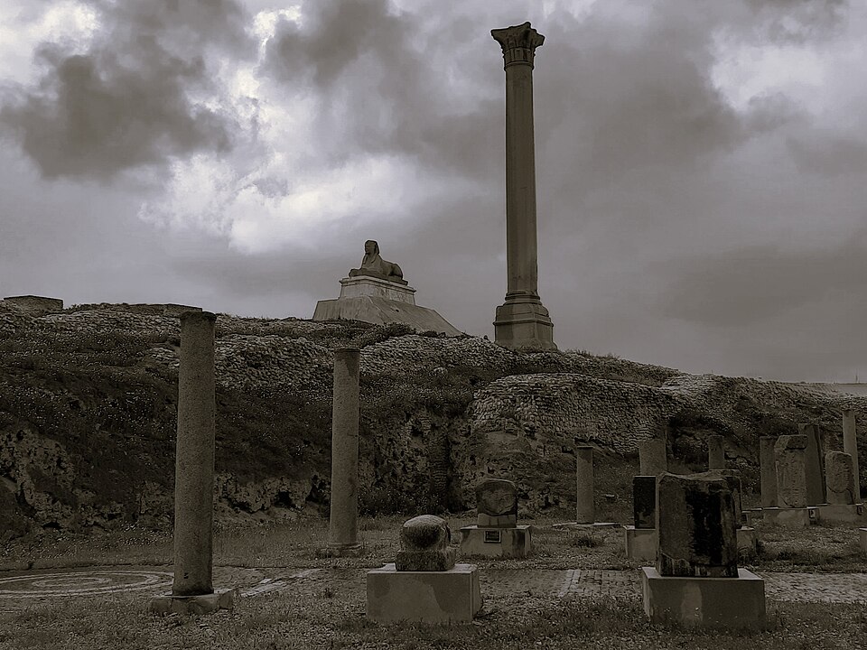
Pompey's Pillar with a Ptolemaic sphinx — the tallest ancient monolithic column in Egypt. Wikimedia Commons.
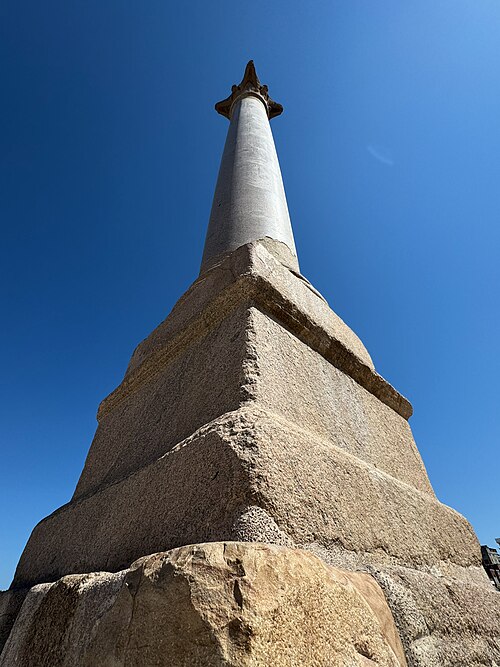
Pompey's Pillar, erected c. AD 297 in honor of Emperor Diocletian. Wikimedia Commons.
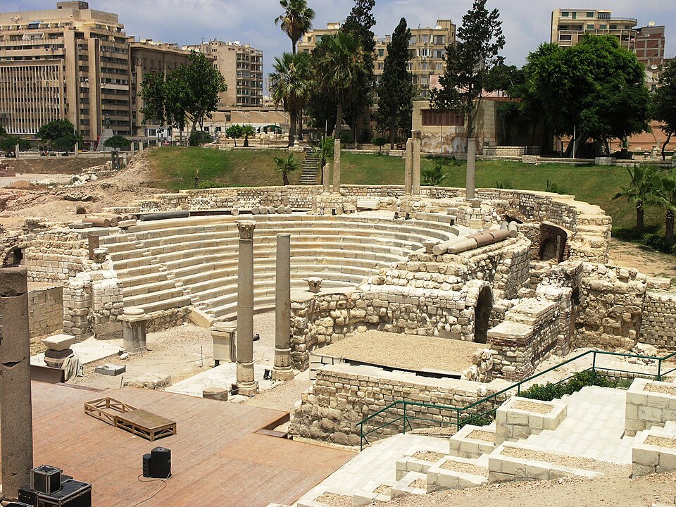
The Roman amphitheater at Kom el-Dikka — the only Roman theater discovered in Egypt. Wikimedia Commons.
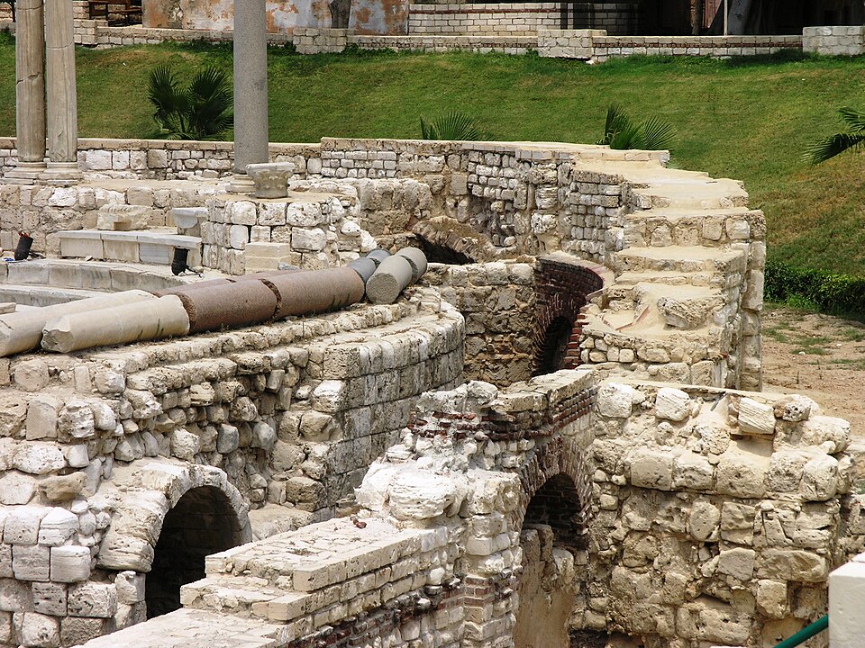
Arches and substructure of the Roman amphitheater. Wikimedia Commons.
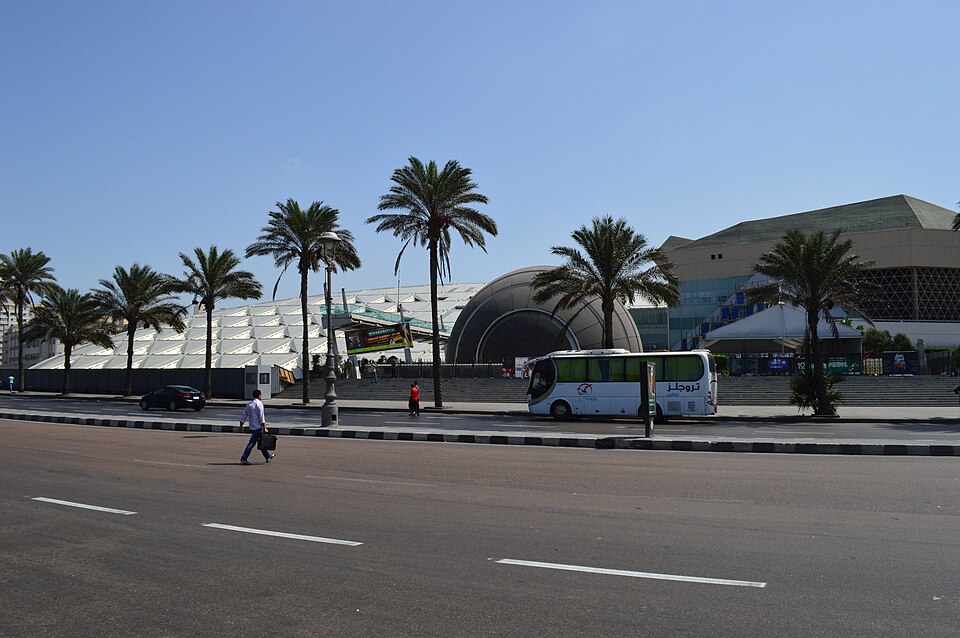
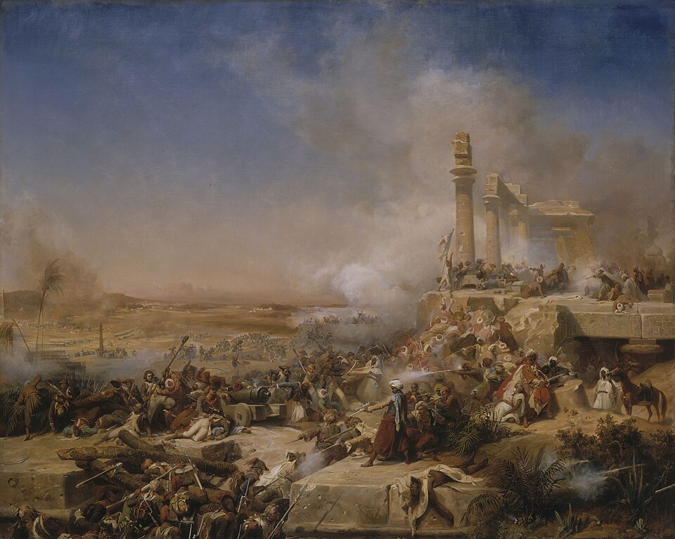
Founded by Alexander the Great in 331 BC, Alexandria became the intellectual capital of the Mediterranean world. Its Library (the Mouseion), established under Ptolemy II Philadelphus around 283 BC, aimed to collect all the world's knowledge and may have held hundreds of thousands of scrolls at its peak. The library suffered major damage during Julius Caesar's siege in 48 BC, and its remaining collections were likely destroyed during the decree of Emperor Theodosius I in AD 391. The Pharos Lighthouse, one of the Seven Wonders, guided ships into the harbor.
For Jewish history, Alexandria was home to the largest Jewish community in the ancient world, the birthplace of the Septuagint, and the home of Philo. For Christian history, it was the seat of one of the five great patriarchates, the birthplace of monasticism, and the intellectual home of Clement, Origen, and Athanasius.
The modern Bibliotheca Alexandrina, opened in 2002 near the site of the ancient library, is a deliberate echo of Alexandria's scholarly legacy. Today, most of ancient Alexandria lies beneath the modern city or underwater in the harbor. Visitors can also explore the Catacombs of Kom el-Shoqafa — Roman-era underground tombs blending Egyptian, Greek, and Roman funerary art — and Pompey's Pillar, remnants of Roman Alexandria.
Three names for overlapping areas of the eastern Delta that are central to the biblical narrative:
- Goshen — The biblical name for the region where Joseph settled his family (Genesis 47:6). The exact boundaries are uncertain, but it corresponds to the eastern Delta's pastureland.
- Avaris (modern Tell el-Dab'a) — The Hyksos capital (c. 1650–1550 BC), located within the Goshen region. Austrian archaeologist Manfred Bietak's excavations have revealed a Semitic settlement with Canaanite-style architecture, Syro-Palestinian pottery, and donkey burials — cultural markers consistent with a Semitic population living in Egypt.
- Pi-Ramesses — The great city built by Ramesses II in the eastern Delta, near the site of Avaris. Exodus 1:11 mentions that the Israelites built the store cities "Pithom and Raamses" — Pi-Ramesses is the most likely candidate for the latter.
Also in the Delta: Tanis (San el-Hagar), the 21st–22nd Dynasty capital whose royal tombs rival the Valley of the Kings (discovered 1939).
The geography of the Exodus: The eastern Delta is where the biblical narrative concentrates. Joseph's family settled here. The Israelites labored here. Moses confronted Pharaoh here. And the Exodus journey began here, heading east toward the Red Sea (or Sea of Reeds). Understanding that Goshen, Avaris, and Pi-Ramesses all occupy the same general region — the eastern Delta, closest to Canaan — helps make geographic sense of the entire patriarchal-through-Exodus narrative.
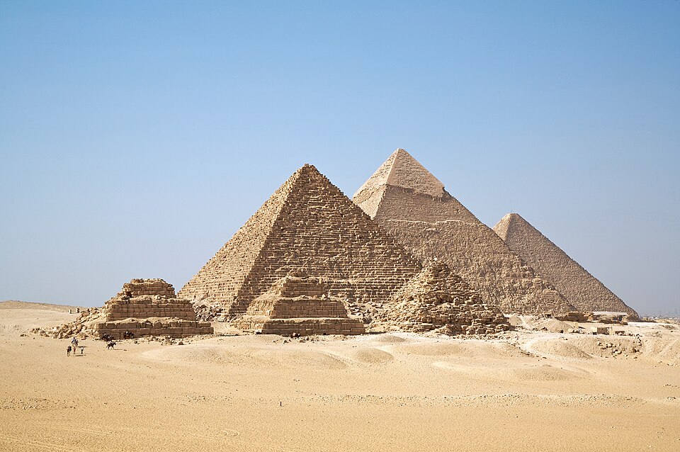
The three great pyramids of Giza — Khufu, Khafre, and Menkaure. Wikimedia Commons, CC BY-SA.
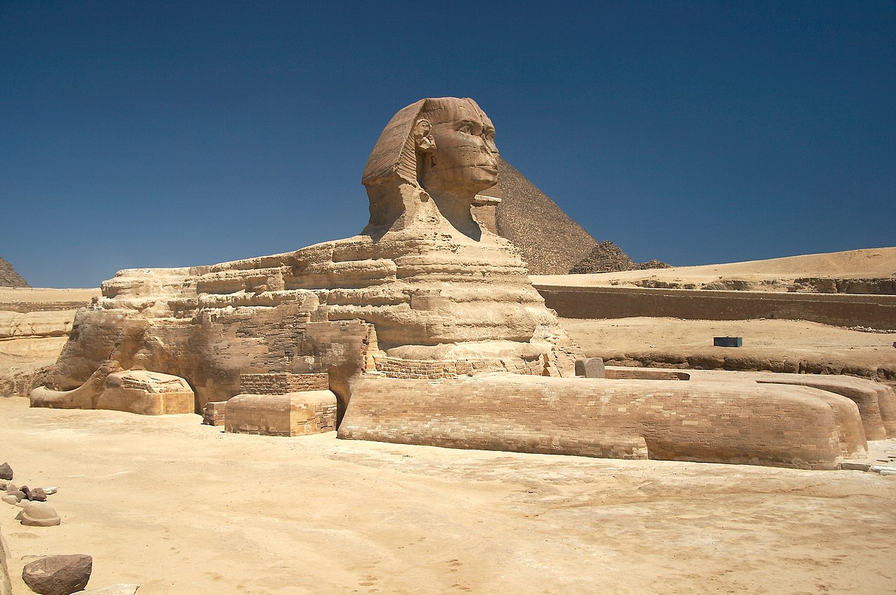
The Great Sphinx, with the Pyramid of Khafre behind. CC-BY-SA.
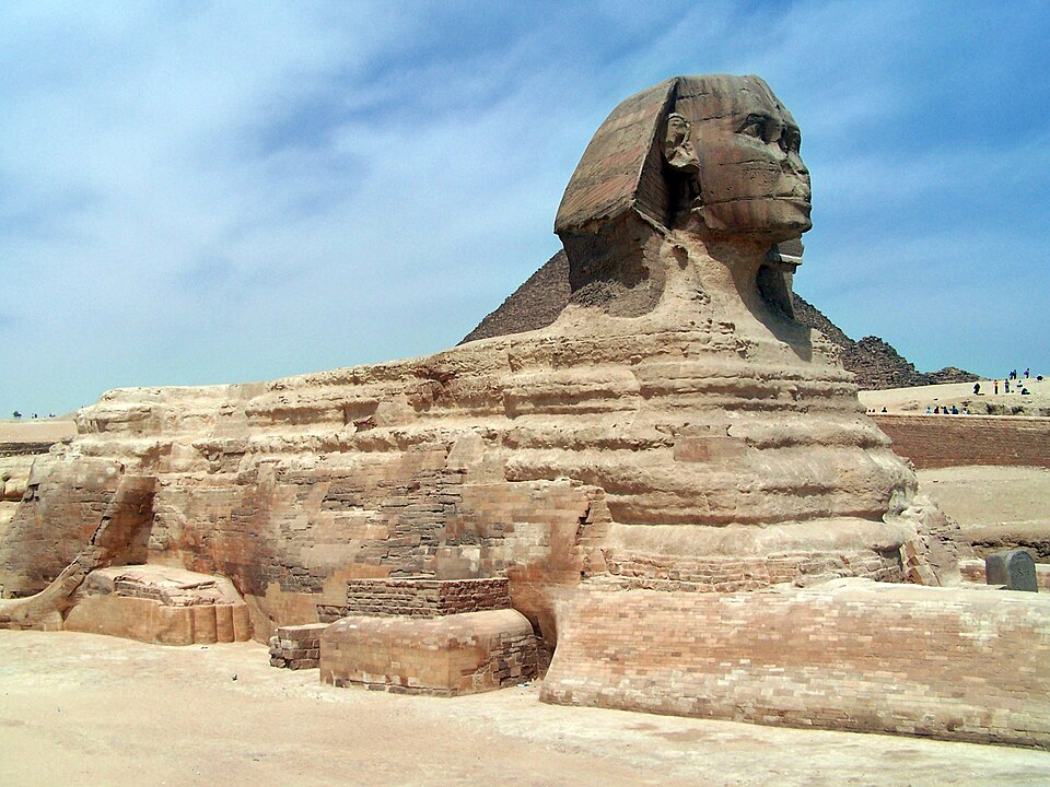
The Great Sphinx of Giza. Wikimedia Commons.
The three great pyramids — Khufu (the Great Pyramid), Khafre, and Menkaure — are the most iconic monuments of Egyptian civilization. The Great Pyramid stood as the tallest structure on earth for nearly 4,000 years (until the construction of Lincoln Cathedral's spire around AD 1311).
The pyramids were already over a thousand years old when Abraham entered Egypt. By the New Kingdom (Moses's era), they were ancient monuments that Egyptians themselves visited as tourists. The Great Sphinx, carved from the bedrock of the plateau, was periodically buried in sand and excavated even in antiquity.
Modern archaeology has established that the pyramids were built by organized labor forces (not slaves) — workers' villages, bakeries, and administrative records have been excavated at Giza. The adjacent Grand Egyptian Museum (opened 2025) — the largest archaeological museum in the world — houses over 100,000 artifacts, including Tutankhamun's complete treasures.
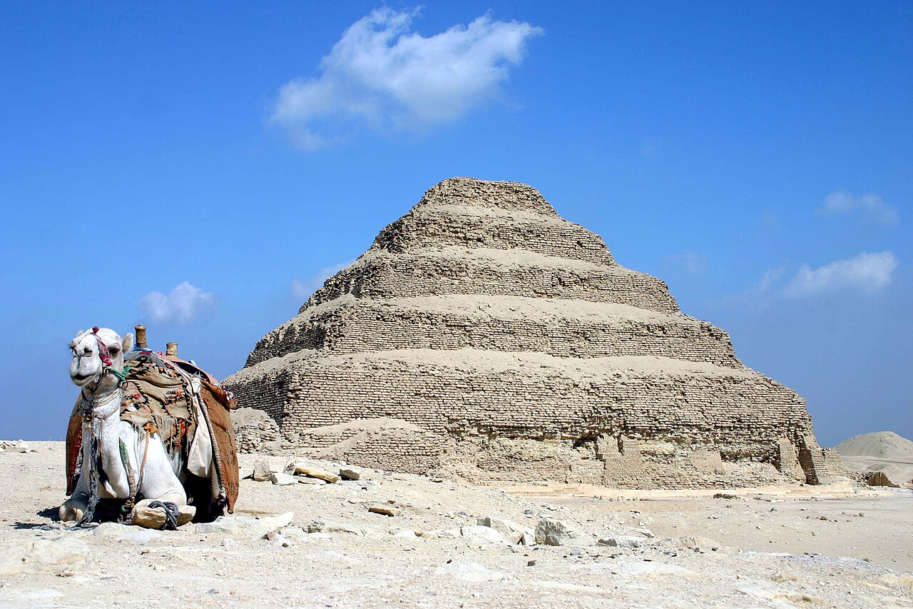
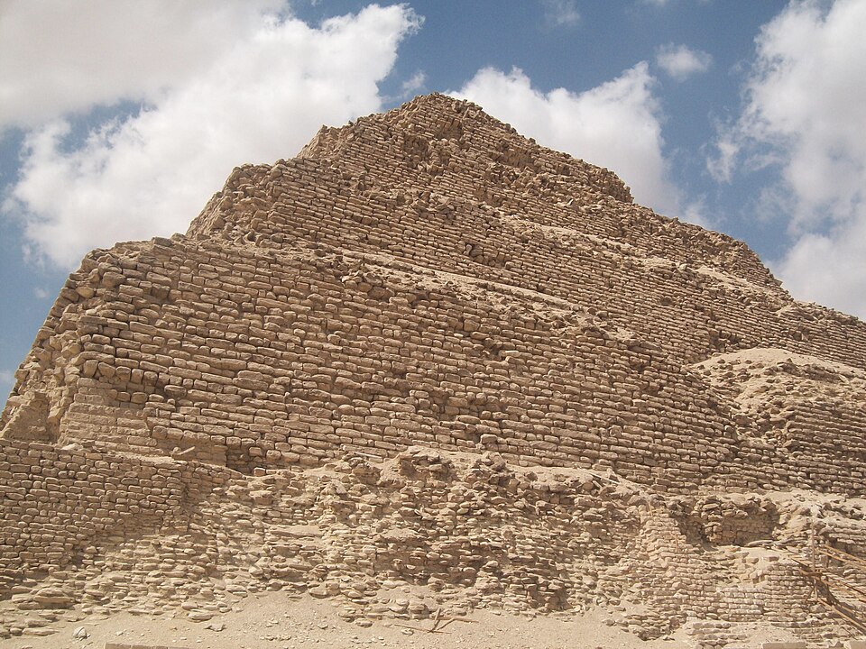
The Step Pyramid of Djoser (c. 2670 BC) — the world's oldest monumental stone structure. CC-BY-SA.
Close-up of the Step Pyramid's limestone blocks. Wikimedia Commons.
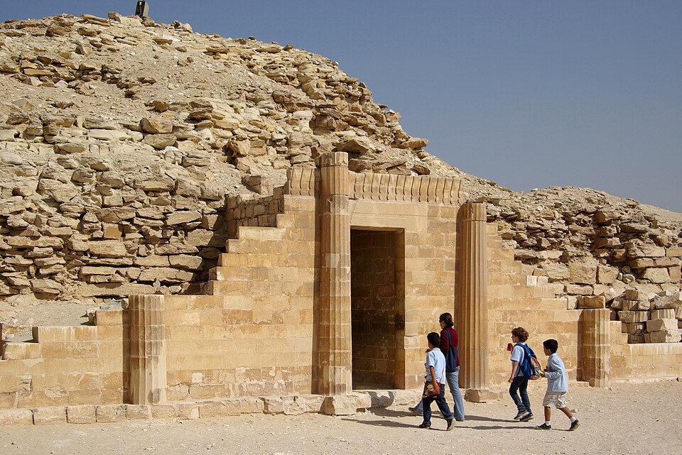
The columned entrance doorway to Djoser's funerary complex. Wikimedia Commons.
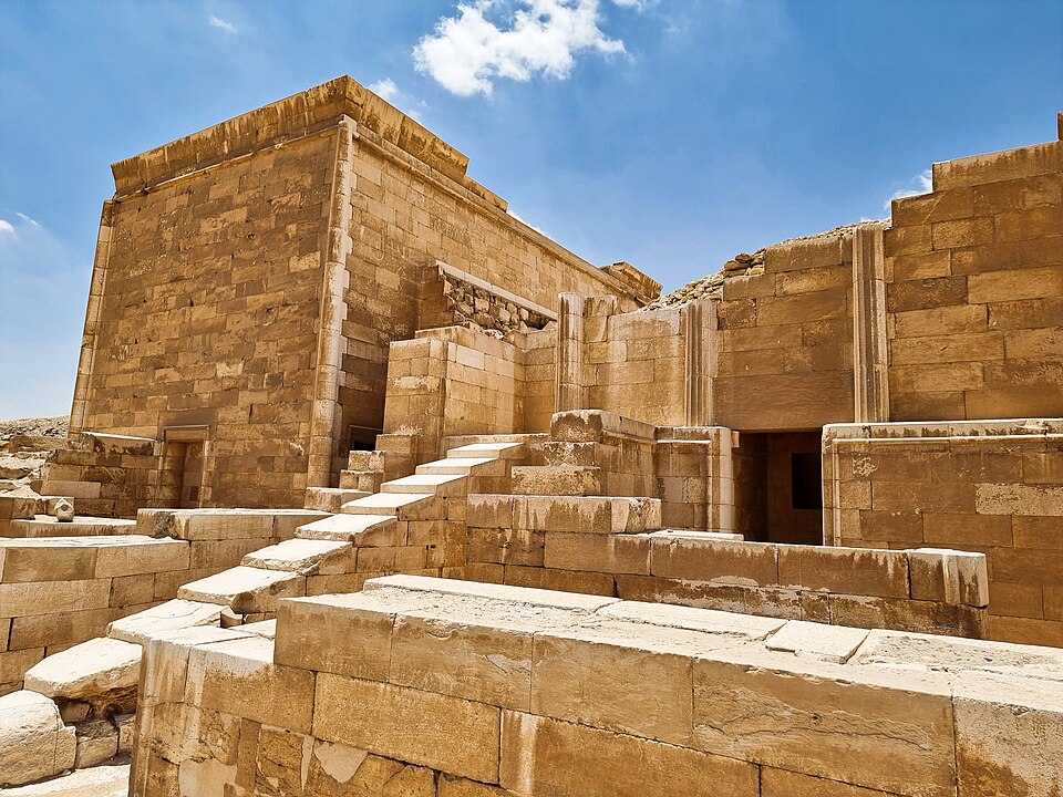
Ceremonial buildings within the Step Pyramid complex. Wikimedia Commons.
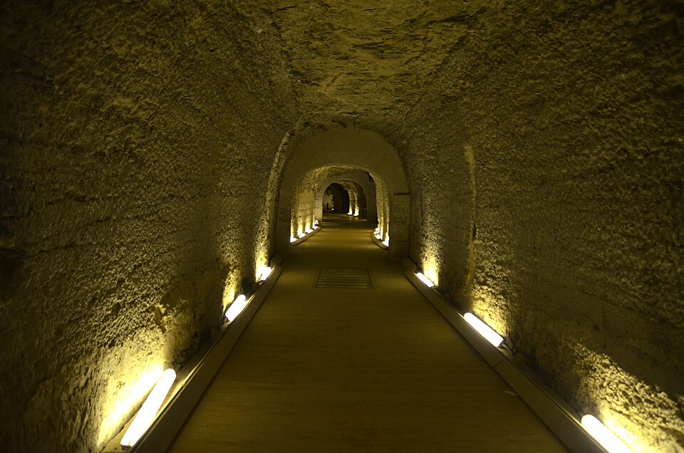
The Serapeum — underground catacombs where the sacred Apis bulls were entombed. Wikimedia Commons.
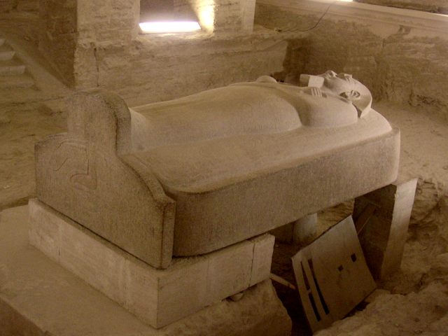
Saqqara is the vast necropolis of nearby Memphis, stretching across the desert plateau for nearly four miles. It contains burials spanning almost every period of Egyptian history. Its most famous monument is the Step Pyramid of Djoser (c. 2670 BC), designed by the legendary architect Imhotep — the world's oldest monumental stone structure and the prototype from which all later pyramids evolved.
Beyond the Step Pyramid, Saqqara holds the Serapeum — the underground catacombs where the sacred Apis bulls were mummified and entombed in enormous granite sarcophagi — as well as decorated mastaba tombs whose painted reliefs provide some of the most detailed images of daily life in the Old Kingdom. Recent excavations continue to uncover new tombs and workshops, making Saqqara one of Egypt's most active archaeological sites.
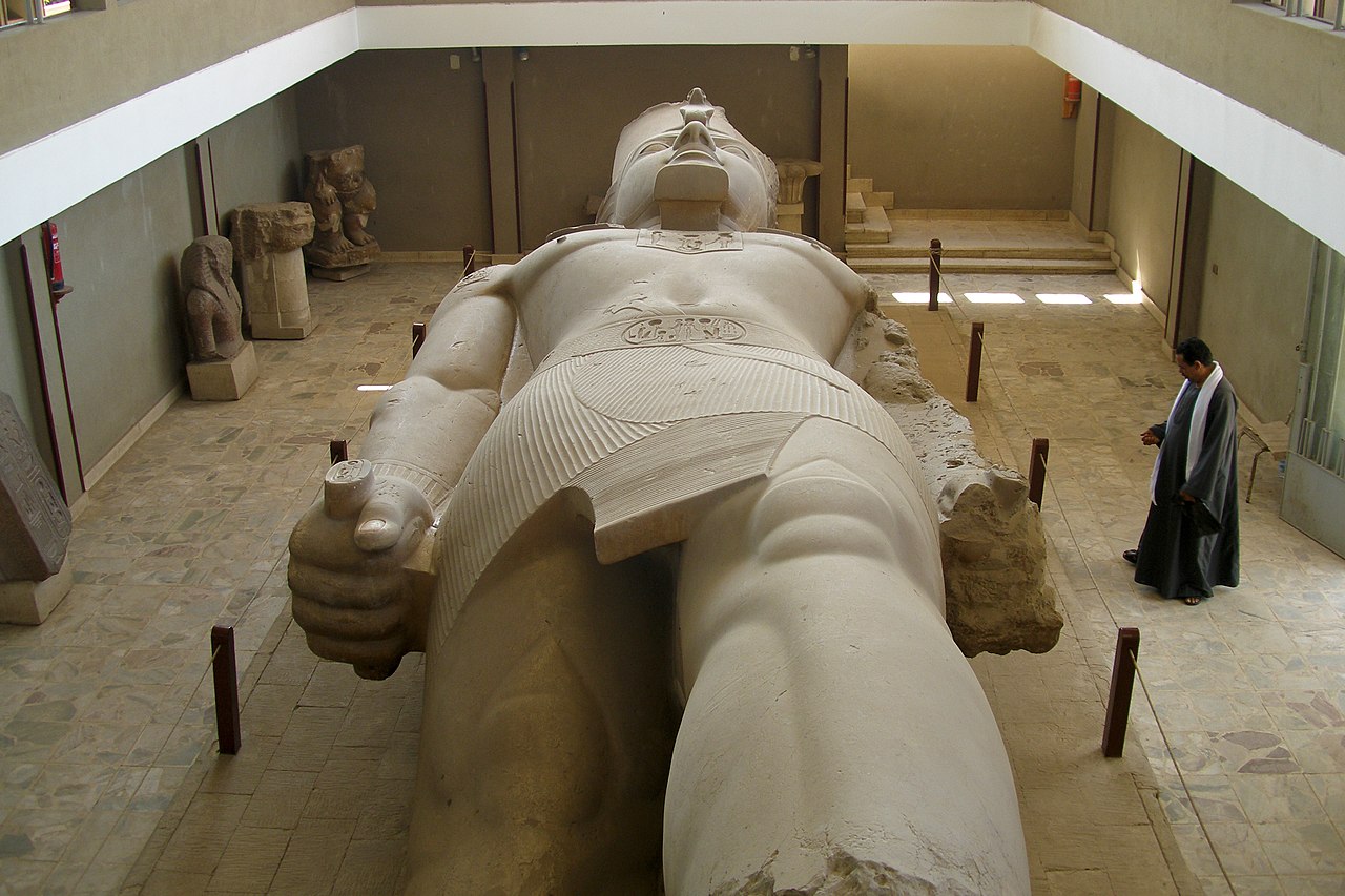
The fallen Colossus of Ramesses II at the Mit Rahina open-air museum. Wikimedia Commons.
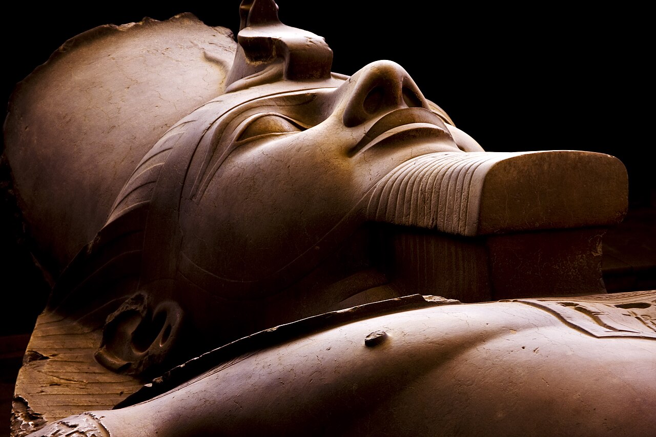
Detail of the Colossus of Ramesses II at Memphis. Wikimedia Commons.
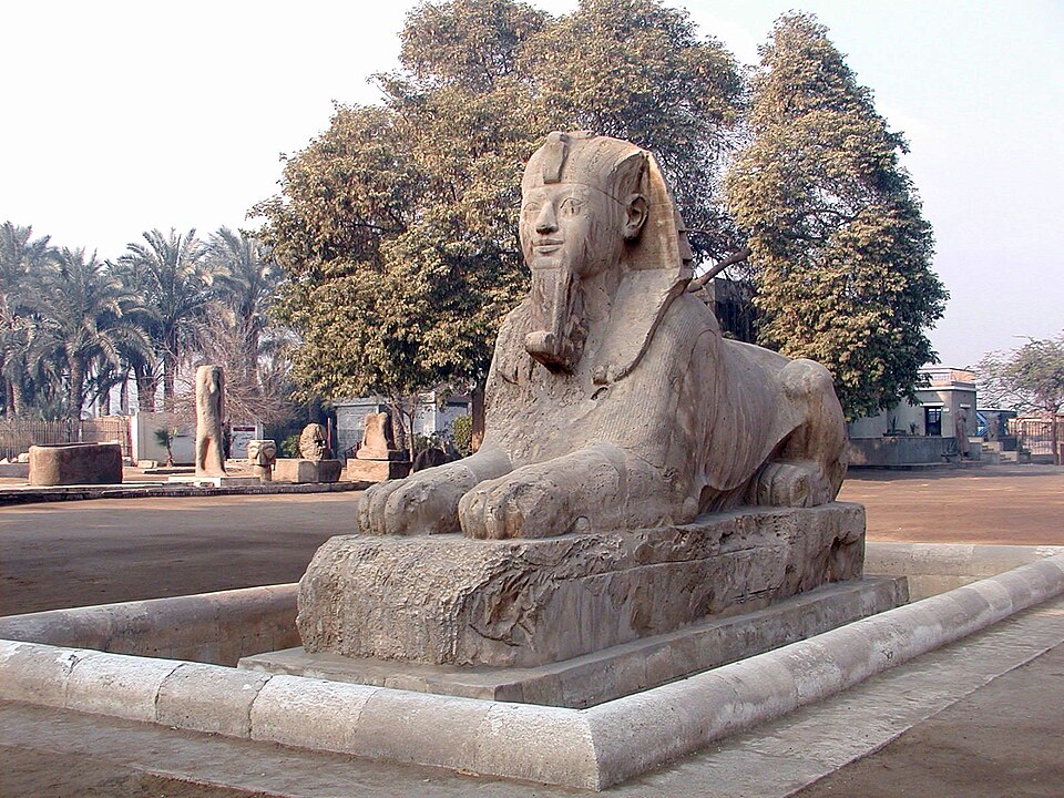
The alabaster sphinx at Memphis — the largest known calcite statue in Egypt. Wikimedia Commons.
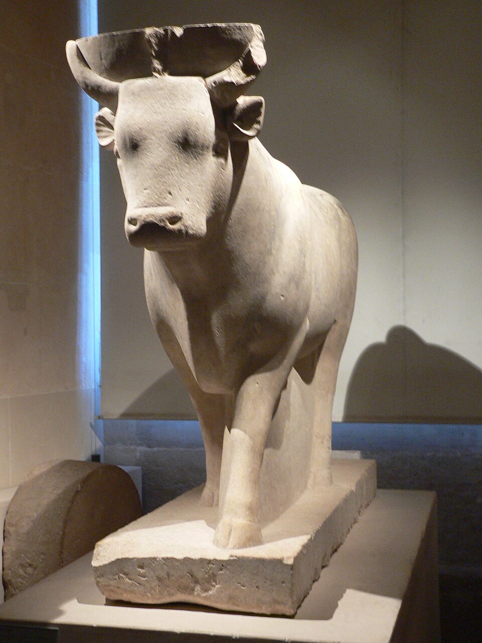
Apis bull statue from Memphis — the sacred bull of Ptah. Louvre Museum, Wikimedia Commons.
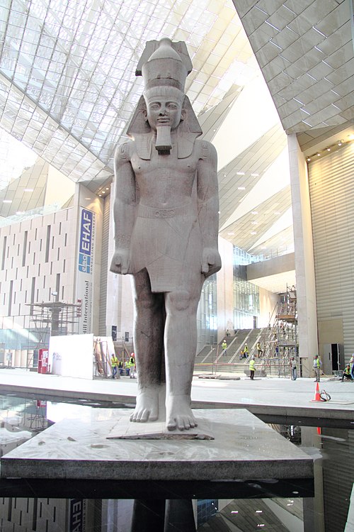
Standing colossus of Ramesses II in the Grand Egyptian Museum atrium — originally from Memphis. Wikimedia Commons.
Remains of the Temple of Hathor at Mit Rahina, the site of ancient Memphis. Wikimedia Commons.
Memphis was Egypt's first great capital, founded at the strategic junction where Upper and Lower Egypt meet. It served as the administrative heart of the Old Kingdom and remained a major religious and commercial center for nearly three thousand years. Memphis was the cult center of Ptah, the creator god whom Egyptian theology credited with speaking the world into existence. The word "Coptic" — and ultimately "Egypt" itself — derives from the Greek name for Memphis's great temple: Hwt-ka-Ptah ("mansion of the spirit of Ptah") became Aigyptos, which became qibt.
Memphis figures prominently in biblical prophecy. Jeremiah prophesied against the city (Jeremiah 46:14, 19), and Jewish refugees settled there after Jerusalem's destruction in 586 BC (Jeremiah 44:1). Isaiah and Hosea also reference the city under its Hebrew name Noph (Isaiah 19:13; Hosea 9:6). Today the site is best known for the fallen Colossus of Ramesses II preserved in an open-air museum at Mit Rahina.
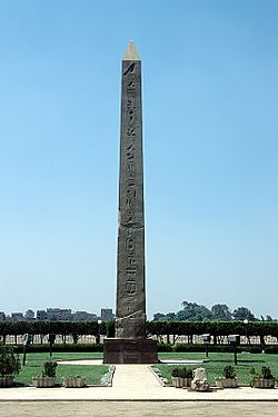
The Obelisk of Senusret I (c. 1950 BC) — the oldest standing obelisk in Egypt, all that remains above ground of ancient Heliopolis. Wikimedia Commons.
Battle of Heliopolis by Léon Cogniet (1837) — ancient ruins of the sun temple visible in the background. Wikimedia Commons.
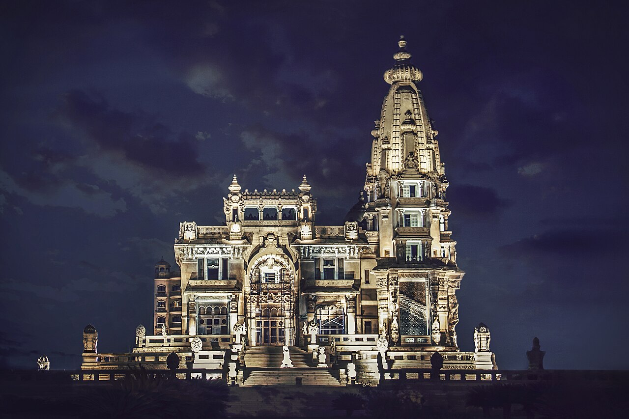
The Baron Empain Palace (1911) in the modern Heliopolis district of Cairo, built on the outskirts of the ancient city. Wikimedia Commons.
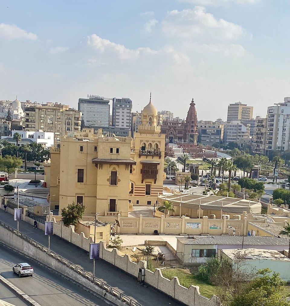
Modern Heliopolis — the ancient city lies buried beneath this Cairo district. Wikimedia Commons.
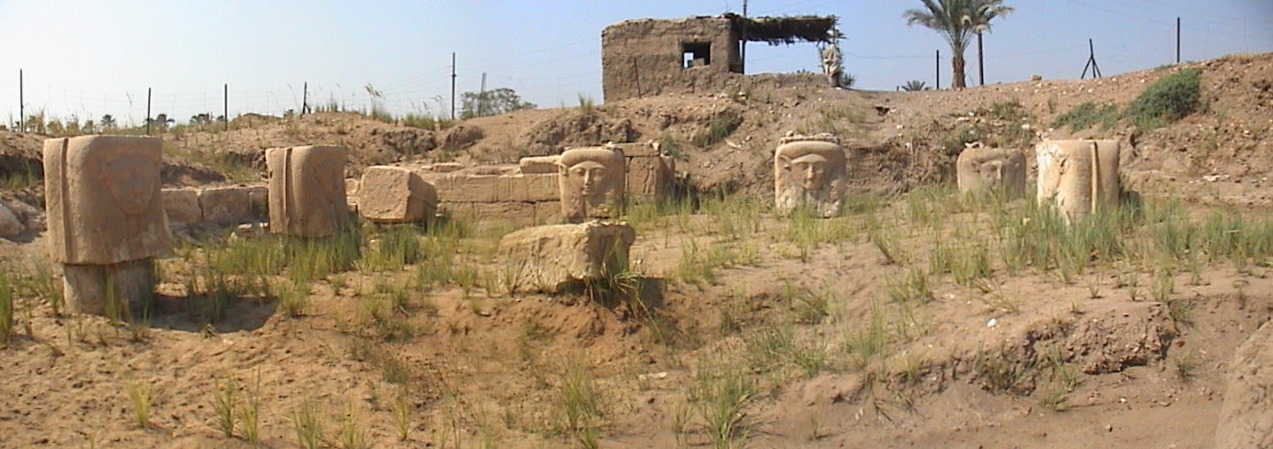
Heliopolis (Egyptian Iunu; biblical "On") was one of ancient Egypt's most important sacred cities and the principal center of the solar cult of Ra. Its priesthood developed the Ennead — the group of nine creator gods headed by Atum-Ra — whose theology shaped Egyptian religion for millennia. The great obelisks that became synonymous with Egypt originated here; Heliopolis was filled with them, and pharaohs later carried the tradition to temple complexes across the country.
Heliopolis has a direct biblical connection. Joseph married Asenath, the daughter of Potiphera, priest of On (Genesis 41:45; Genesis 46:20). That Joseph's wife came from a priestly family at Egypt's foremost religious center underscores the extraordinary position he held in Egyptian society.
Very little of the ancient city survives above ground today — modern Cairo has grown over most of the site. The Obelisk of Senusret I (c. 1950 BC), the oldest standing obelisk in Egypt, still marks the location and stands as a solitary witness to the city that once rivaled Memphis and Thebes in importance.
Coptic Cairo — one of the oldest Christian quarters in the world. CC-BY-SA.
The Ben Ezra Synagogue, site of the Cairo Genizah discovery. Wikimedia Commons, CC BY-SA 4.0.
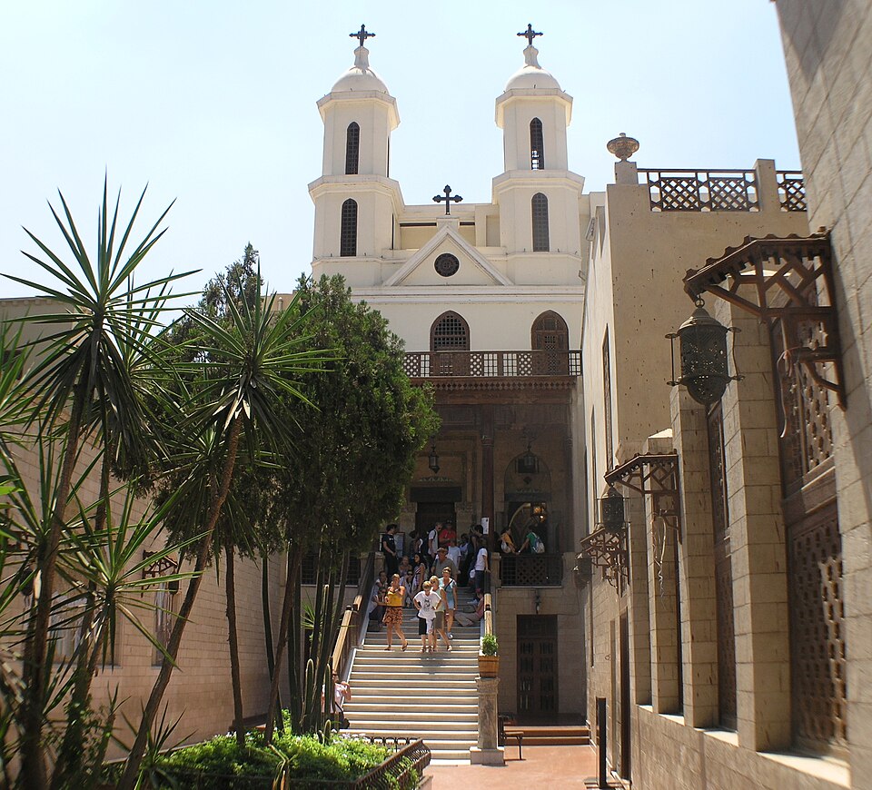
The Hanging Church (Al-Mu'allaqa) — one of the oldest churches in Egypt. Wikimedia Commons.
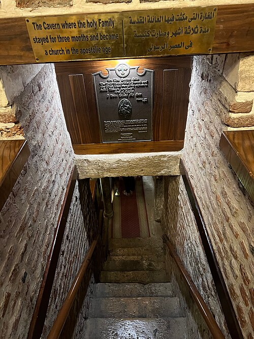
The Church of Saints Sergius and Bacchus (Abu Serga), built over a crypt associated with the Holy Family. Wikimedia Commons.
The Ben Ezra Synagogue is famous for the discovery of the Cairo Genizah — a storeroom containing approximately 400,000 manuscript fragments spanning a thousand years (c. AD 870–1880). Jewish law prohibits destroying documents containing the name of God, so worn-out texts were deposited in the genizah rather than discarded.
The discovery, principally by Solomon Schechter in 1896, revolutionized the study of medieval Jewish history, literature, liturgy, and daily life. Genizah fragments are now housed in libraries worldwide, with the largest collection at Cambridge University.
Tradition holds that the synagogue was built on the site where the infant Moses was found in the Nile, or where the prophet Jeremiah gathered the Jewish community. The nearby Hanging Church and Church of Saints Sergius and Bacchus (Abu Serga), built over a crypt traditionally associated with the Holy Family's stay in Egypt, testify to the deep roots of both Jewish and Christian life in Egypt.
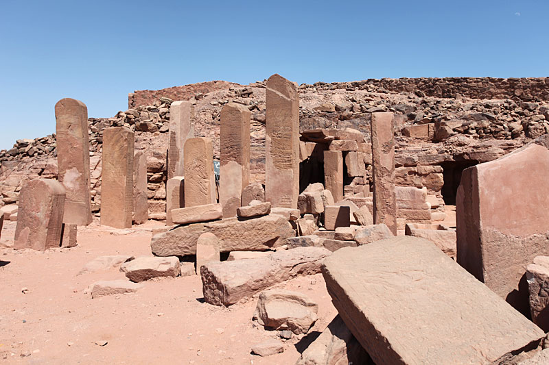
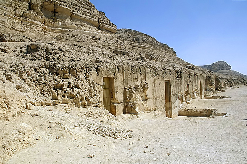
Serabit el-Khadim — a remote mining sanctuary in the Sinai. Wikimedia Commons.
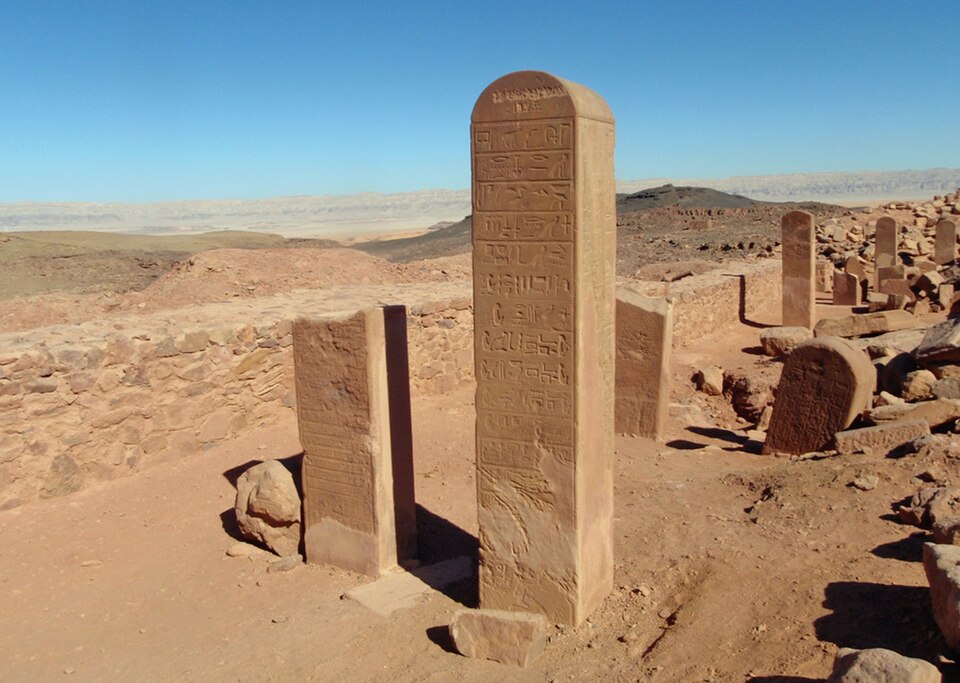
Inscribed stelae left by Egyptian mining expeditions at the desert sanctuary. Wikimedia Commons.
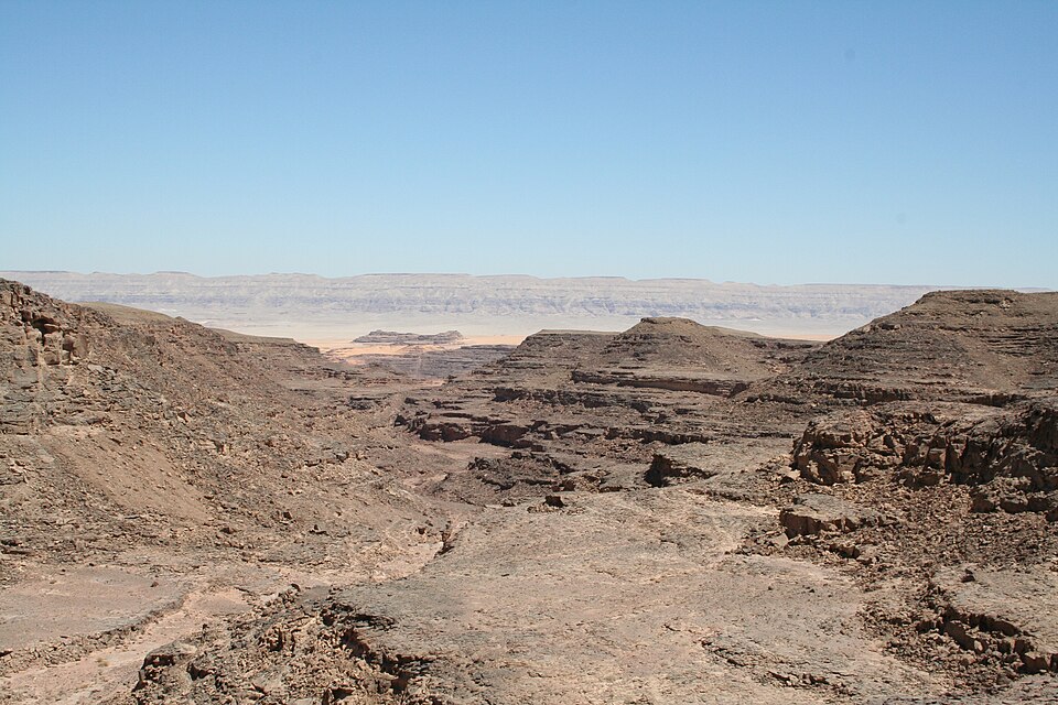
The remote desert landscape surrounding Serabit el-Khadim. Wikimedia Commons.

The twin chapels of the Hathor temple at Serabit el-Khadim. Wikimedia Commons.
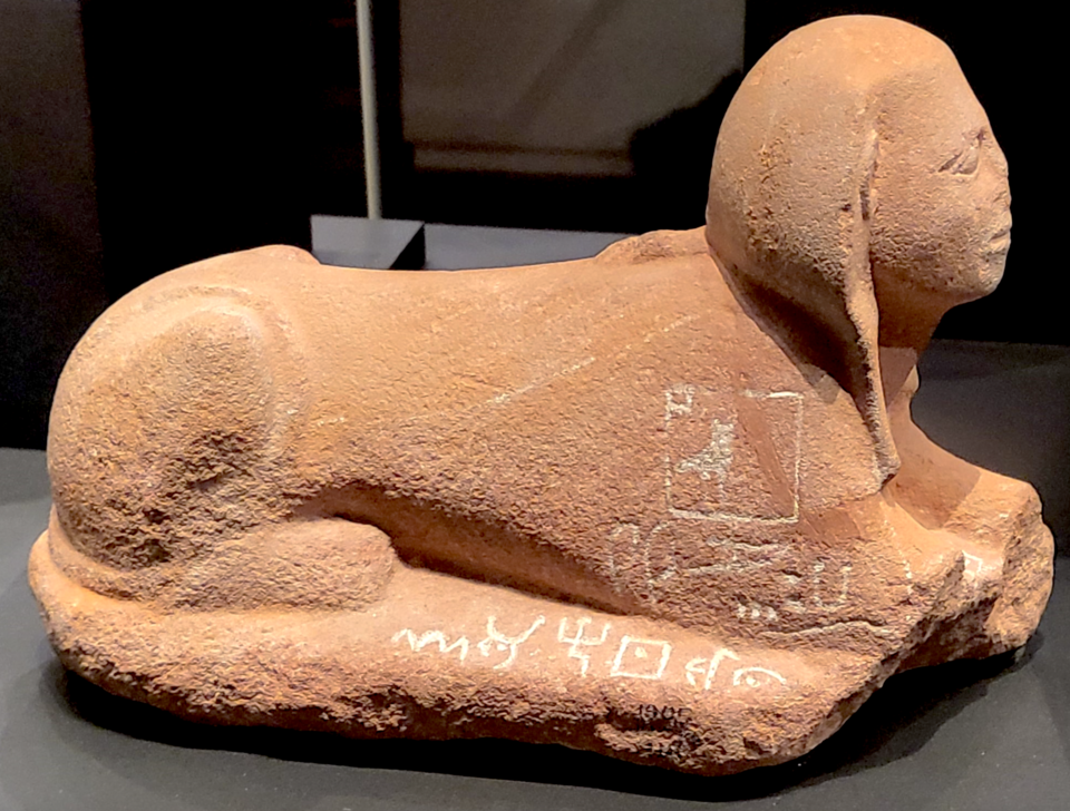
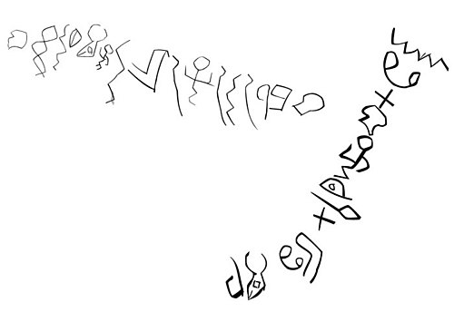
Sphinx with Proto-Sinaitic inscription (British Museum, EA41748) — one of the earliest examples of alphabetic writing. Wikimedia Commons.
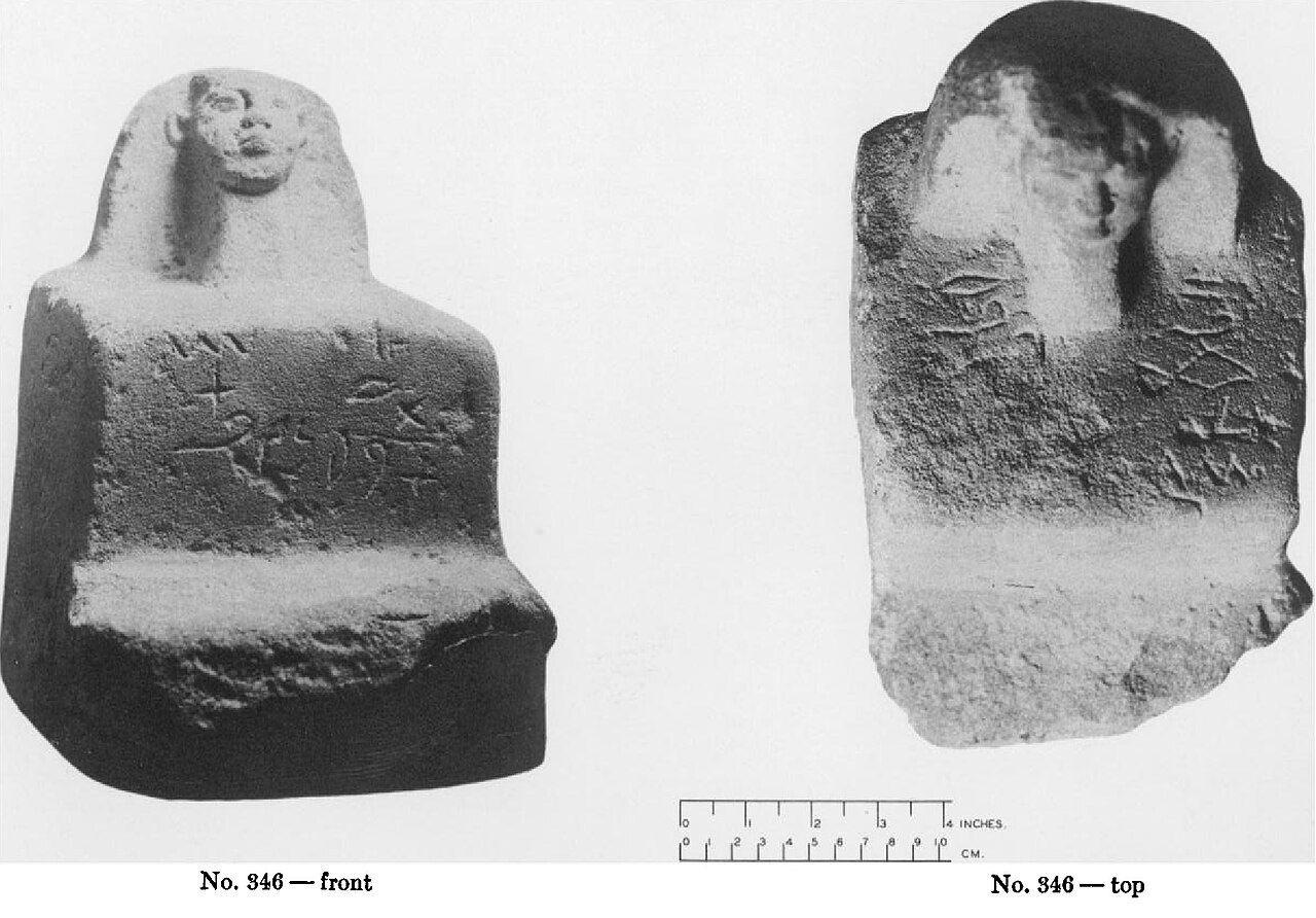
Proto-Sinaitic inscription No. 346 — front and top views. Photo: Romain Butin. Wikimedia Commons.
Proto-Sinaitic inscription No. 349. Photo: Romain Butin. Wikimedia Commons.
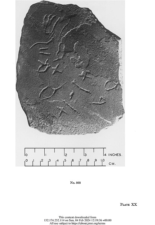
Proto-Sinaitic inscription No. 363. Photo: Romain Butin. Wikimedia Commons.
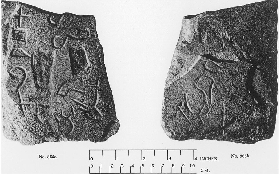
Proto-Sinaitic inscription No. 365. Photo: Romain Butin. Wikimedia Commons.
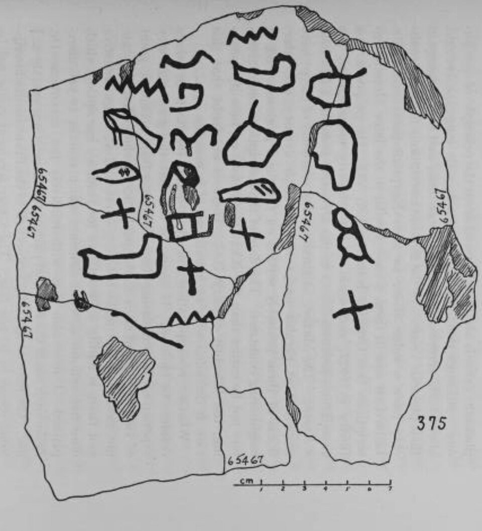
Proto-Sinaitic inscription No. 375. Photo: Romain Butin. Wikimedia Commons.
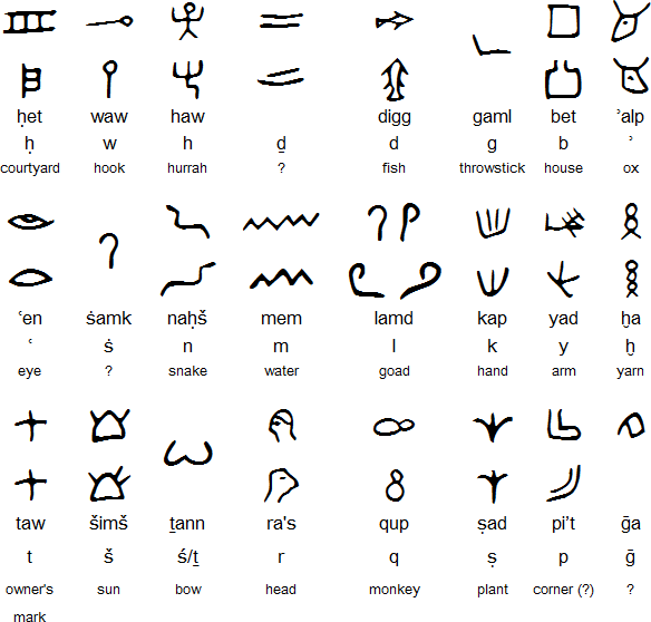
The Proto-Sinaitic alphabet — letter forms derived from Egyptian hieroglyphs, ancestral to Phoenician, Hebrew, Greek, and Latin scripts.
A remote mining and pilgrimage site in southwestern Sinai, Serabit el-Khadim was dedicated chiefly to Hathor, "Lady of Turquoise." Egyptian expeditions came here to quarry turquoise, leaving behind shrines, stelae, and inscriptions on the desert plateau.
The site is especially important because it preserves some of the earliest known Proto-Sinaitic inscriptions — a key stage in the development of the alphabet that would eventually shape Phoenician, Hebrew, Greek, and Latin writing.
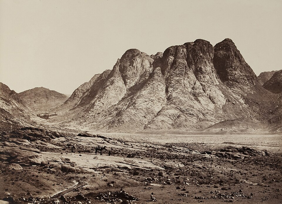
Mount Sinai (Jebel Musa) — 19th-century photograph. Wikimedia Commons.
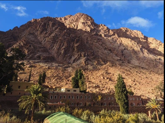
St. Catherine's Monastery at the foot of Jebel Musa — one of the oldest continuously operating monasteries in the world. Wikimedia Commons.
The mountain where Moses received the Law is the pivotal site of the covenant between God and Israel. After the Exodus from Egypt, the Israelites camped at the foot of the mountain while Moses ascended into the cloud of God's presence to receive the Ten Commandments and the instructions for the Tabernacle (Exodus 19:16–20; Exodus 20:1–17; Exodus 24:12–18). The exact identification of the mountain remains debated among scholars, but Jebel Musa in the southern Sinai has been the traditional site since at least the 4th century AD.
At the foot of Jebel Musa stands St. Catherine's Monastery, built by order of Emperor Justinian in the 6th century AD. It is one of the oldest continuously operating Christian monasteries in the world. Its library preserves the Codex Sinaiticus, discovered by Constantine von Tischendorf in 1844 — one of the earliest near-complete manuscripts of the Greek Bible and a cornerstone of modern biblical textual scholarship.
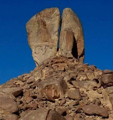
The "Split Rock of Moses" near Jebel al-Maqla in northwestern Saudi Arabia — identified as such by local tradition, though not archaeologically verified.
The relationship between Horeb and Sinai is one of the most debated questions in biblical geography. "Sinai" appears primarily in Exodus and Leviticus, while "Horeb" appears in Deuteronomy and the historical books. Some scholars treat them as two names for the same mountain; others see Horeb as a broader region with Sinai as a specific peak within it; still others propose that the burning bush narrative took place at a different mountain entirely from the one where the Law was given.
The traditional identification places both Sinai and Horeb at Jebel Musa in the southern Sinai Peninsula (the site of St. Catherine's Monastery). However, alternative proposals include Jebel al-Maqla near Jabal al-Lawz in northwestern Saudi Arabia, based partly on Paul's reference to "mount Sinai in Arabia" (Galatians 4:25) and the location of biblical Midian. Other candidates have been proposed in the central and northern Sinai. None of these identifications can be determined definitively.
Horeb is especially associated with Elijah's journey. Fleeing Queen Jezebel, the prophet traveled forty days and forty nights to "Horeb the mount of God," where he sheltered in a cave. There God passed by — not in the wind, not in the earthquake, not in the fire, but in the "still small voice" (1 Kings 19:8–12). Moses encountered God at Horeb as well: the burning bush appeared "in Horeb" (Exodus 3:1–6), and the rock that yielded water was struck "in Horeb" (Exodus 17:6).
The rock-cut tombs of Beni Hasan, famous for Middle Kingdom paintings and scenes of Asiatic visitors. Wikimedia Commons.
The cliff-face tomb entrances at Beni Hasan overlooking the Nile valley. Wikimedia Commons.
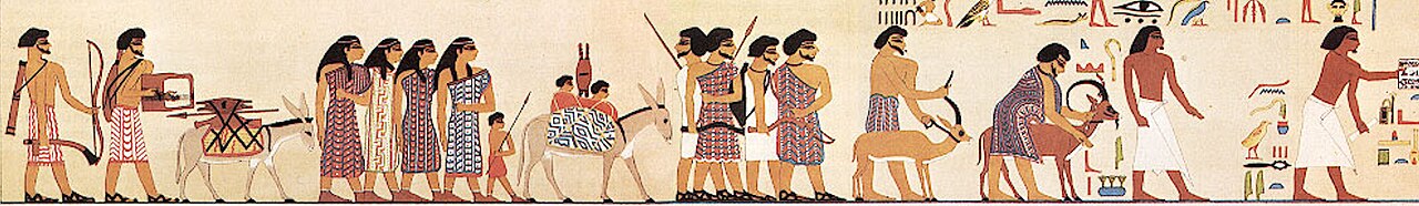
The cliff tombs of Beni Hasan preserve some of the most vivid painted scenes from the Middle Kingdom. They are especially famous for the mural showing a caravan of Asiatic visitors entering Egypt around 1890 BC — an image that powerfully evokes the world of Abraham, Jacob, and Joseph.
These tombs also preserve scenes of wrestling, hunting, and daily life that give an unusually intimate look at provincial Egyptian society outside the royal court.
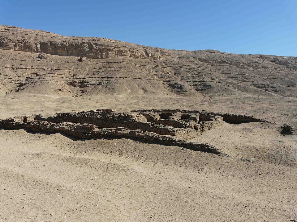
Amarna, Akhenaten's short-lived royal capital in Middle Egypt. Wikimedia Commons.
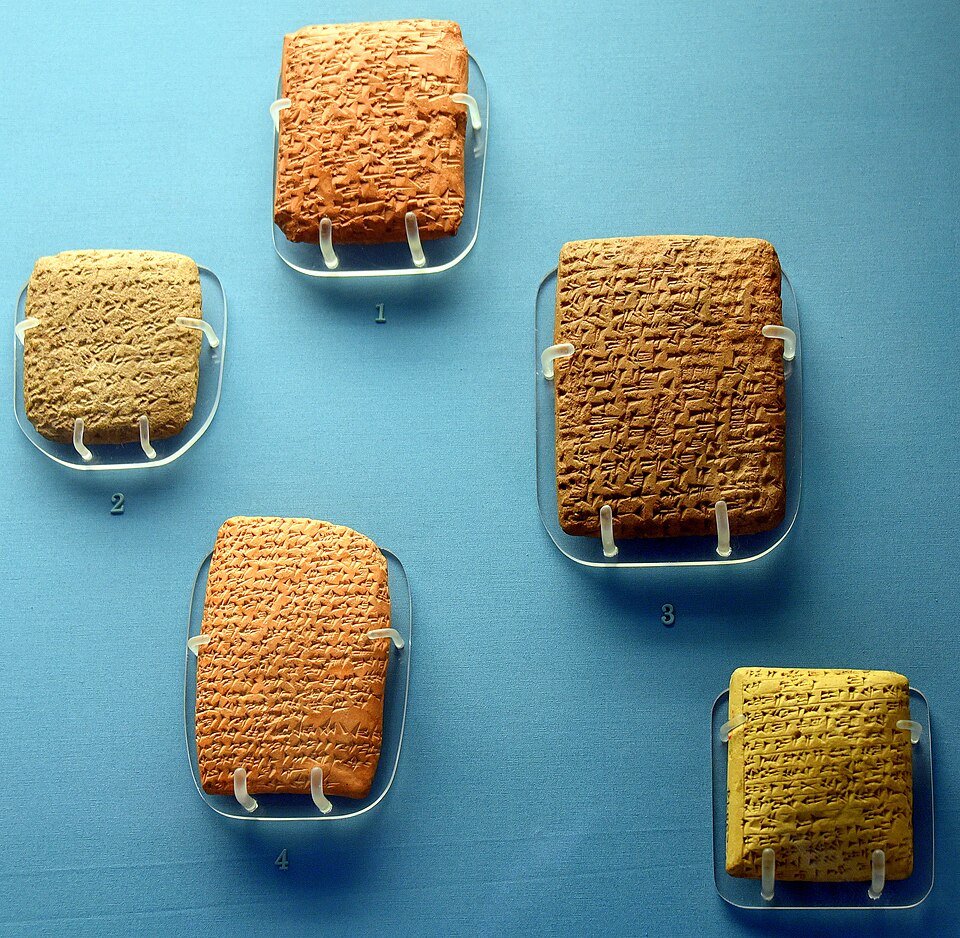
Five Amarna Letters on display at the British Museum — diplomatic tablets in Akkadian cuneiform. Wikimedia Commons.
Amarna was Akhenaten's purpose-built capital, founded for the worship of the Aten and abandoned soon after his death. Though the city flourished only briefly, it has yielded extraordinary evidence for royal religion, urban planning, and daily life in the 14th century BC.
Most famous of all are the Amarna Letters — diplomatic tablets written in Akkadian cuneiform that illuminate Egypt's foreign relations in the Late Bronze Age and provide one of the most important archives for the biblical world.
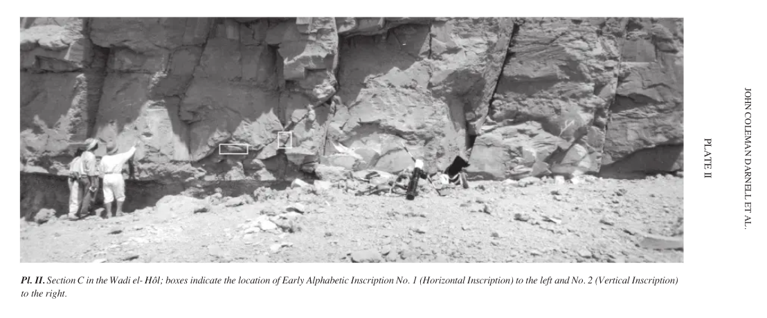
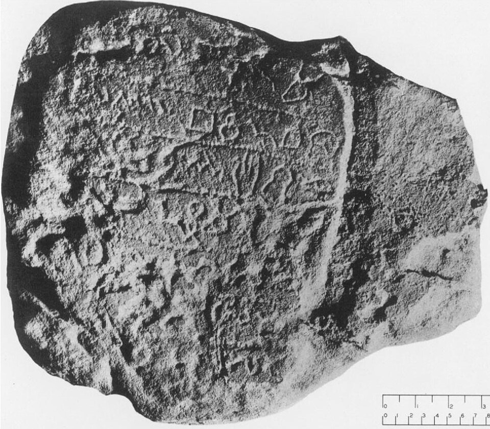
Section C of the Wadi el-Hol — boxes mark the locations of the early alphabetic inscriptions. Photo: John Coleman Darnell et al.
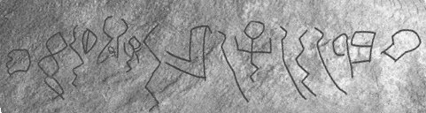
Close-up of a Wadi el-Hol inscription — 16 early alphabetic characters carved into the limestone. Wikimedia Commons.
Scholarly drawing of the Wadi el-Hol inscriptions — among the earliest known examples of alphabetic writing (c. 1800 BC). Wikimedia Commons.
In 1999, Yale Egyptologists John and Deborah Darnell discovered two short inscriptions carved into the limestone walls of a remote desert wadi along an ancient caravan route. These Wadi el-Hol inscriptions, dating to roughly 1800 BC, are among the earliest known examples of alphabetic writing. The letter forms were adapted from Egyptian hieroglyphs to write a Semitic language — the same innovation seen at Serabit el-Khadim in the Sinai.
The inscriptions appear to have been carved by Semitic-speaking workers or soldiers serving in the Egyptian military. Together with the Proto-Sinaitic inscriptions from Serabit el-Khadim, they provide the strongest evidence that the alphabet was invented by Semitic peoples living in close contact with Egyptian culture during the early second millennium BC — a revolution in communication explored further in our Writing Systems section.

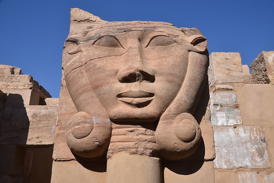
The Temple of Hathor at Dendera. Wikimedia Commons.
Aerial view of the Dendera temple complex with the Nile valley beyond. Wikimedia Commons.
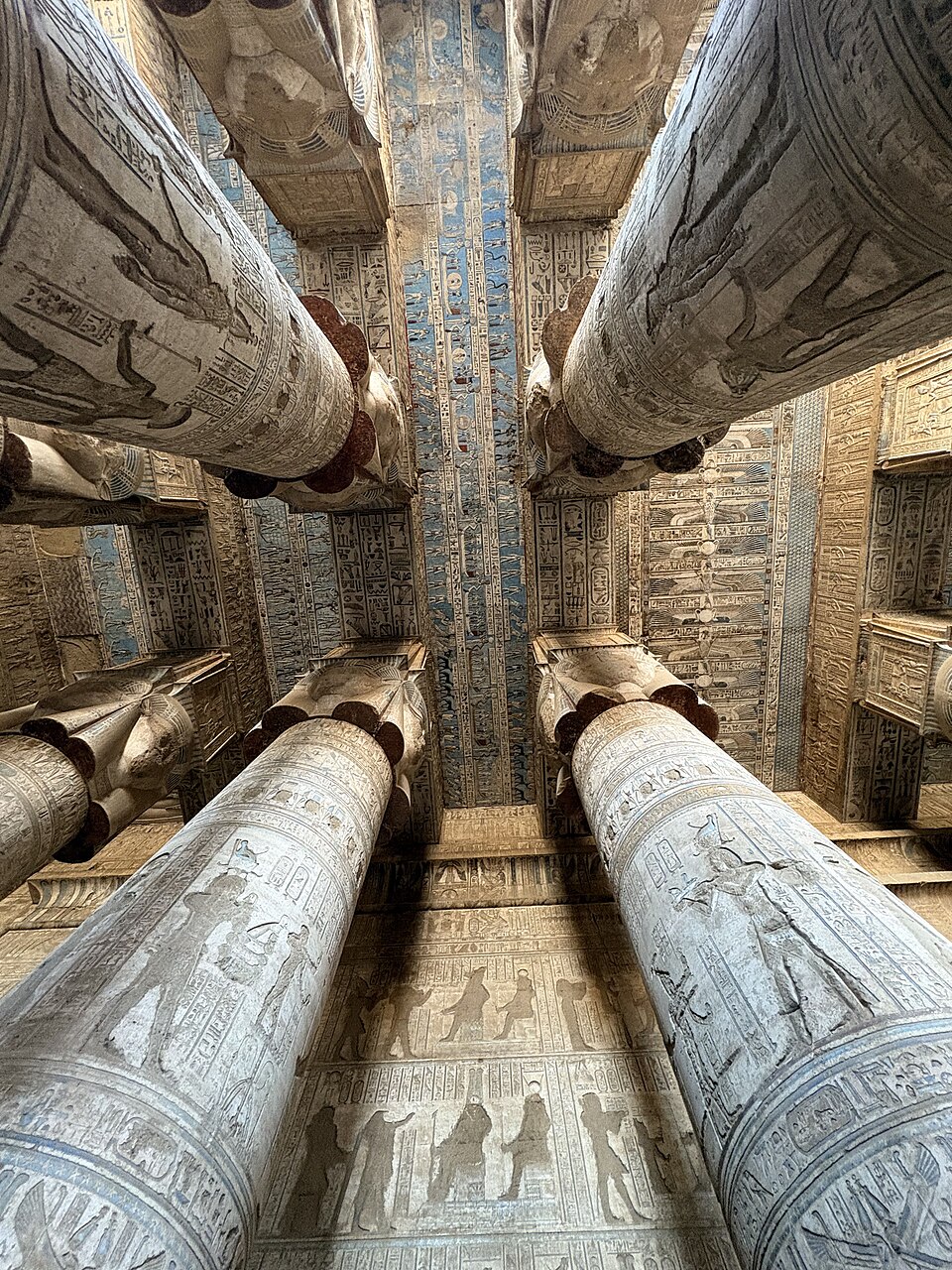
The painted ceiling and Hathor-headed columns of the hypostyle hall. Wikimedia Commons.
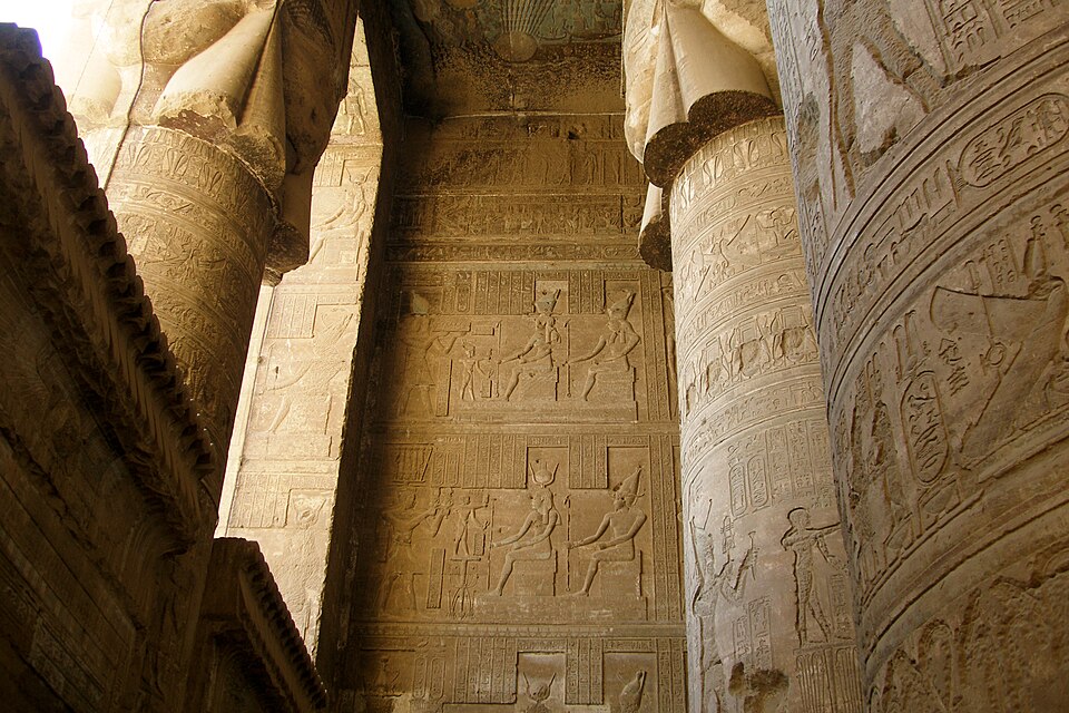
Hieroglyph-covered columns and walls inside the Temple of Hathor. Wikimedia Commons.
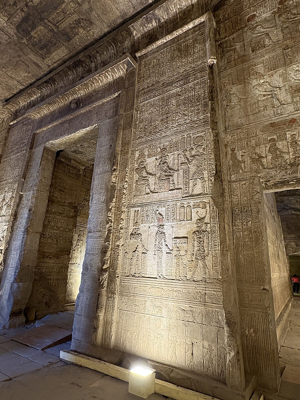
Intricately carved walls inside Dendera Temple. Wikimedia Commons.
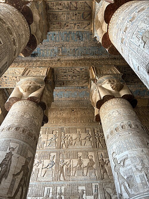
Relief-carved columns inside the Temple of Hathor. Wikimedia Commons.
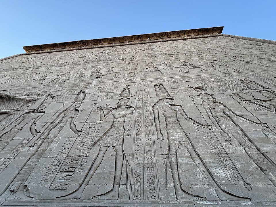
Exterior wall carvings depicting Cleopatra VII and Caesarion — among the last royal images of pharaonic Egypt. Wikimedia Commons.
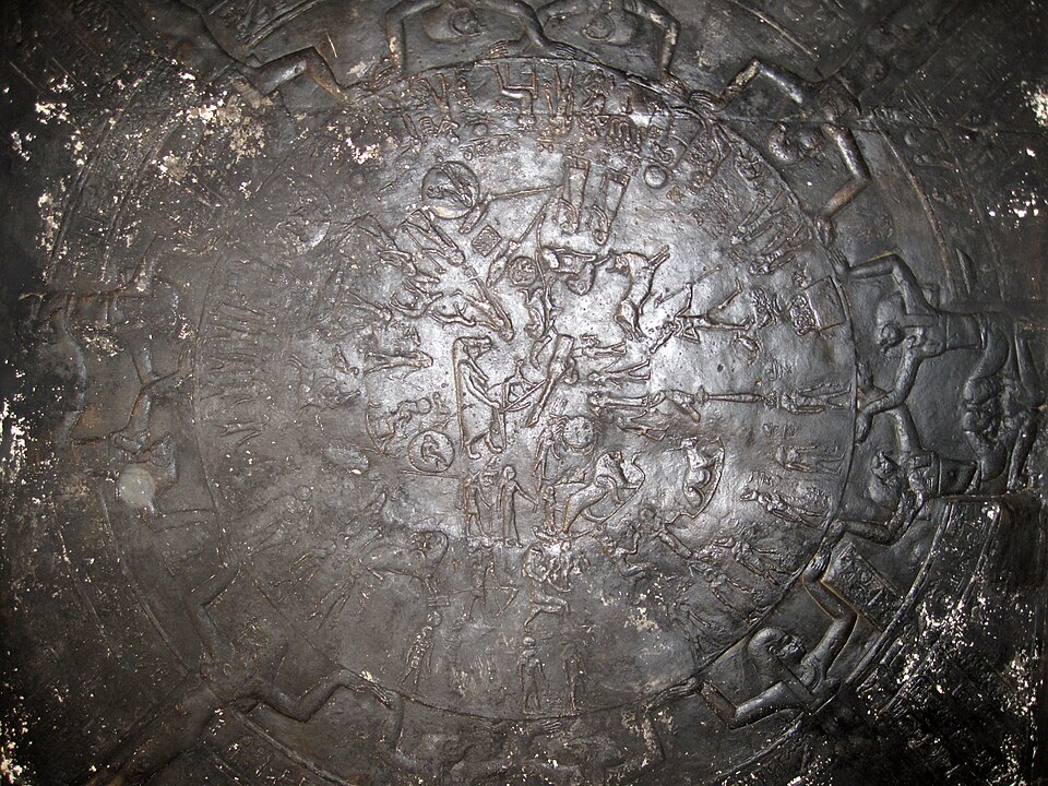
The Dendera Zodiac (original) — a circular star map now in the Louvre. Wikimedia Commons.
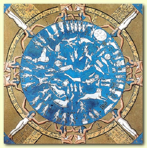
Reconstruction drawing of the Dendera Zodiac. Wikimedia Commons.
Interior view of the Temple of Hathor at Dendera. Wikimedia Commons.
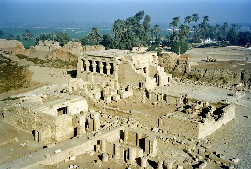
The Temple of Hathor at Dendera is one of the most complete and visually stunning temples in Egypt. Though the current structure dates to the Ptolemaic and Roman periods, worship at Dendera stretches back to at least the Old Kingdom. The temple's ceilings preserve some of the finest astronomical art in the ancient world, including the famous Dendera Zodiac — a circular star map now displayed in the Louvre — which represents one of the earliest known depictions of the constellations in their recognizable forms.
The complex includes a mammisi (birthing house) celebrating the divine birth of Hathor's son Ihy, underground crypts decorated with ritual scenes, and exterior carvings depicting Cleopatra VII and her son Caesarion making offerings to the gods — among the last royal images of pharaonic Egypt. The temple roof, accessible by stairway, offers panoramic views and preserves chapels dedicated to the resurrection of Osiris.
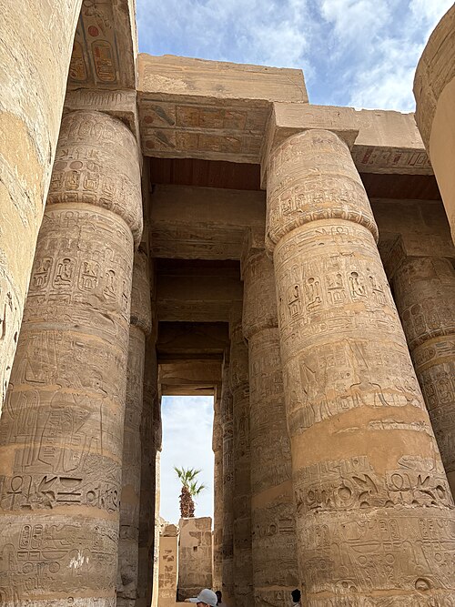
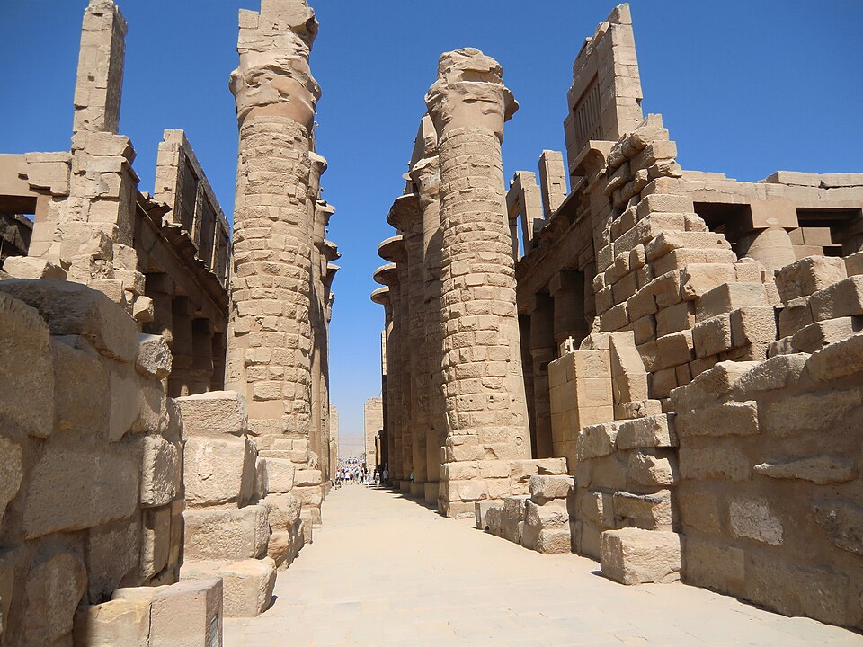
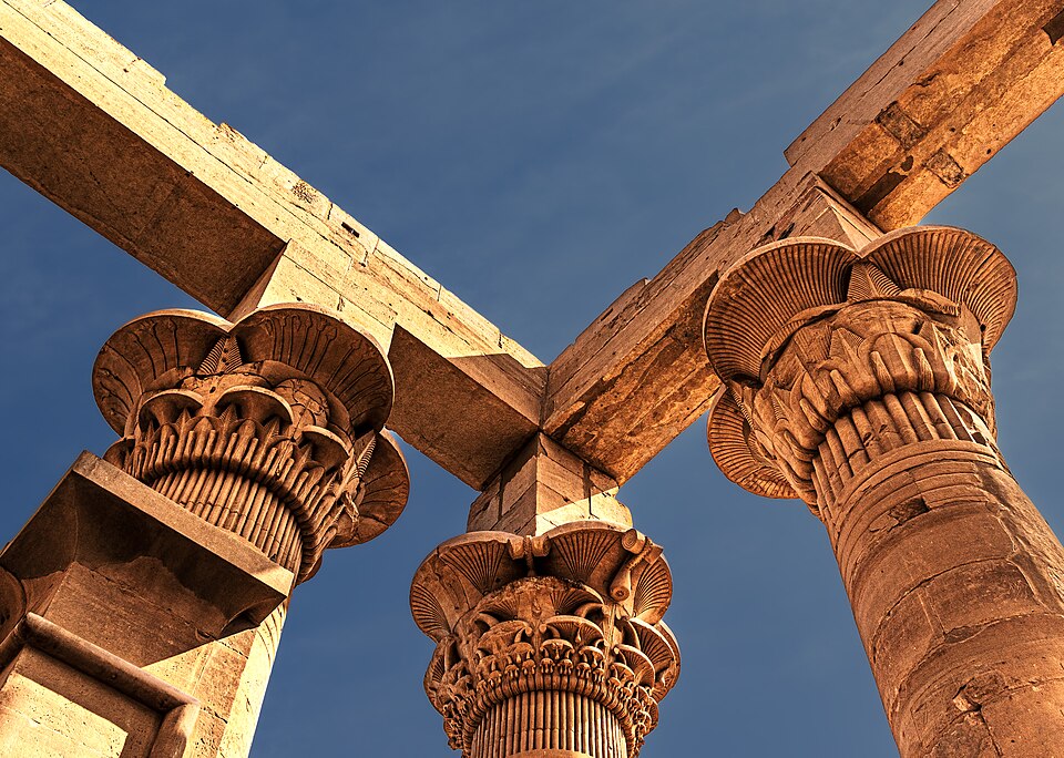
The Great Hypostyle Hall — 134 columns, the largest reaching 69 feet. Wikimedia Commons, CC-BY-SA.
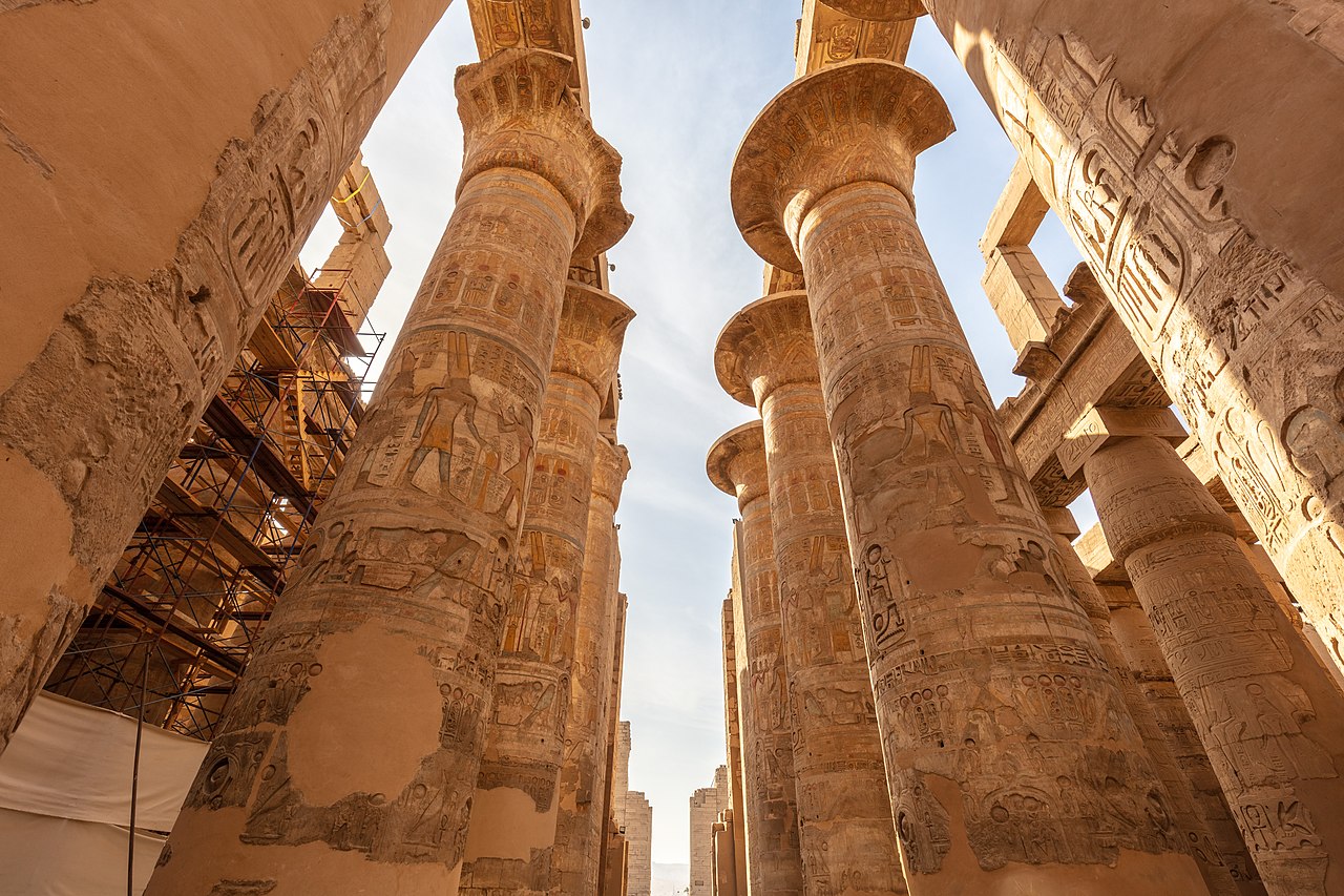
Looking up through the Great Hypostyle Hall — the columns retain traces of original paint. Wikimedia Commons.
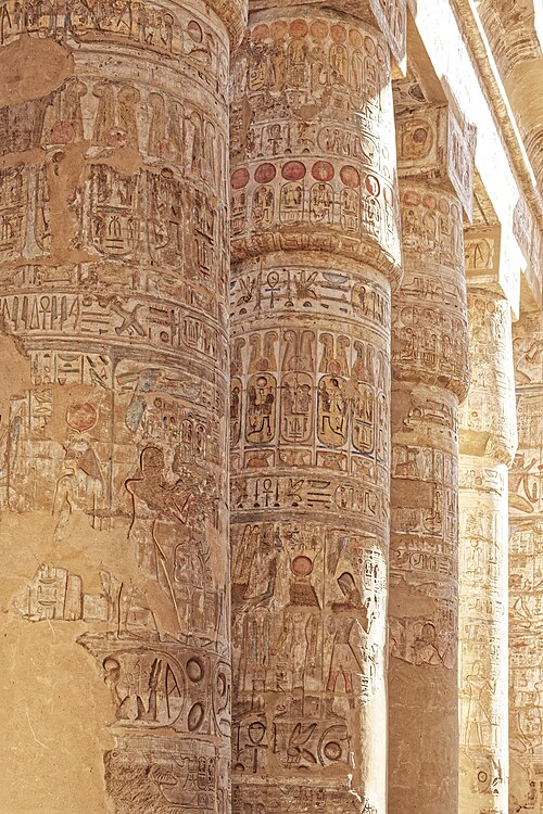
Painted hieroglyphic reliefs on the columns of Karnak — traces of the original vivid colors survive. Wikimedia Commons.
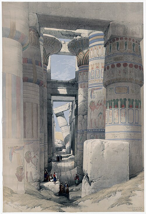
The Hypostyle Hall as depicted by David Roberts (1838) — showing the columns with more surviving paint than today. Wikimedia Commons.
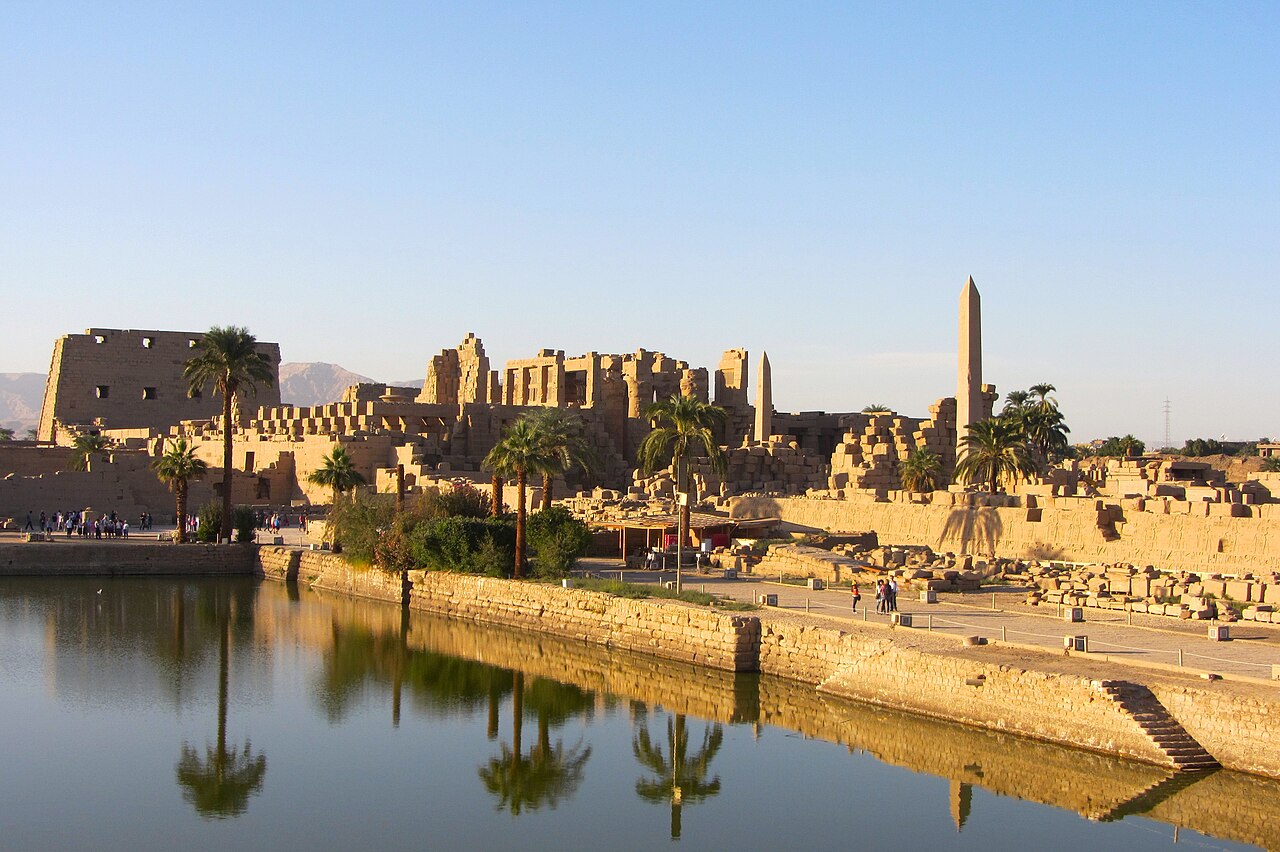
The Karnak Temple Complex reflected in the Sacred Lake at sunset. Wikimedia Commons.
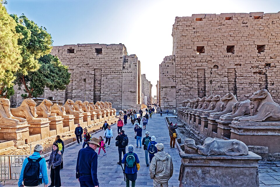
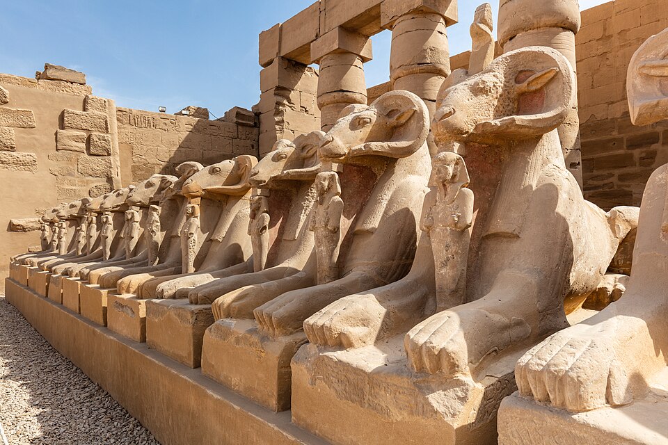
The ram-headed sphinx avenue leading to the first pylon of Karnak. Wikimedia Commons.
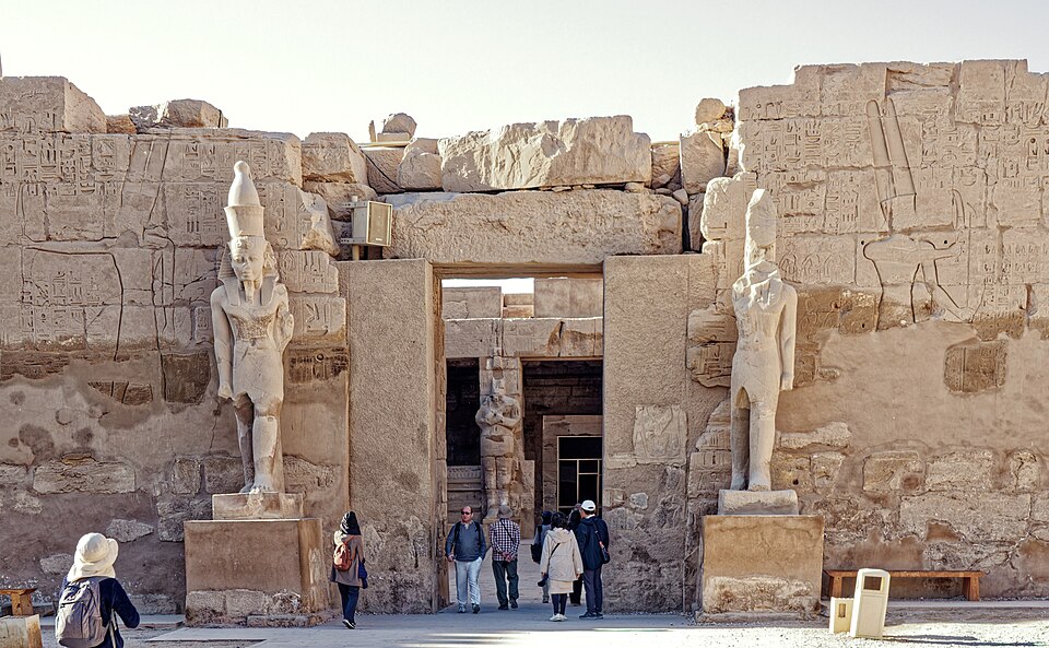
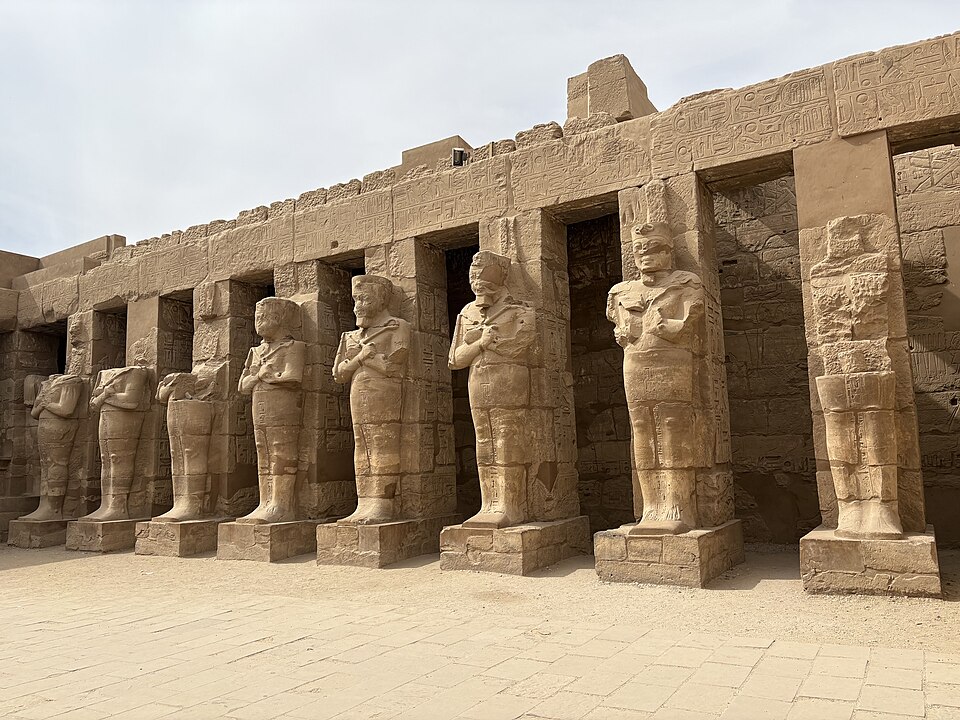
Gateway with Osiride statues at Karnak. Wikimedia Commons.
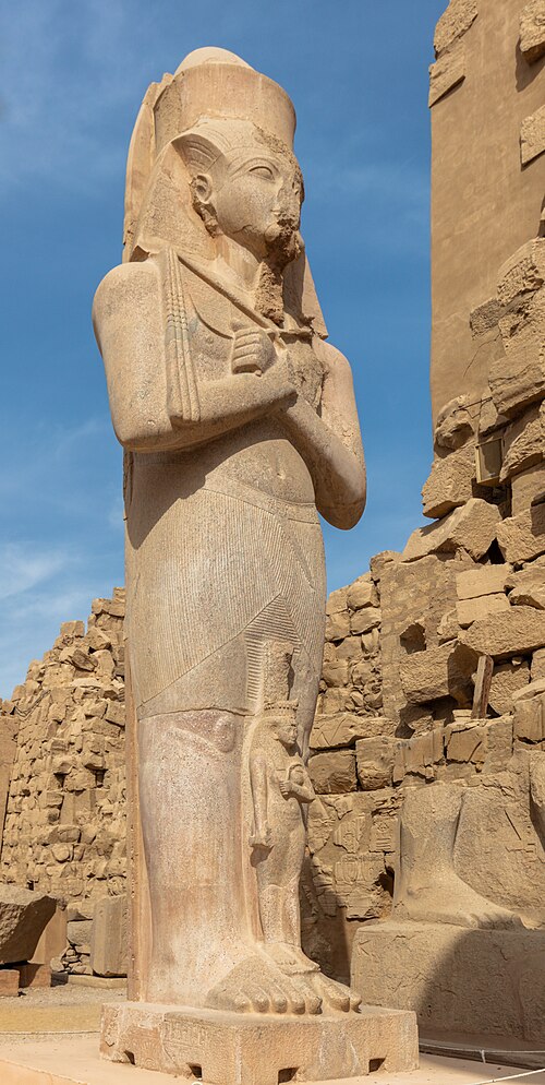
Colossal statue of Ramesses II at the Karnak Temple Complex. Wikimedia Commons.
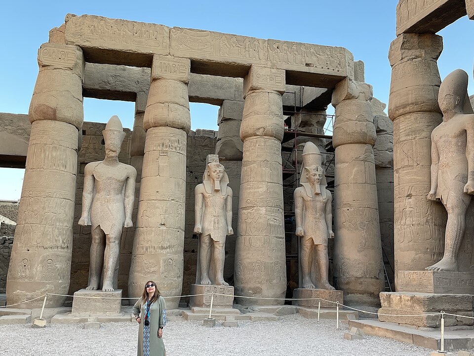
Colossal statues in the Great Court of Karnak. Wikimedia Commons.
The massive columns of the Hypostyle Hall from below. Wikimedia Commons.
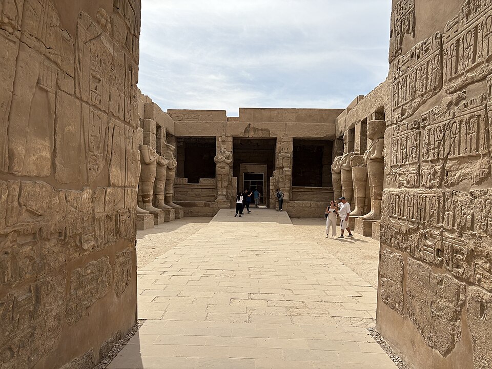
Inner court of the Karnak Temple Complex with Osiride statues. Wikimedia Commons.
A processional corridor within the Karnak complex. Wikimedia Commons.
The approach to Karnak Temple. Wikimedia Commons.
Towering columns inside the Karnak Temple Complex. Wikimedia Commons.
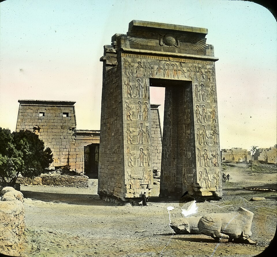
The gateway of Ptolemy III at Karnak — vintage hand-tinted photograph. Wikimedia Commons.
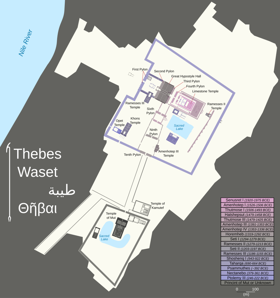
Plan of the Karnak Temple Complex at Thebes, showing structures built over nearly 2,000 years. Wikimedia Commons.
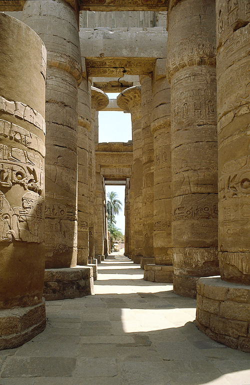
The largest religious building ever constructed — built, expanded, and modified over nearly two thousand years by successive pharaohs. Karnak was the home of Amun-Ra and the center of Egyptian state religion. Its great Hypostyle Hall (134 columns, the largest reaching 69 feet) remains one of the most awe-inspiring architectural achievements of the ancient world.
Sheshonq I's (biblical Shishak) campaign against Judah is recorded on the Bubastite Portal at Karnak (c. 925 BC) — one of the rare cases where an Egyptian inscription directly corroborates a biblical account (1 Kings 14:25–26).
Thebes (modern Luxor) was the great religious capital of the New Kingdom. The prophet Nahum referenced the Assyrian sack of Thebes (663 BC) as a warning to Nineveh (Nahum 3:8). The Hebrew name for Thebes was No or No-Amon ("city of Amun"). In the Ptolemaic period, Thebes had the greatest concentration of Jews outside Alexandria (Muhlestein). The priest Hor, whose papyrus would become part of the Joseph Smith collection, served at the Karnak, Montu, and Khonsu temples in Thebes around 200 BC.

Luxor Temple, dominated by the seated statues of Ramesses II. Wikimedia Commons.
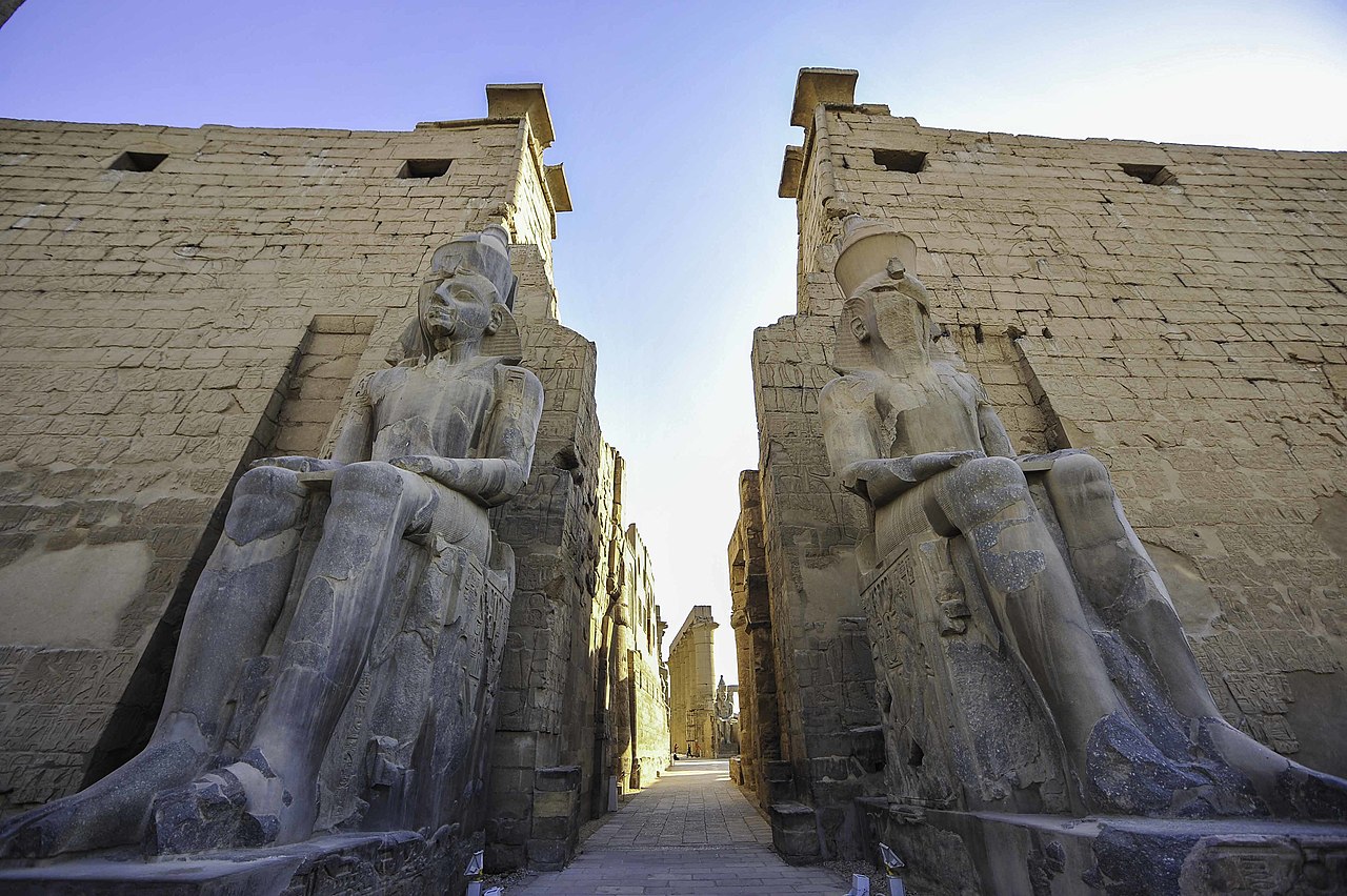
Colossal statue of Ramesses II at Luxor Temple. Wikimedia Commons.
The colonnade of Amenhotep III at Luxor Temple. Wikimedia Commons.
The Court of Amenhotep III at Luxor Temple, illuminated at night. Wikimedia Commons.
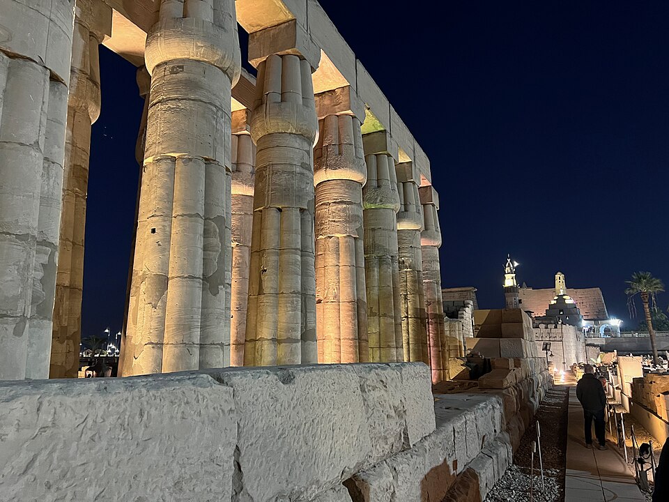
Columns of Luxor Temple at night, with the mosque of Abu el-Haggag visible beyond. Wikimedia Commons.
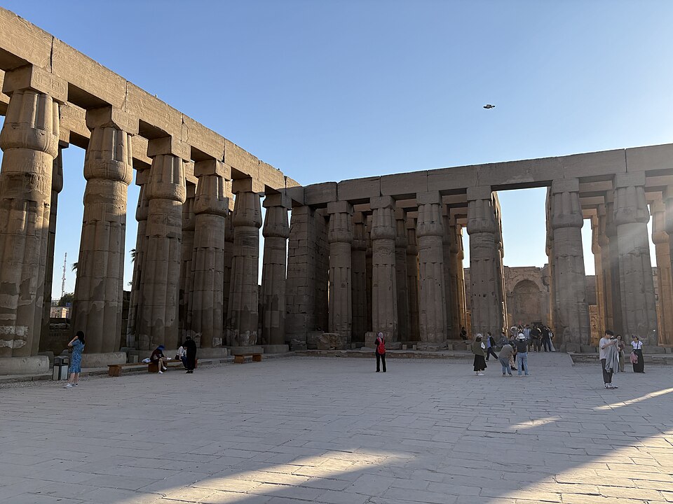
The columned court of Luxor Temple. Wikimedia Commons.
Ram-headed sphinxes on the Avenue of Sphinxes connecting Luxor Temple and Karnak. Wikimedia Commons.
Luxor Temple from the entrance. Wikimedia Commons.
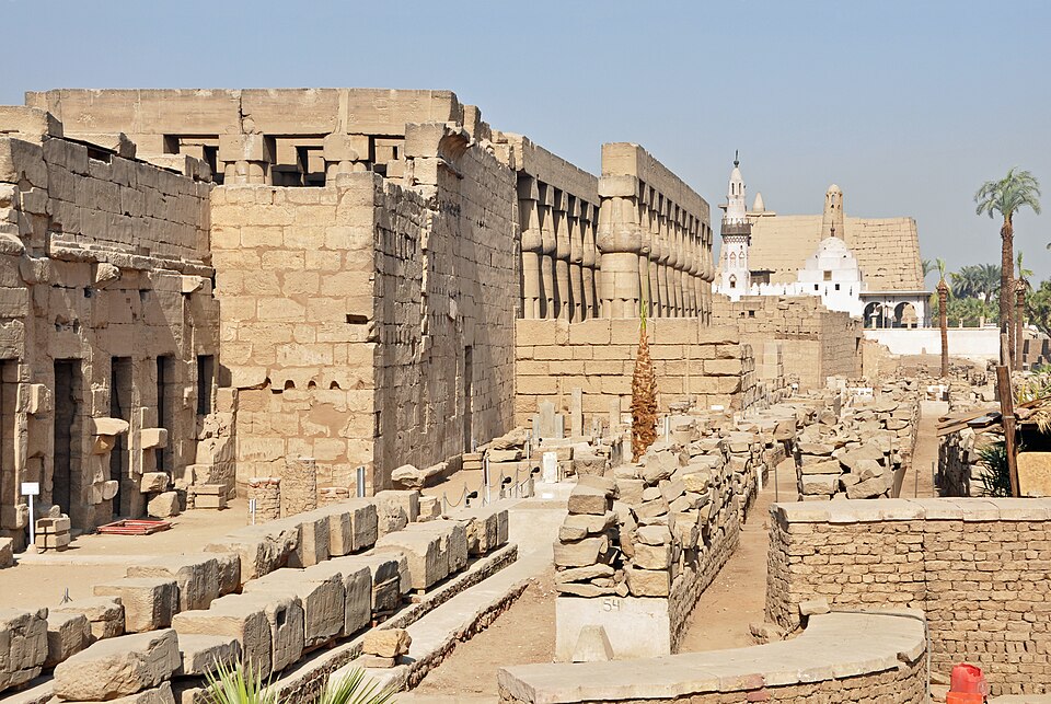
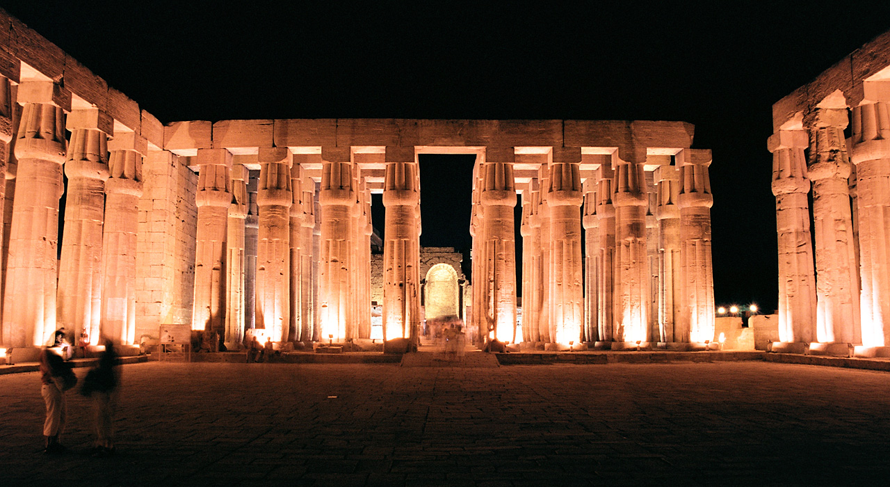
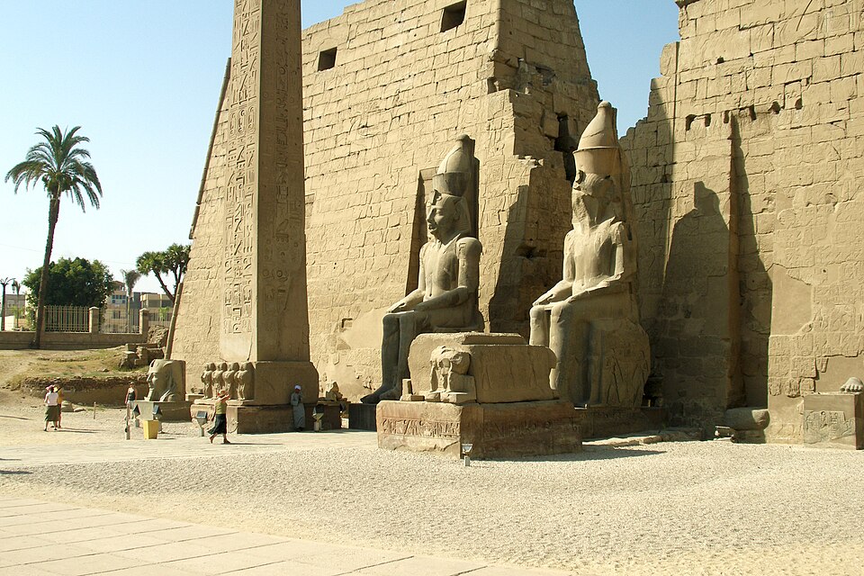
Luxor Temple was the southern partner to Karnak, connected by the great Avenue of the Sphinxes — a 1.7-mile processional road lined with sphinx statues, recently restored and reopened in 2021. The temple was built principally by Amenhotep III and Ramesses II and served as a key ceremonial center during the annual Opet Festival.
Unlike the more sprawling temple city at Karnak, Luxor Temple preserves a compact, processional grandeur that makes it one of the clearest examples of how Egyptian state ritual shaped sacred architecture.
A tomb entrance in the Valley of the Kings, cut into the limestone cliffs. Wikimedia Commons.
Panoramic view of the Valley of the Kings. Wikimedia Commons.
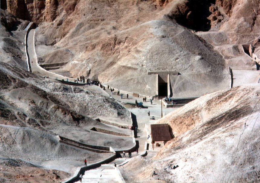
Visitors walking the paths through the Valley of the Kings. Wikimedia Commons.
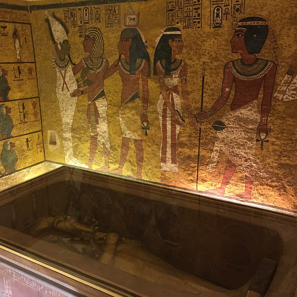
Inside Tutankhamun's burial chamber (KV62) — painted walls depicting the pharaoh with the gods, sarcophagus visible below. Wikimedia Commons.
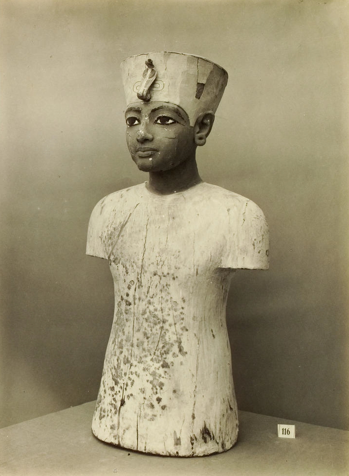
Painted wooden mannequin of Tutankhamun from his tomb — one of thousands of artifacts discovered by Howard Carter. Wikimedia Commons.
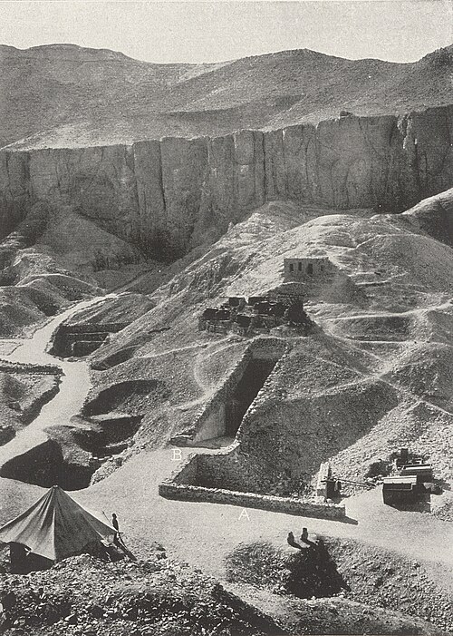
The Valley of the Kings during the Tutankhamun excavations (1924). Wikimedia Commons.
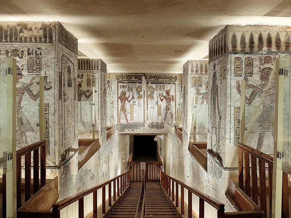
Painted entrance corridor of the Tomb of Ramesses III (KV11). Wikimedia Commons.
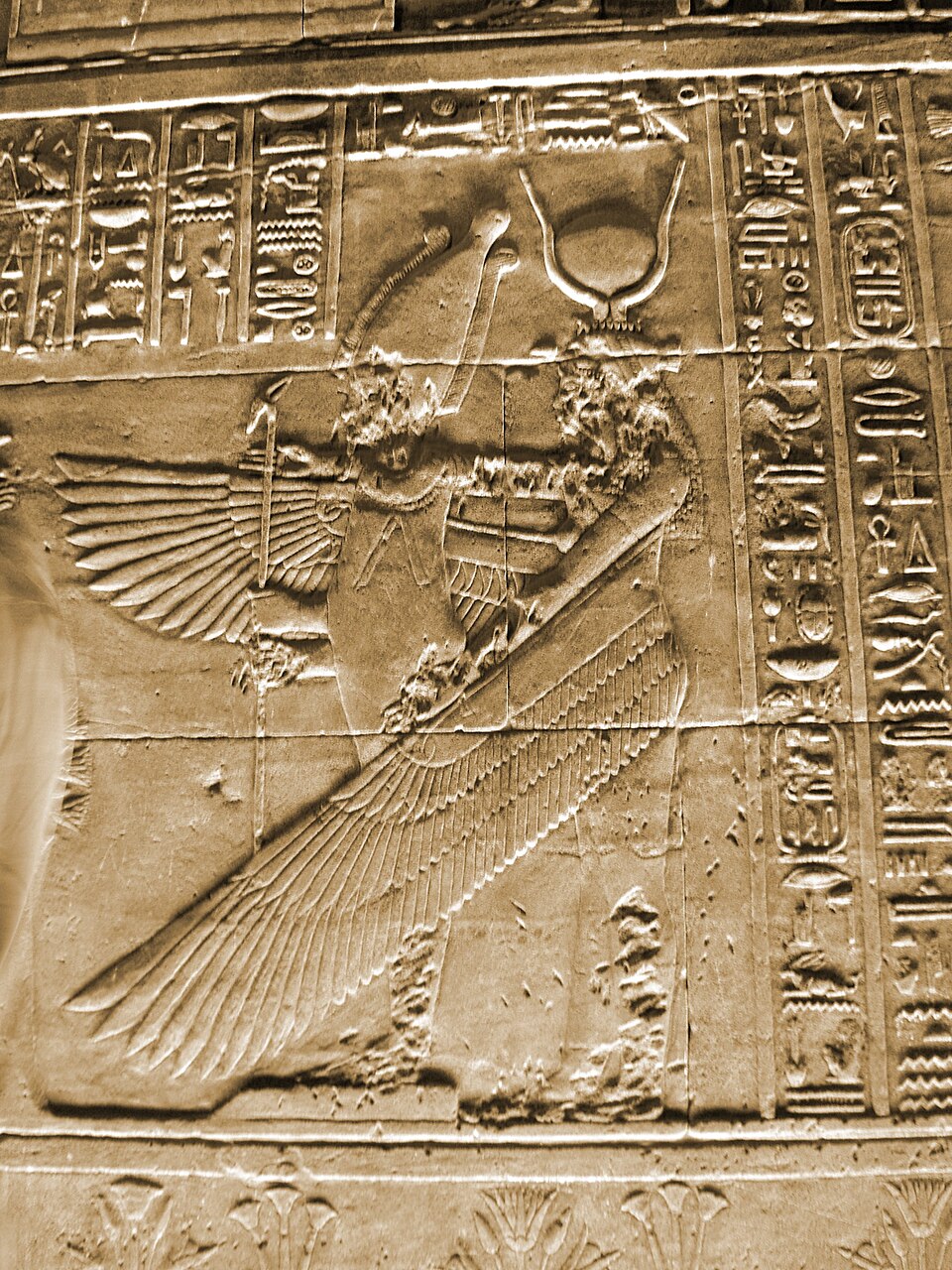
Painted burial chamber of the Tomb of Tausert and Setnakht (KV14) — winged deity on the rear wall. Wikimedia Commons.
A royal sarcophagus inside a tomb in the Valley of the Kings. Wikimedia Commons.
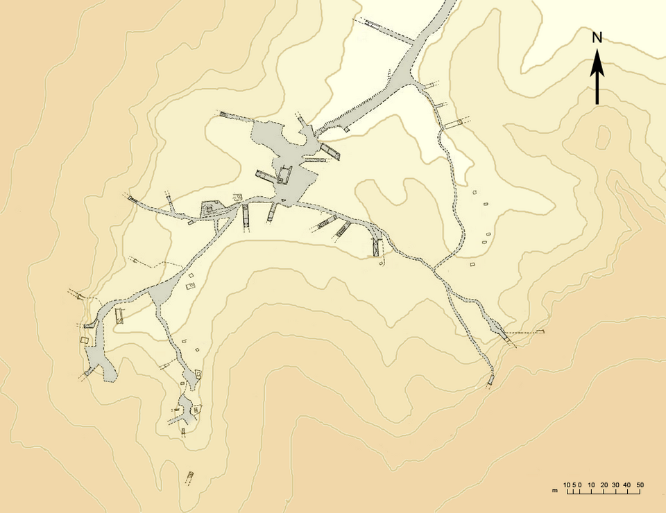
Topographic sketch map of the East Valley of the Kings showing all known tomb locations. Wikimedia Commons.
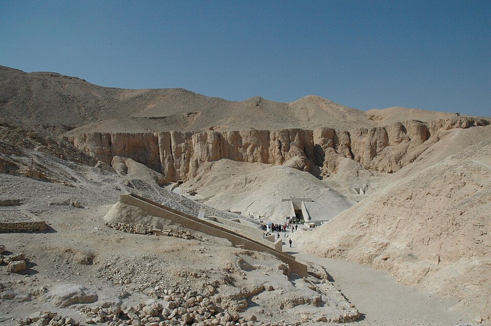
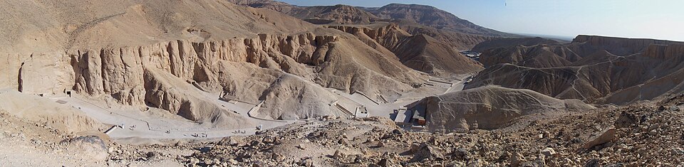
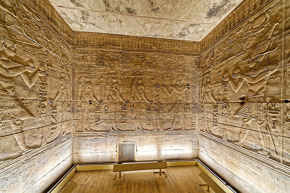
The royal necropolis of the New Kingdom pharaohs, containing 65 known tombs cut into the limestone cliffs. Here lay the pharaohs of the Exodus era — Thutmose III, Amenhotep II, Ramesses II, and Merneptah. Tutankhamun's tomb (KV62), discovered intact by Howard Carter in 1922, is the most famous archaeological discovery of the 20th century.
The tombs are decorated with elaborate scenes from funerary texts including the Book of the Dead, the Book of Gates, and the Amduat ("Book of What Is in the Underworld") — the same religious traditions that produced the papyri Joseph Smith would later acquire.
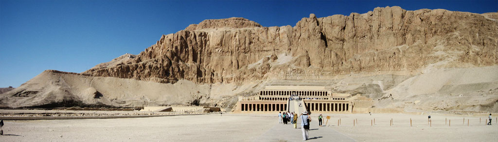
Also on the west bank: Hatshepsut's Mortuary Temple at Deir el-Bahri, the spectacular terraced temple of the female pharaoh cut into the cliffs; and the Colossi of Memnon, two massive seated figures of Amenhotep III.

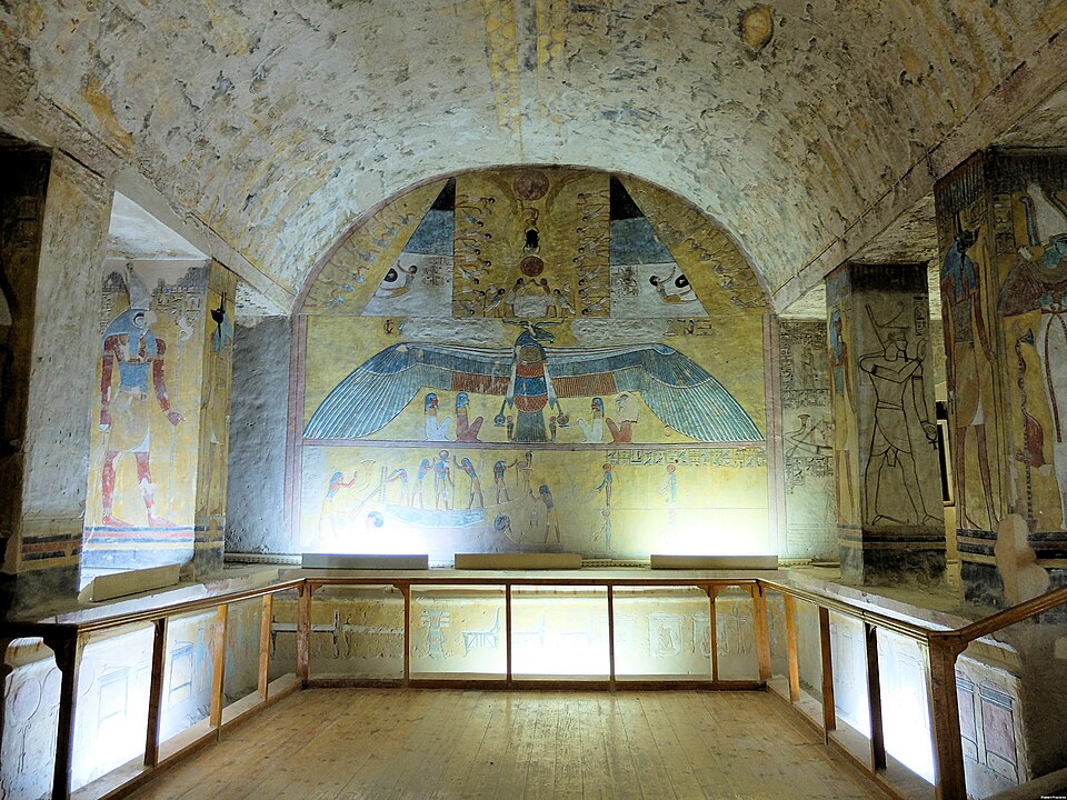
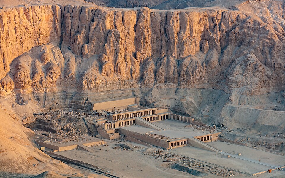
Hatshepsut's terraced mortuary temple at Deir el-Bahri. CC-BY-SA.
Panoramic view of the temple against the western cliffs of Thebes. Wikimedia Commons.

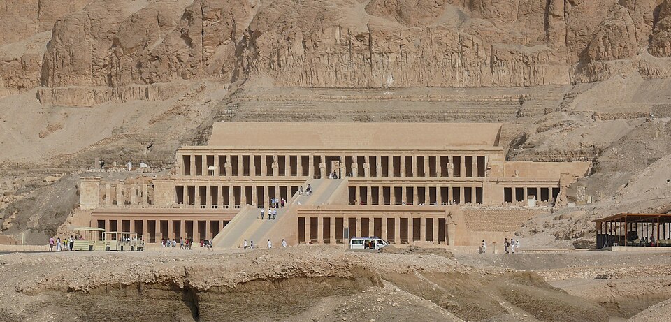
The terraced facade of Hatshepsut's mortuary temple. Wikimedia Commons.
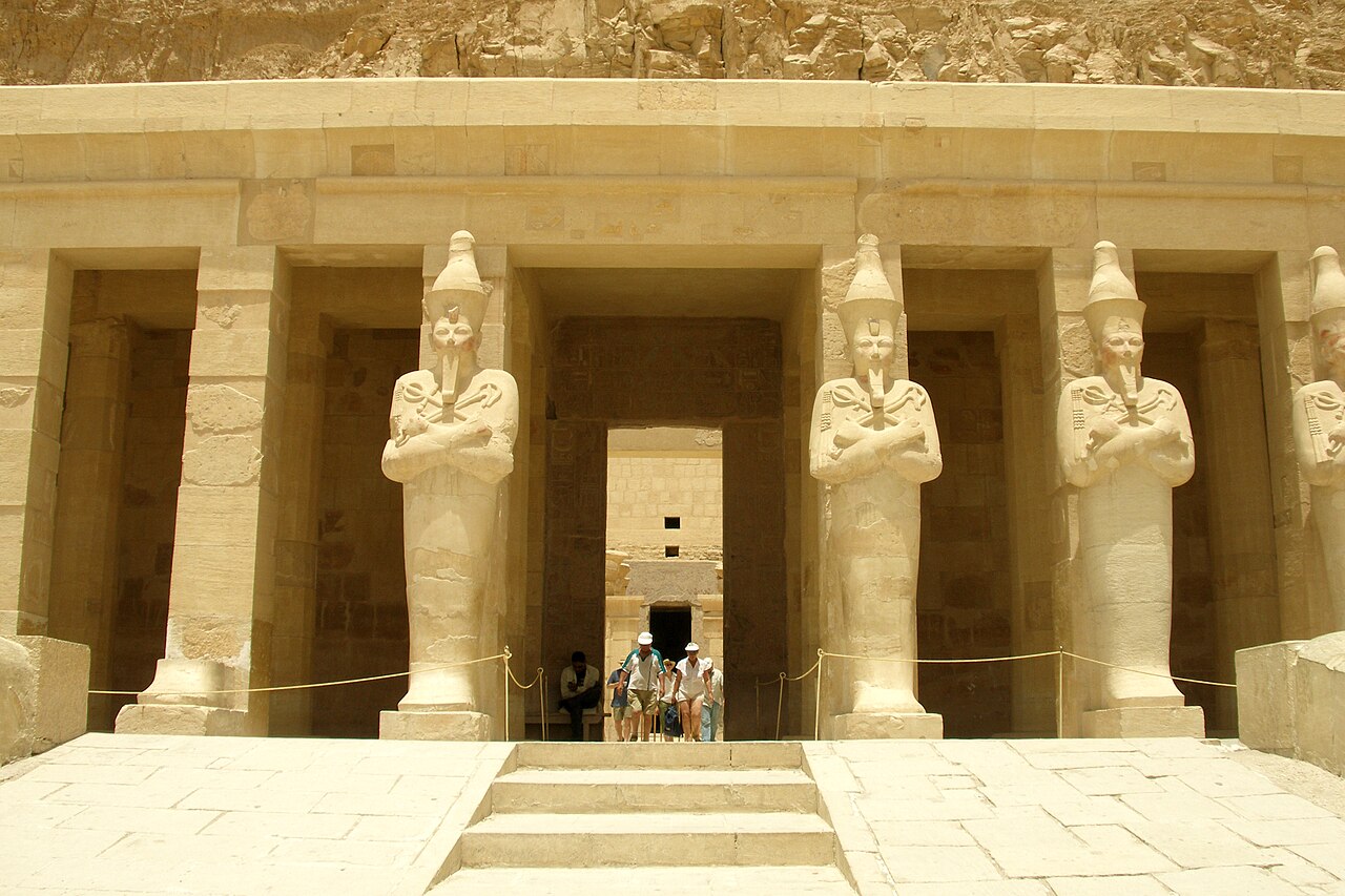
Osirian statues of Hatshepsut flanking the upper terrace entrance. Wikimedia Commons.
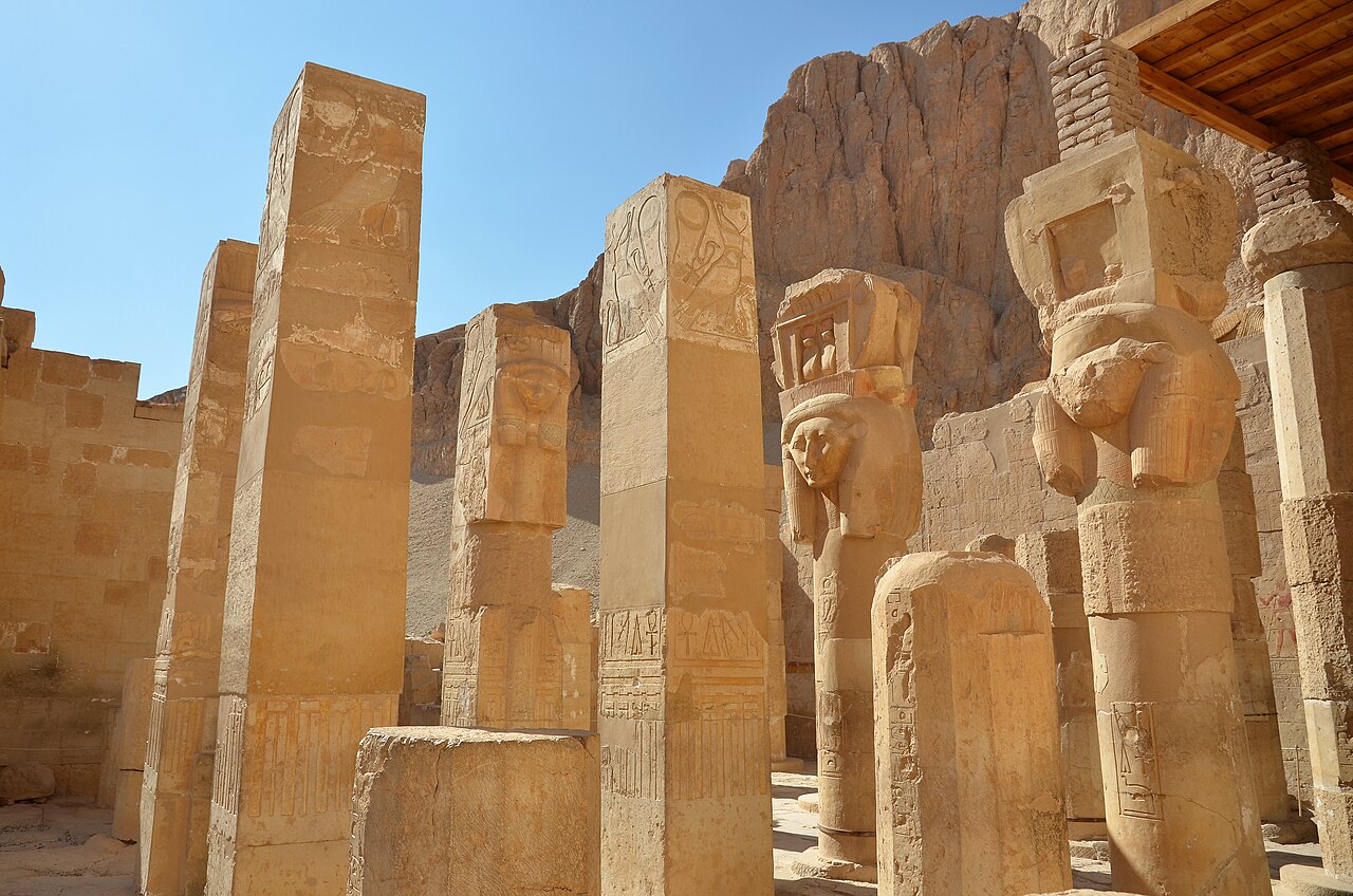
Hathor-headed pillars in the Chapel of Hathor at Deir el-Bahri. Wikimedia Commons.
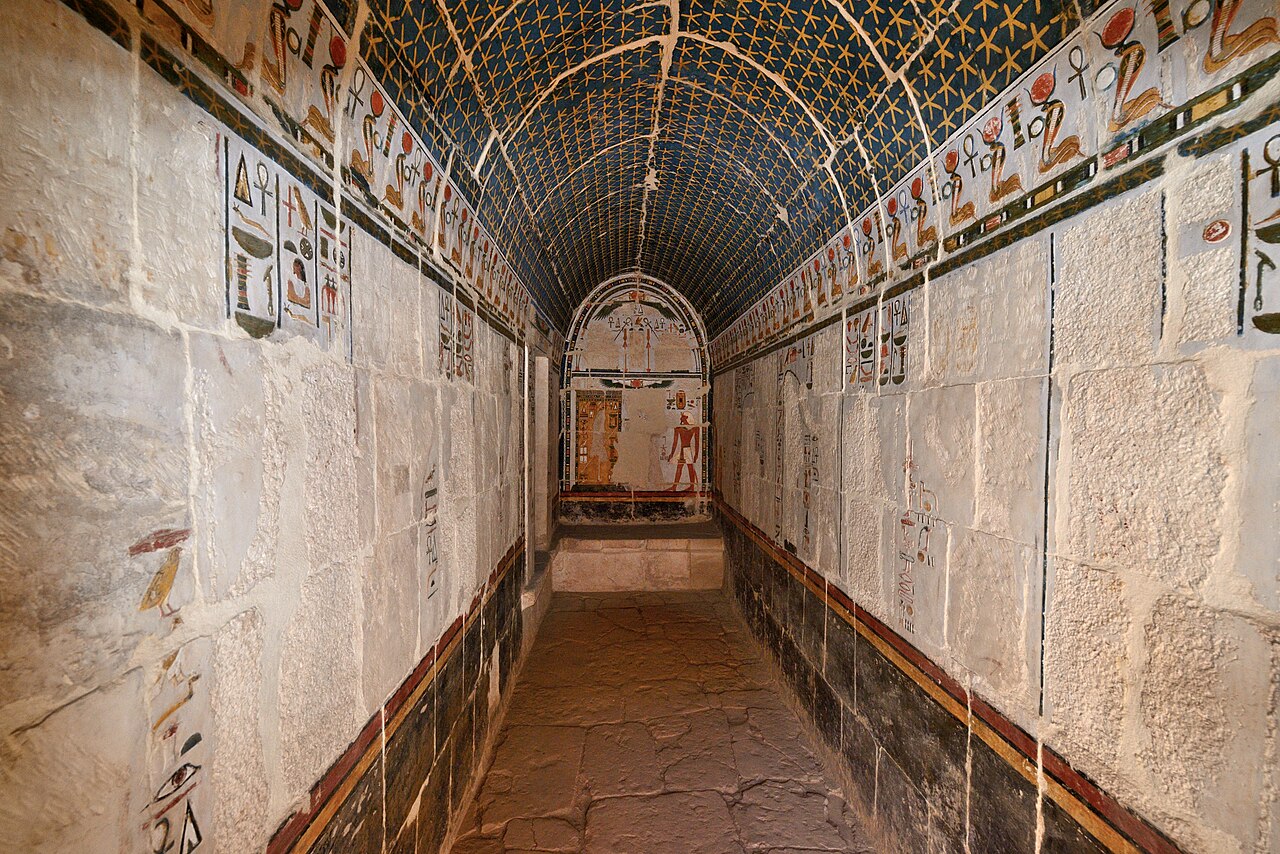
A painted corridor with star-decorated ceiling inside the temple. Wikimedia Commons.
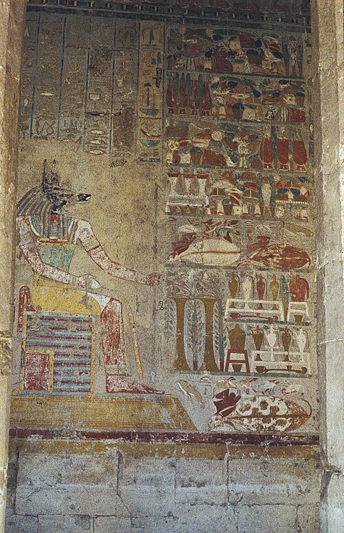
Painted relief of Anubis with offerings in the Chapel of Anubis. Wikimedia Commons.
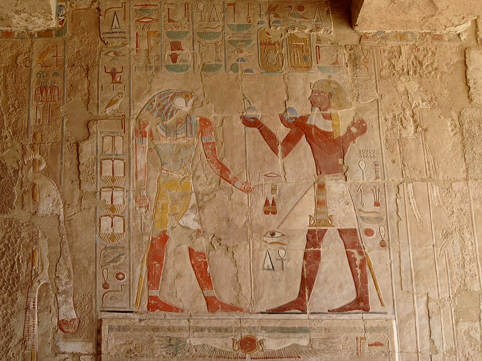
Painted relief of Horus and a pharaoh at Deir el-Bahri. Wikimedia Commons.
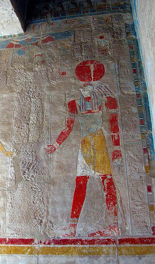
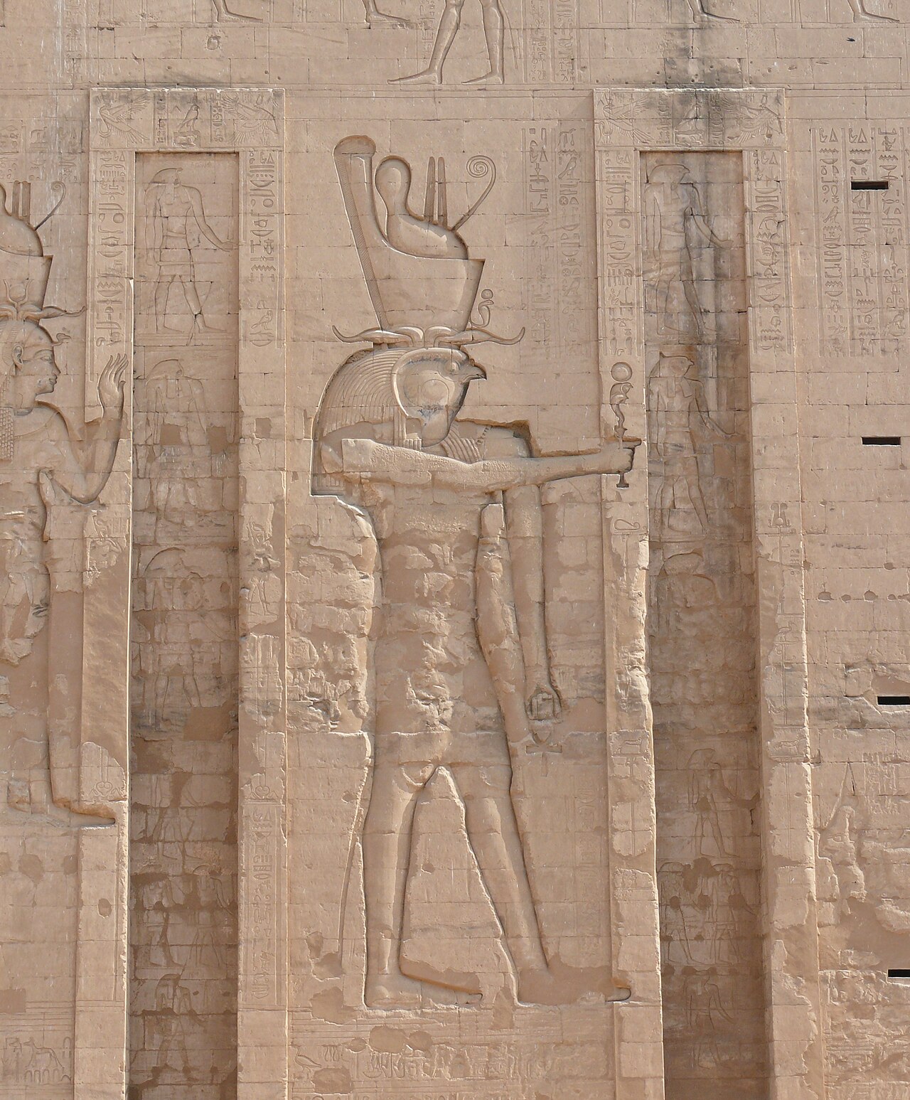
Painted figure of Ra-Horakhty at Hatshepsut's mortuary temple. Wikimedia Commons.
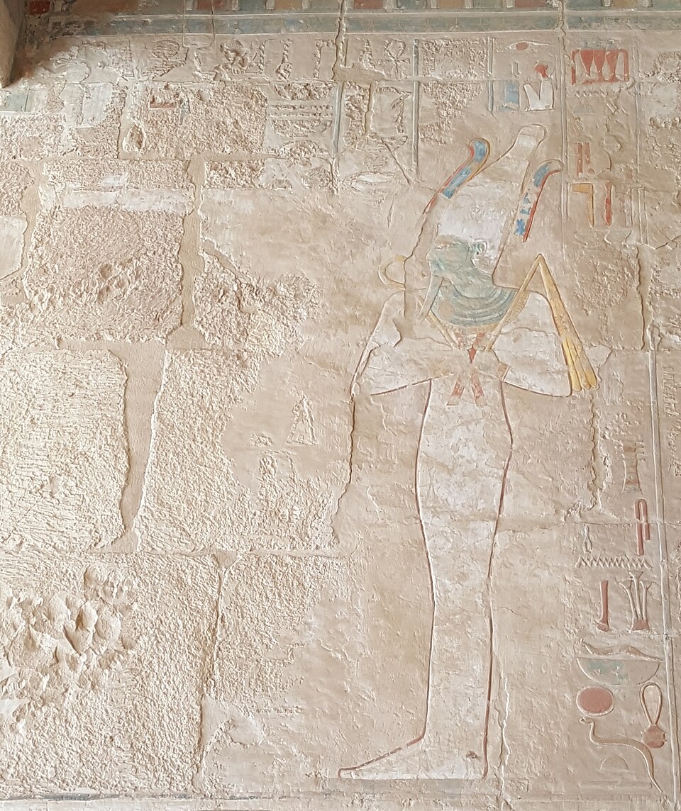
A relief where Hatshepsut's image was deliberately erased by Thutmose III — evidence of the damnatio memoriae. Wikimedia Commons.
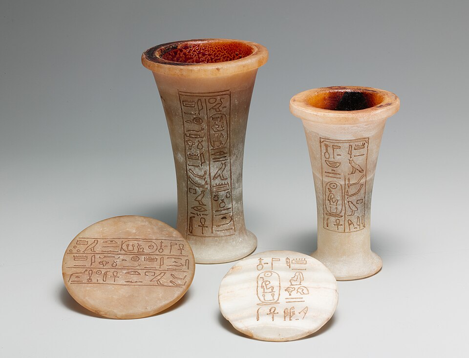
Alabaster ointment jars inscribed with Hatshepsut's cartouche — Metropolitan Museum of Art. Wikimedia Commons.
The temple set against the dramatic western cliffs of Thebes. Wikimedia Commons.
Colonnade detail at Hatshepsut's mortuary temple. Wikimedia Commons.
The Mortuary Temple of Hatshepsut at Deir el-Bahri is one of Egypt's most distinctive monuments, built in dramatic terraces against the western cliffs of Thebes. Its clean horizontal lines make it instantly recognizable among Egyptian temples.
Hatshepsut was one of the rare women to rule Egypt as pharaoh in her own right, reigning for approximately twenty years during which Egypt prospered. The temple preserves reliefs of her famous trading expedition to the land of Punt and assertions of her divine birth. After her death, her stepson Thutmose III systematically erased her name and images from monuments across Egypt — a campaign of damnatio memoriae that makes the survival of this temple all the more remarkable.
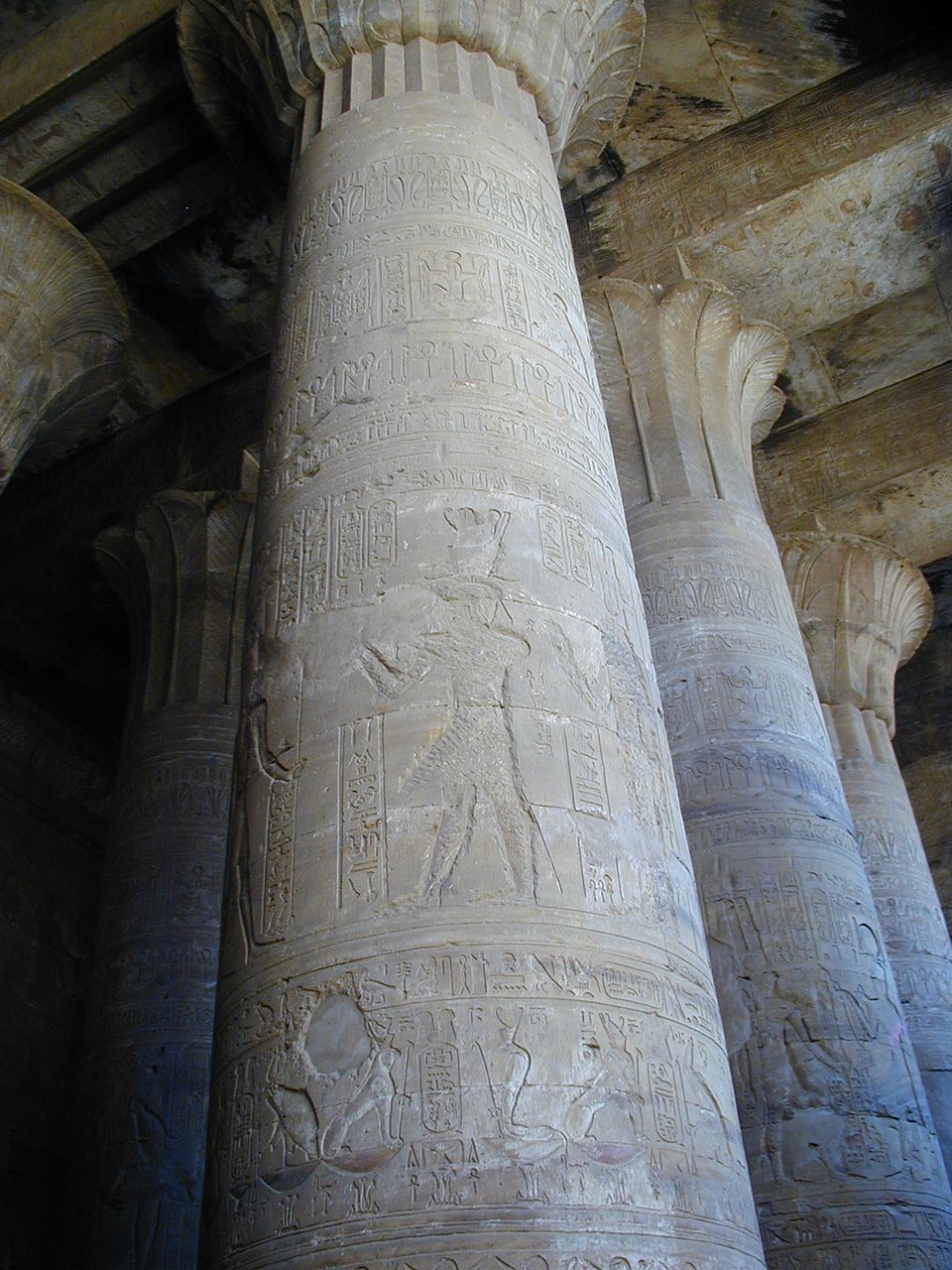
The Temple of Horus at Edfu — the second-largest Egyptian temple. Wikimedia Commons, CC-BY-SA.
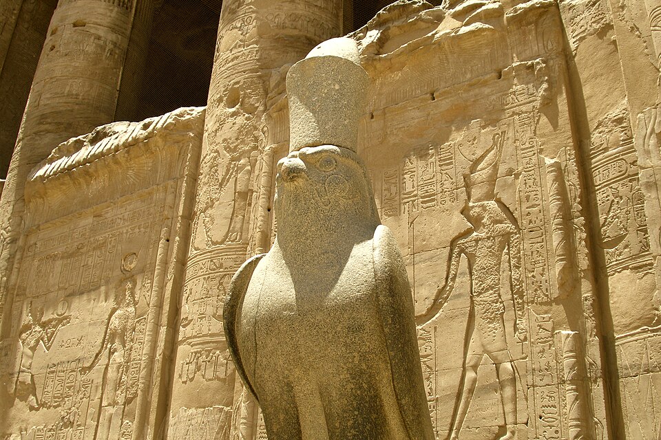
Granite statue of Horus as a falcon at the temple entrance. Wikimedia Commons.
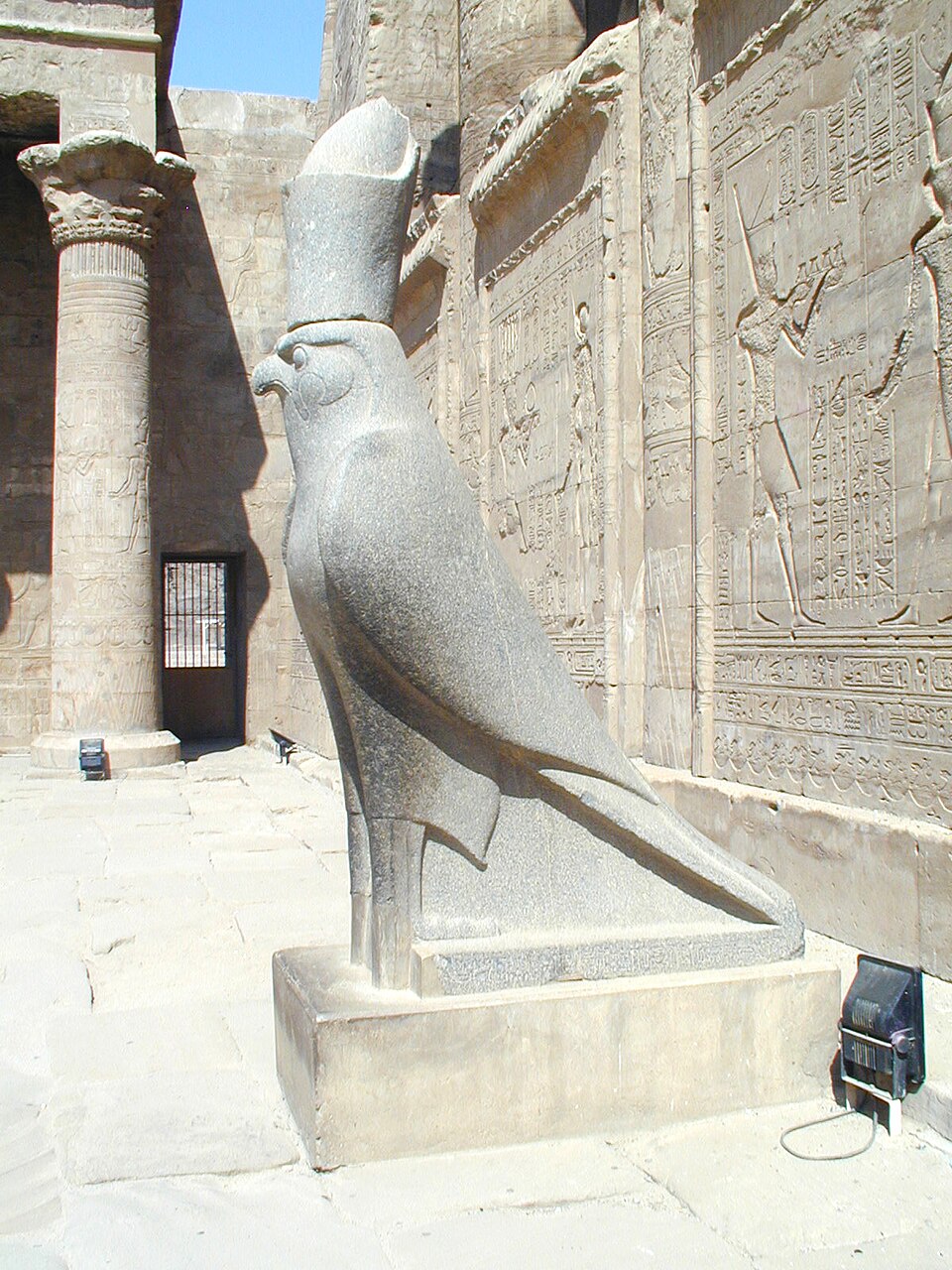
The falcon of Horus wearing the double crown, with relief-carved pylon wall behind. Wikimedia Commons.
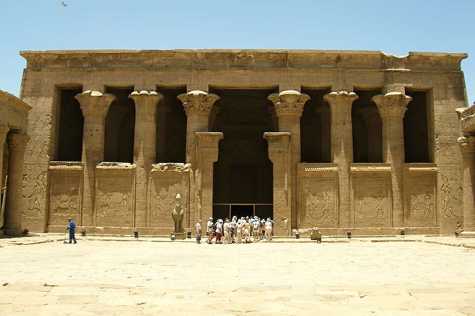
The inner court of the Temple of Horus. Wikimedia Commons.
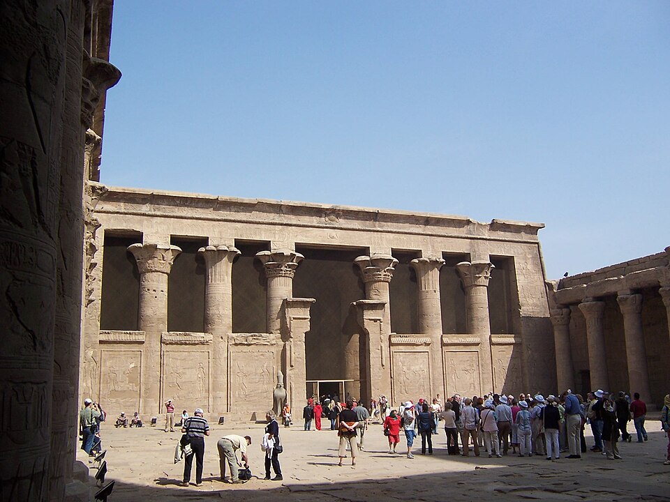
The columned court of Edfu Temple. Photo: Daniel Csorfoly, Wikimedia Commons.
A relief-covered column in the hypostyle hall of Edfu. Wikimedia Commons.
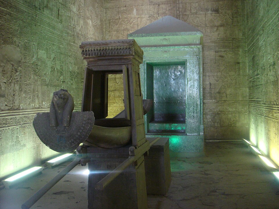
The inner sanctuary — the sacred barque of Horus and the granite naos where the cult statue stood. Wikimedia Commons.
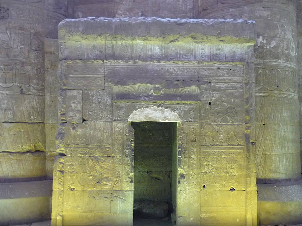
The doorway to the inner sanctuary of Edfu Temple. Wikimedia Commons.
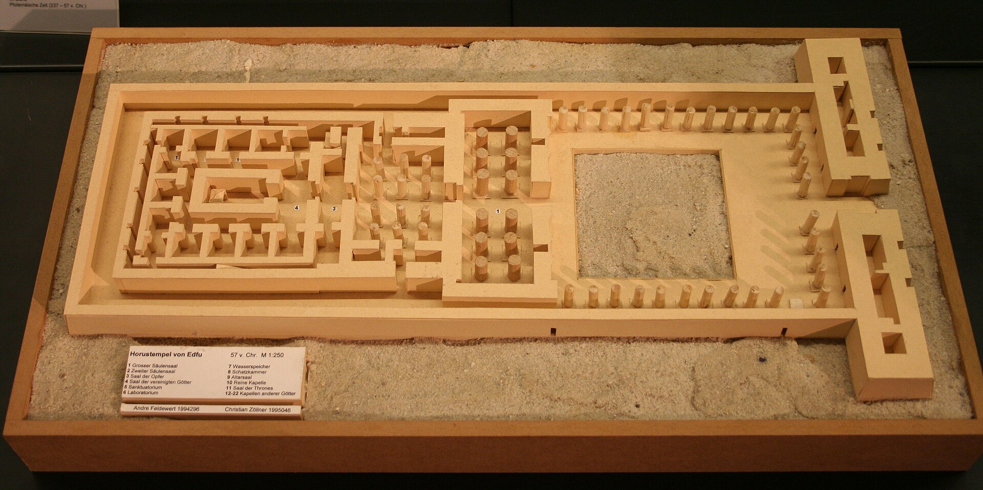
Scale model of the Temple of Horus at Edfu — showing the complete plan of a Ptolemaic temple. Kestner Museum, Wikimedia Commons.
19th-century plan and elevation drawing of the Temple of Horus at Edfu. Wikimedia Commons.
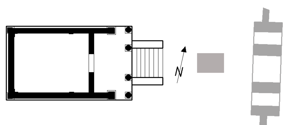
The Temple of Horus at Edfu is the second-largest Egyptian temple (after Karnak) and one of the most remarkably well-preserved, having been buried under sand and village buildings for centuries. Built during the Ptolemaic period, it preserves the full plan of an Egyptian temple — from the massive pylon entrance through the hypostyle halls to the inner sanctuary — giving modern visitors the clearest picture of what a complete Egyptian temple looked like in its functioning state.
Edfu's walls contain an unusually complete record of temple liturgy and ritual, including the dramatic annual reenactment of the myth of Horus defeating Seth — the triumph of order over chaos. The temple's inscriptions also preserve the "Building Texts," which describe the mythological origins of Egyptian temples themselves, tracing the tradition back to a primeval island of creation.
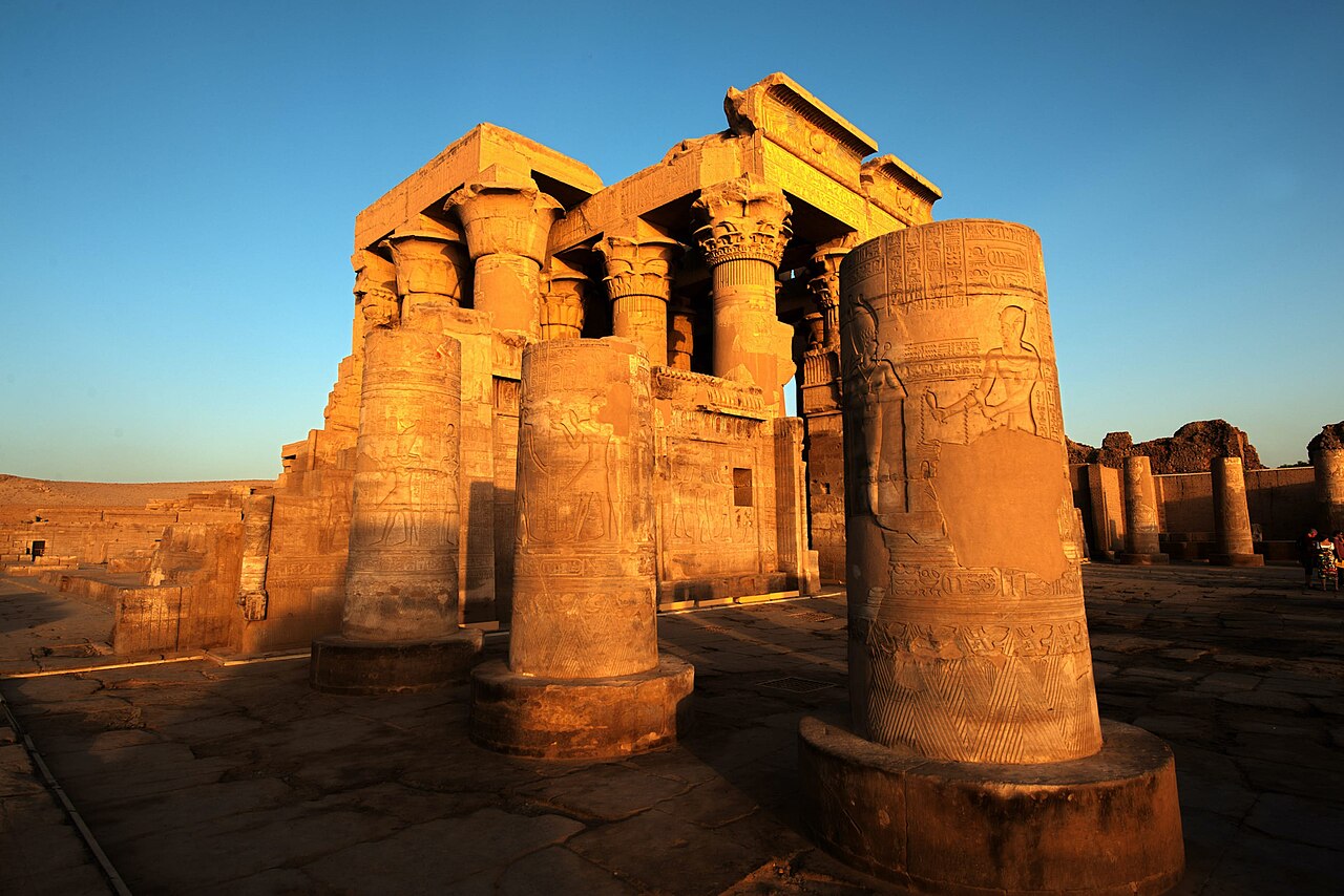
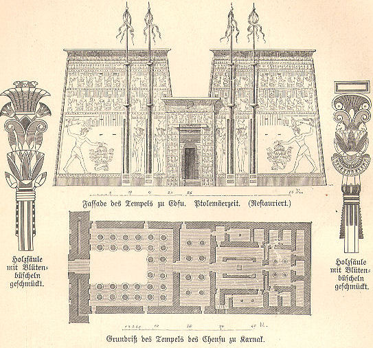
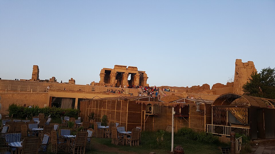
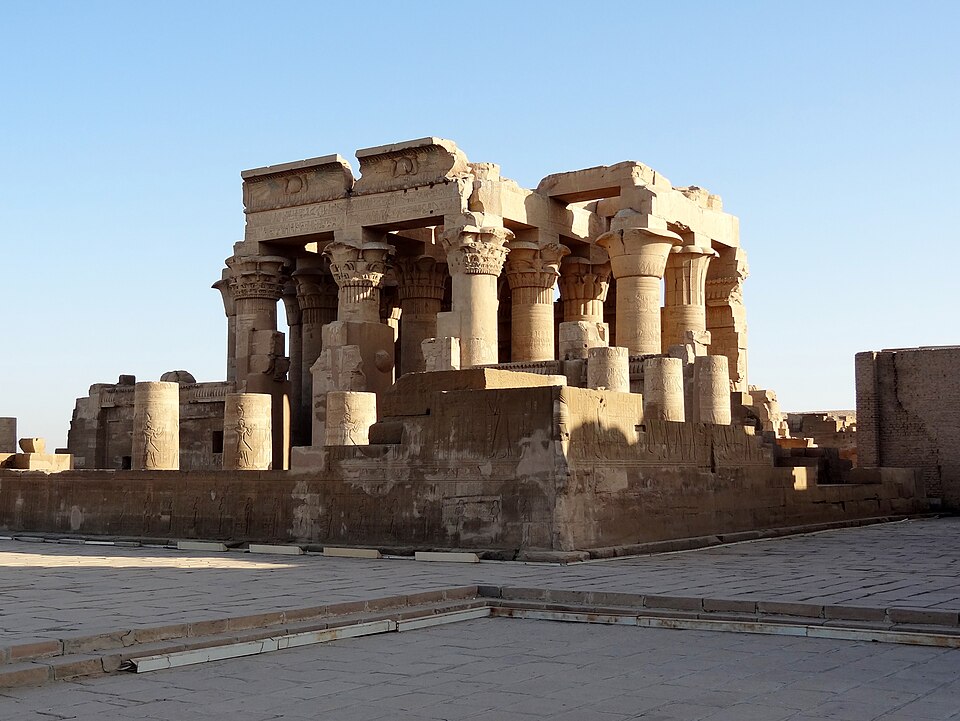
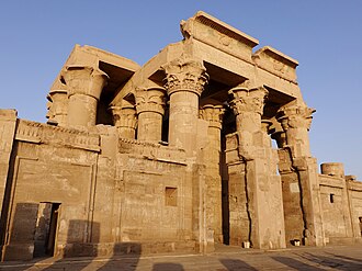
The double temple at Kom Ombo. CC-BY-SA.
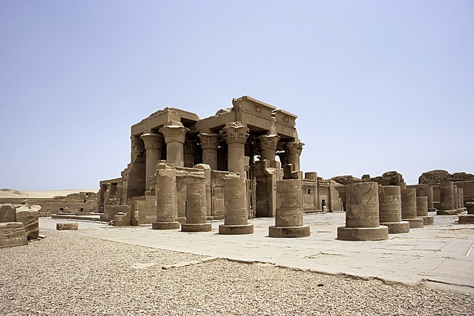
The double temple of Kom Ombo — the symmetrical twin entrances are visible. Wikimedia Commons.
Kom Ombo Temple at sunset, viewed from the Nile. Wikimedia Commons.
Kom Ombo overlooking the Nile. Wikimedia Commons.
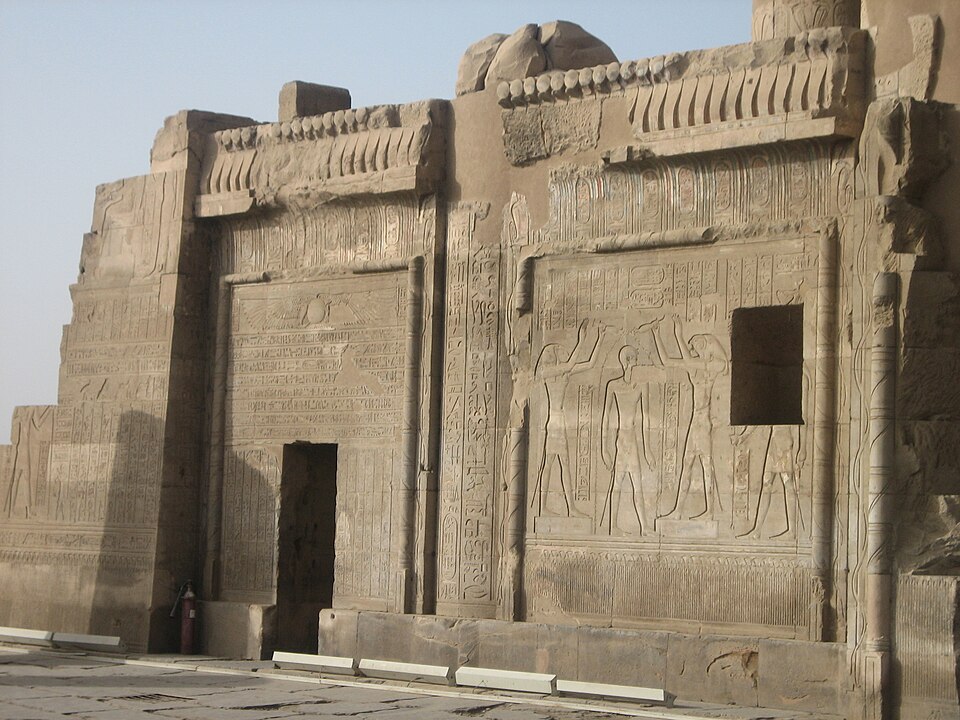
The twin doorways of Kom Ombo — one for Sobek, one for Horus. Wikimedia Commons.
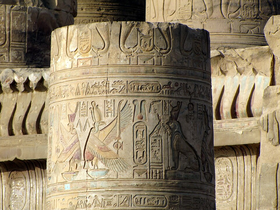
Hieroglyph-carved columns with winged sun disk at Kom Ombo. Wikimedia Commons.
Carved portal at Kom Ombo. Wikimedia Commons.
Carved lion relief in the pronaos of Kom Ombo. Wikimedia Commons.
Relief of Ptolemy making offerings before Sobek and Hathor. Wikimedia Commons.
Relief of the crocodile god Sobek crowning a pharaoh at Kom Ombo. Wikimedia Commons.
Offering scene in the pronaos of Kom Ombo. Wikimedia Commons.
Procession of deities carved on the exterior wall of Kom Ombo. Wikimedia Commons.
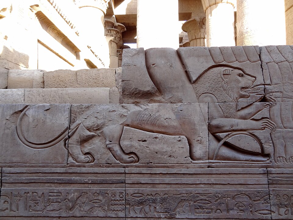
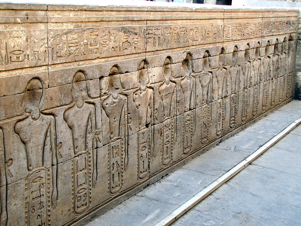
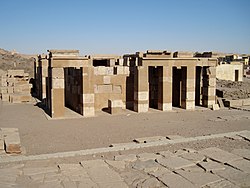
A unique double temple dedicated to two gods: Sobek (the crocodile god) on the right and Horus the Elder on the left. The temple is perfectly symmetrical, with twin entrances, twin halls, and twin sanctuaries. Its riverside location overlooking the Nile — at a point where crocodiles once gathered in large numbers — makes it one of the most dramatically situated temples in Egypt.
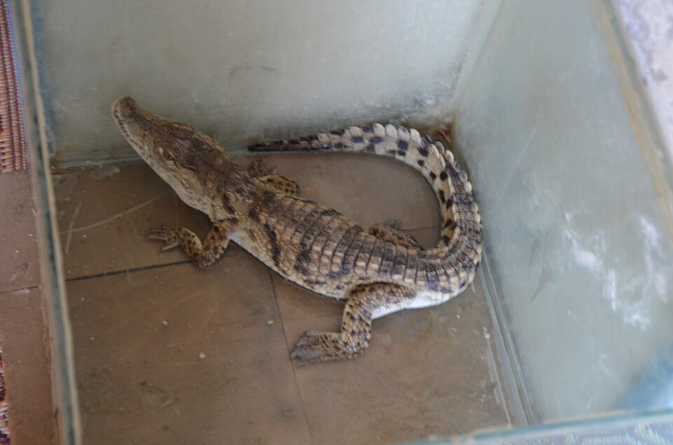
The temple walls include an unusual carved relief depicting what appear to be surgical instruments, suggesting medical knowledge associated with the site. Adjacent to the temple, a small Crocodile Museum displays mummified crocodiles recovered from a nearby necropolis — a vivid reminder of the reverence Egyptians held for Sobek's sacred animal. In antiquity, Kom Ombo also served as a military garrison controlling the trade routes from Nubia into Egypt.
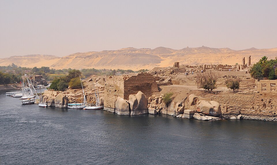
Elephantine Island at the first cataract of the Nile, Aswan. Wikimedia Commons.
A felucca sailing past Elephantine Island at Aswan. Wikimedia Commons.
The lush west bank of Elephantine Island with a moored felucca. Wikimedia Commons.
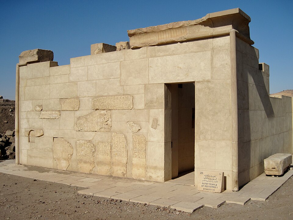
The reconstructed Satet Temple of Sesostris I (12th Dynasty) on Elephantine Island. Wikimedia Commons.
Ruins of the Temple of Satet on Elephantine Island. Wikimedia Commons.
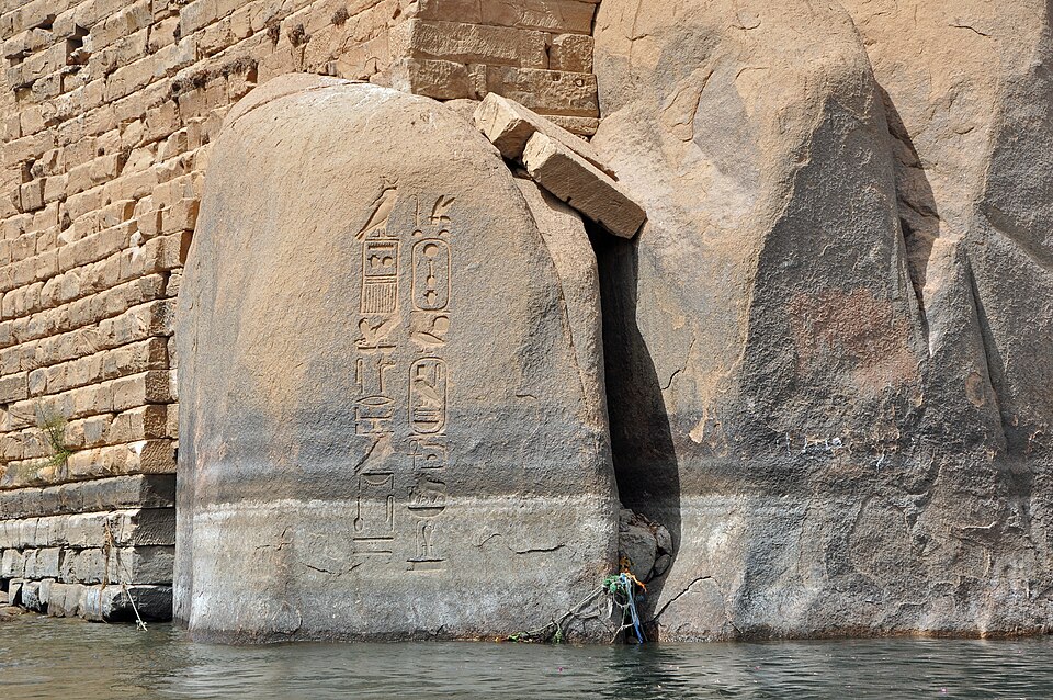
A royal cartouche carved into the granite at the water's edge on Elephantine. Wikimedia Commons.
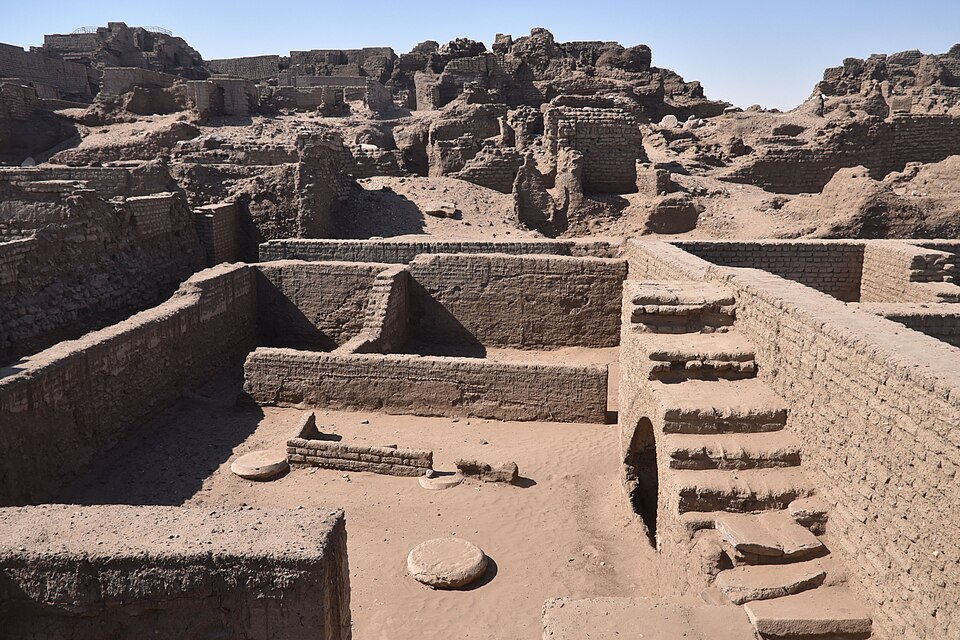
Excavated ruins of the ancient fortified settlement on Elephantine Island. Wikimedia Commons.
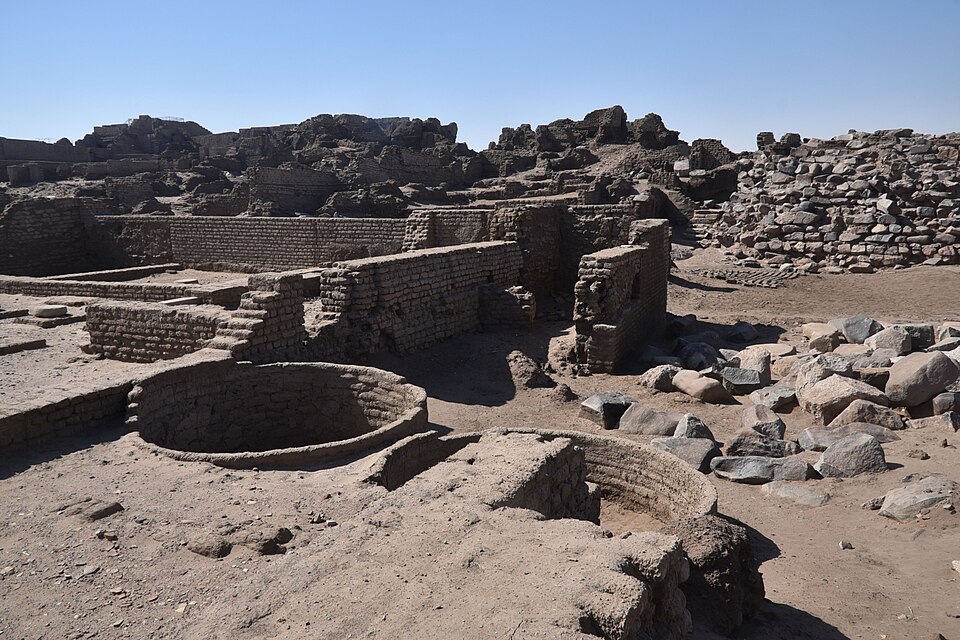
Archaeological remains on Elephantine — the site of the Jewish military colony. Wikimedia Commons.
The fortified settlement ruins on Elephantine, spanning millennia of occupation. Wikimedia Commons.
A Nile crocodile on Elephantine Island — the first cataract was historically a gathering point for crocodiles. Photo: Hatem Moushir, Wikimedia Commons.
A small island at Egypt's southern frontier that became home to the Jewish military colony discussed in our Jewish Communities section. The Aramaic papyri discovered here — letters, contracts, and religious documents from a Jewish garrison serving the Persian Empire — are among the most important extrabiblical witnesses to Jewish life in the 5th century BC.
The island also housed a temple to the ram-headed god Khnum, whose priests destroyed the Jewish temple around 410 BC. A Nilometer (ancient gauge for measuring the Nile flood) survives on the island and was critical for predicting agricultural productivity. Nearby in an Aswan granite quarry lies the Unfinished Obelisk — an enormous abandoned monument that reveals exactly how obelisks were carved from the bedrock.
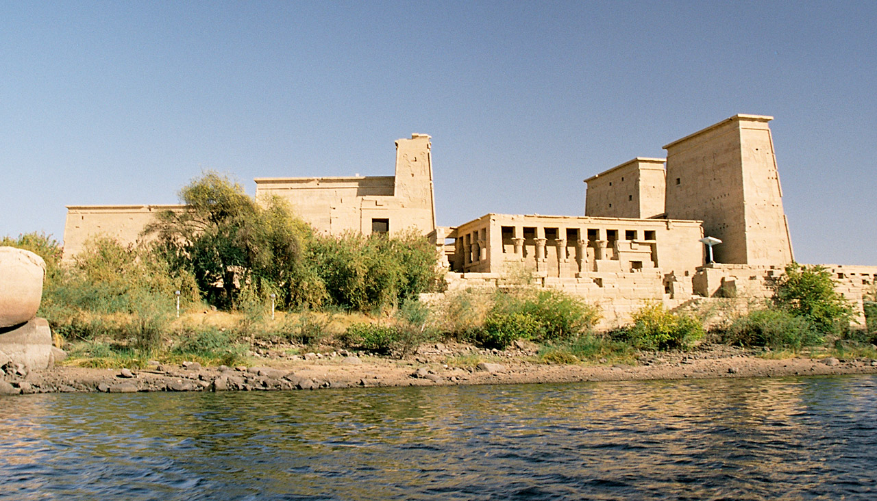
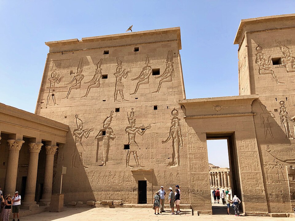
The Temple of Isis at Philae — site of the last known hieroglyphic inscription (AD 394). Wikimedia Commons, CC-BY-SA.
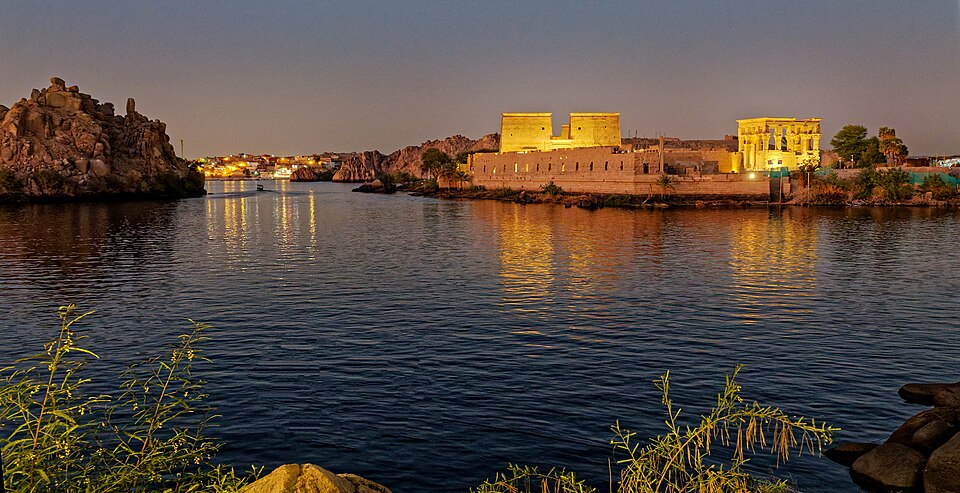
The Philae Temple Complex illuminated at night on Agilkia Island. Wikimedia Commons.
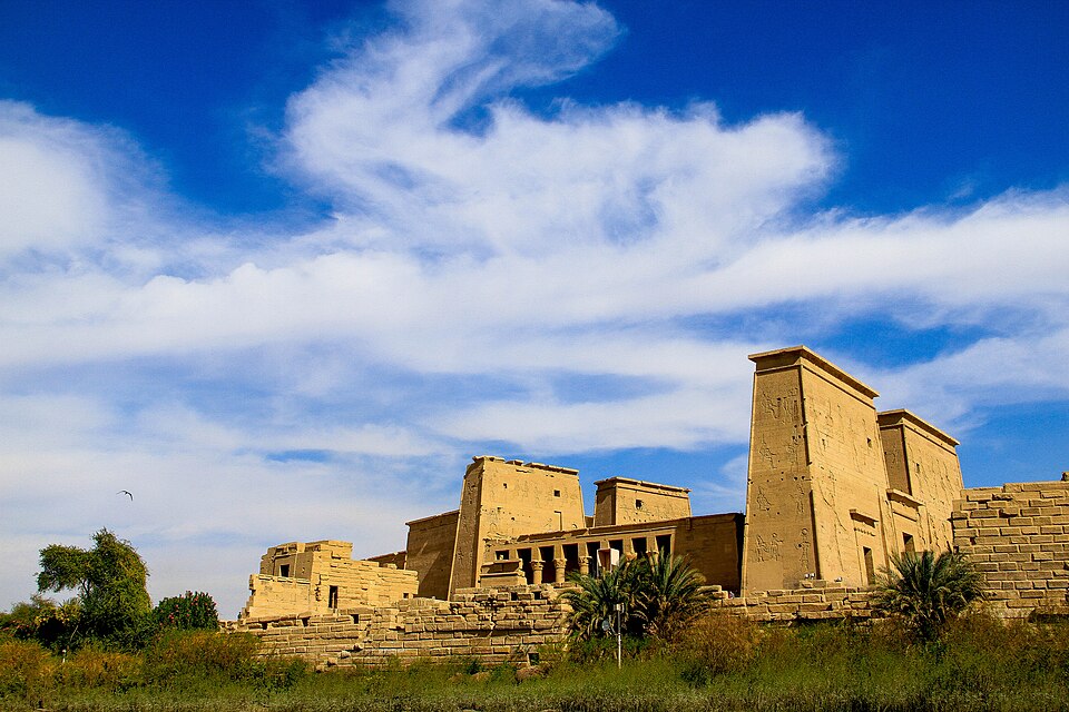
The Temple of Isis at Philae. Wikimedia Commons.
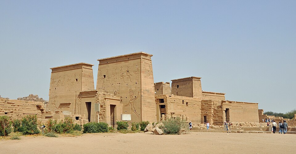
The first pylon — the main entrance to the Temple of Isis. Wikimedia Commons.
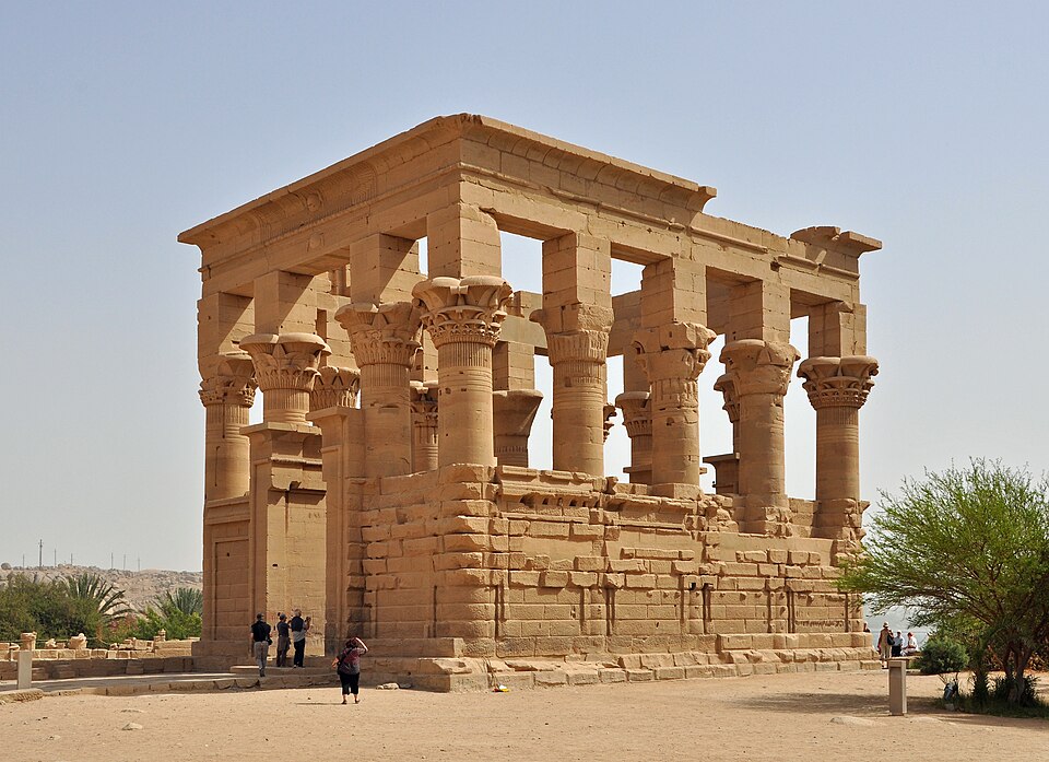
The Kiosk of Trajan — an elegant open pavilion that has become the iconic image of Philae. Wikimedia Commons.
Ornate floral column capitals at Philae. Wikimedia Commons.
Carved reliefs covering the walls of an inner chamber. Wikimedia Commons.
Relief of the winged goddess Isis at Philae. Wikimedia Commons.
Relief of Isis receiving offerings at Philae. Wikimedia Commons.
The Philae Temple Complex from the water. Wikimedia Commons.
Architectural plan of the Temple of Augustus at Philae. Wikimedia Commons.
One of the last functioning Egyptian temples, Philae was dedicated to the goddess Isis and remained active well into the Christian era. The last known hieroglyphic inscription (AD 394) and the last known Demotic inscription (AD 452) were both carved here — making Philae the site where the ancient Egyptian writing tradition finally fell silent.
Like Abu Simbel, the temple was relocated in the 1960s–70s to save it from the Aswan High Dam's floodwaters.
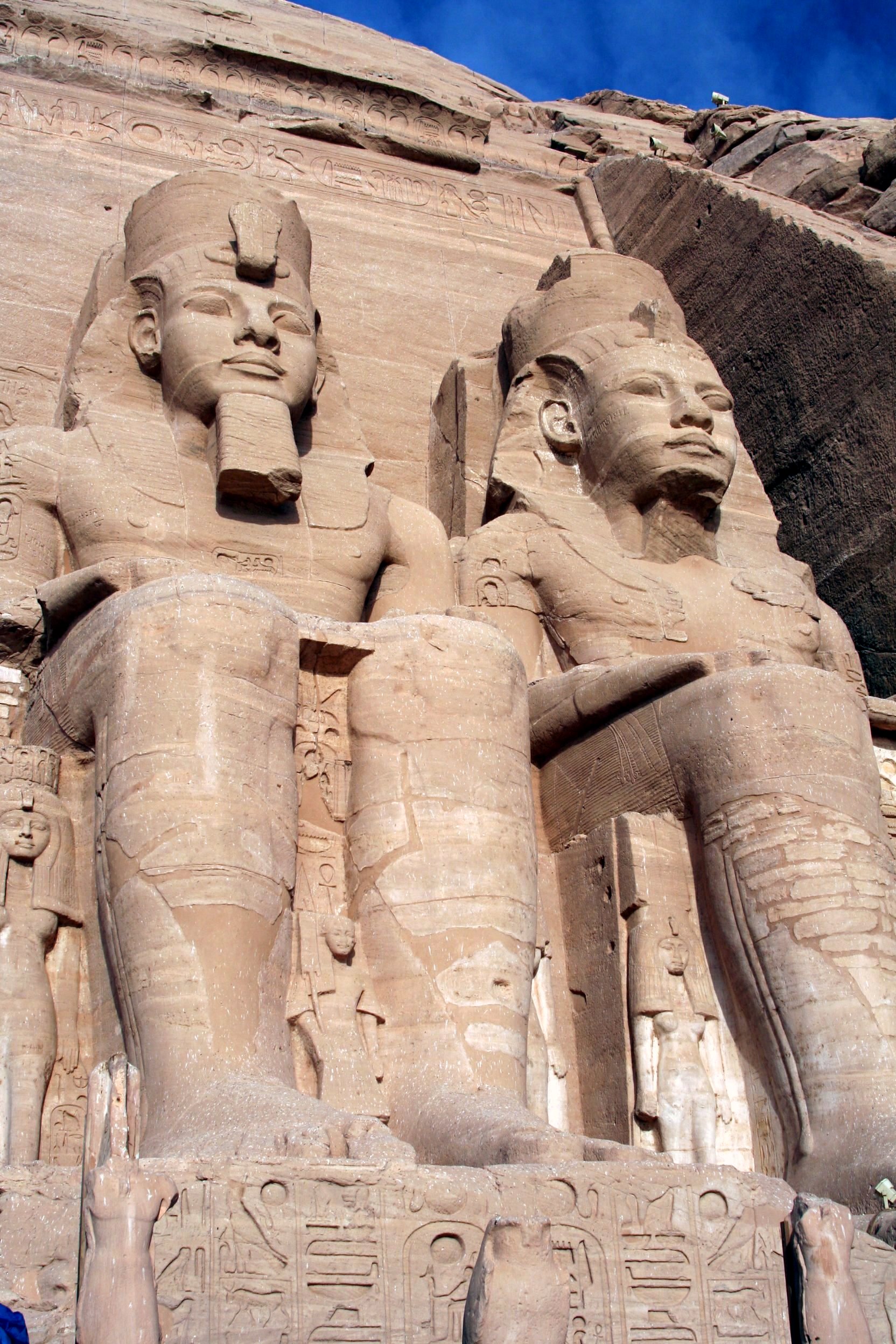
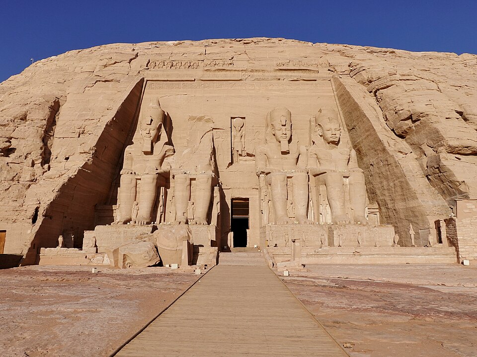
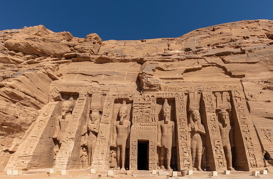
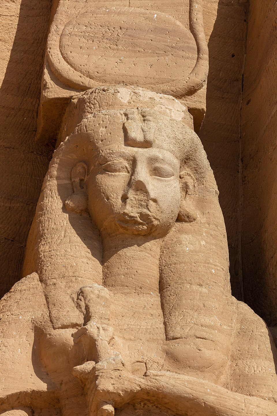
The Great Temple of Abu Simbel — four colossal seated figures of Ramesses II, each 66 feet tall. Wikimedia Commons, CC BY-SA 3.0.
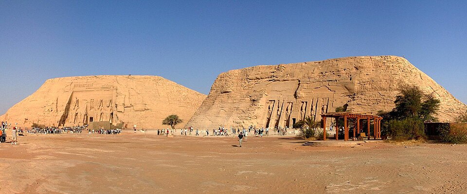
Panoramic view showing both temples — the Great Temple of Ramesses II (left) and the Temple of Nefertari (right). Wikimedia Commons.
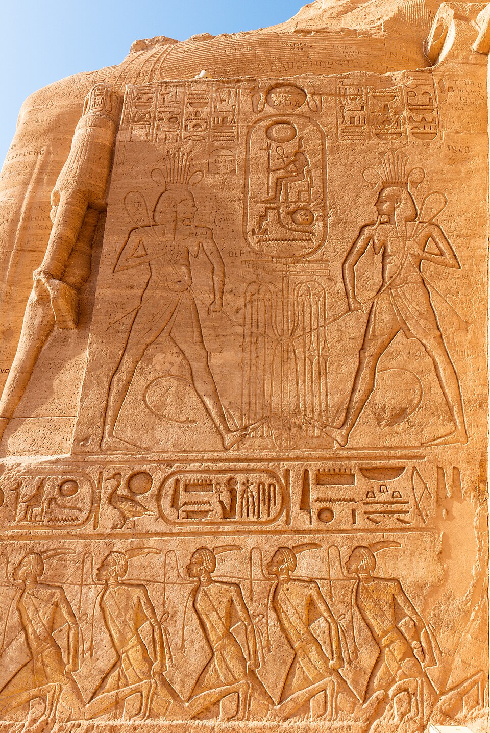
Carved reliefs on the exterior of the Great Temple with cartouches and bound captives. Wikimedia Commons.
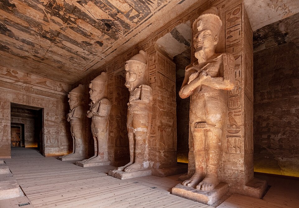
Osiride pillars of Ramesses II lining the interior hall of the Great Temple. Wikimedia Commons.
Inside the Great Temple of Abu Simbel. Wikimedia Commons.
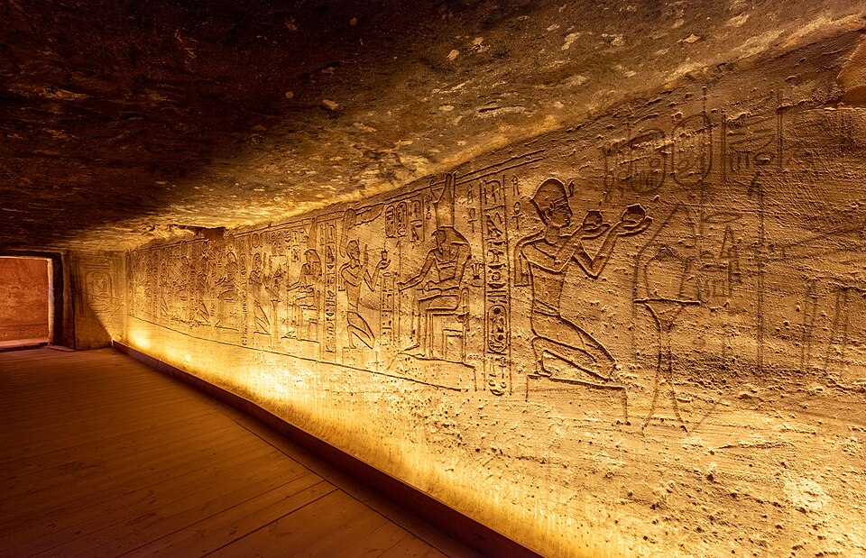
Carved wall reliefs inside the Great Temple depicting Ramesses before the gods. Wikimedia Commons.
Relief of Ramesses II presenting offerings to a deity inside the Great Temple. Wikimedia Commons.
The facade of the Temple of Nefertari — one of the very few Egyptian temples dedicated to a royal wife. Wikimedia Commons.
Close-up of a colossal statue of Nefertari at her temple. Wikimedia Commons.
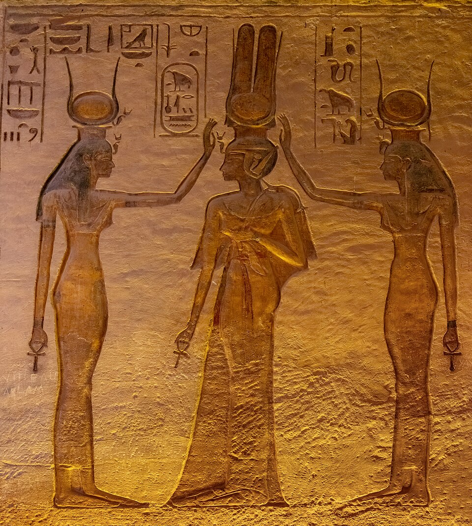
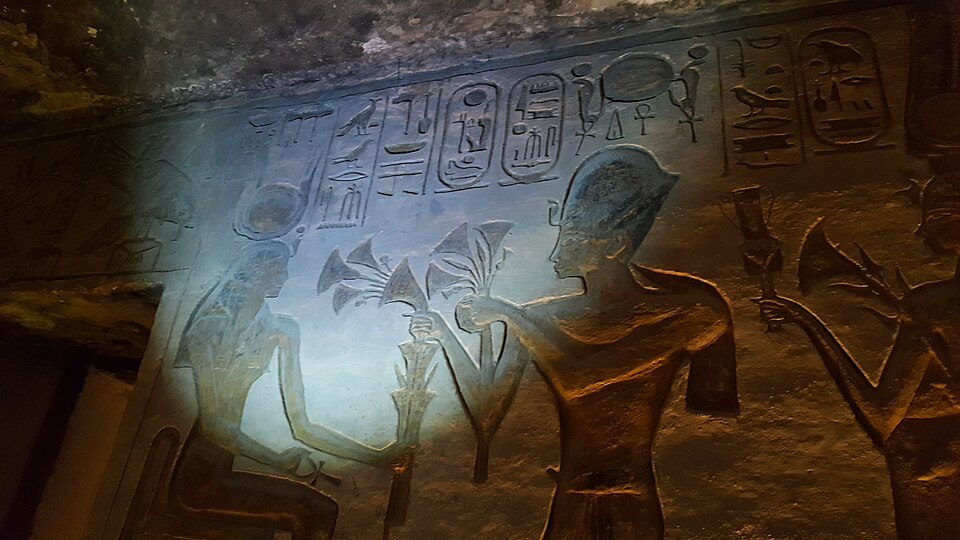
Nefertari crowned by Isis and Hathor — painted relief inside the Temple of Nefertari. Wikimedia Commons.
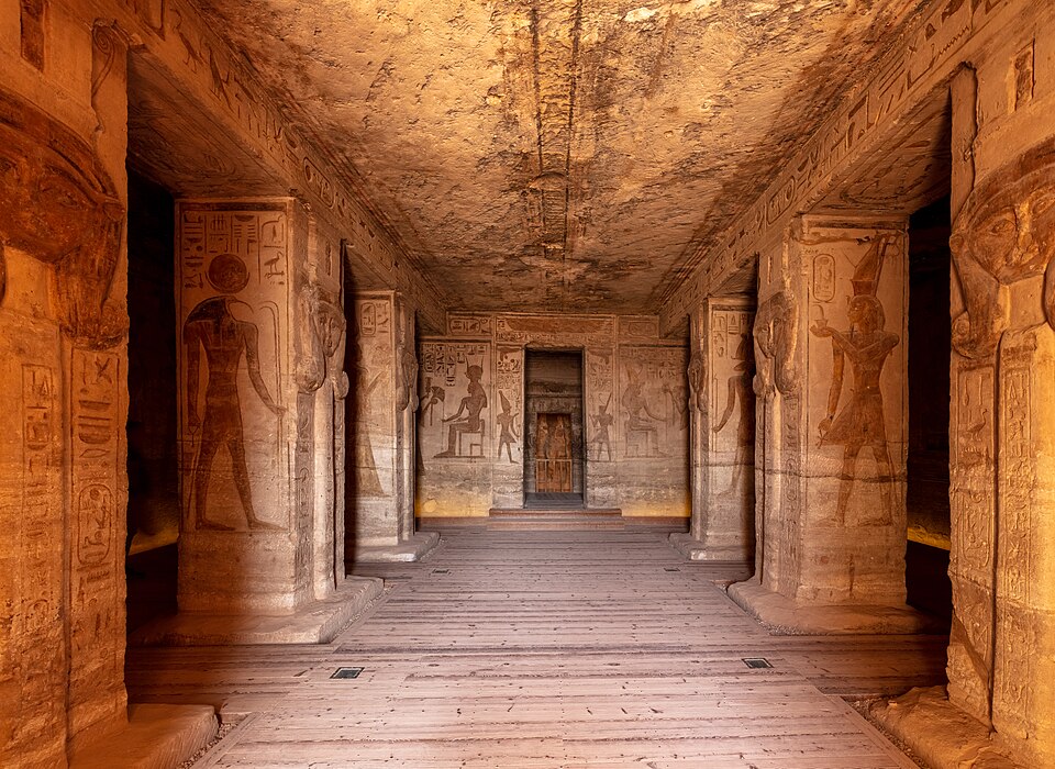
Carved and painted wall reliefs inside the Temple of Nefertari. Wikimedia Commons.
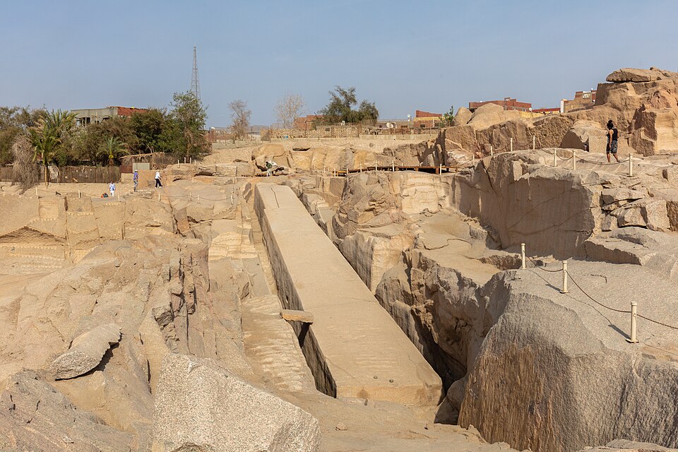
The Unfinished Obelisk in an Aswan granite quarry — revealing how obelisks were carved from the bedrock. Wikimedia Commons.
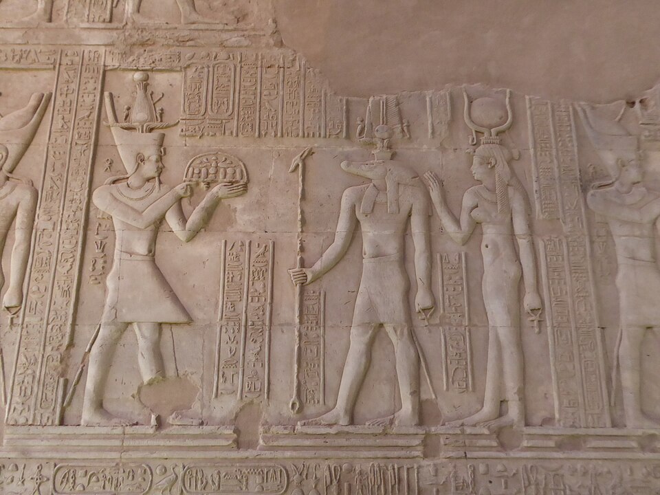
Ramesses II's rock-cut temple complex, featuring four colossal seated figures of the pharaoh (each 66 feet tall) guarding the entrance. The temple was designed so that twice a year, on February 22 and October 22, the rising sun penetrated the full length of the inner sanctuary to illuminate the statues of the gods within.
Adjacent to the Great Temple stands the smaller Temple of Nefertari, dedicated to Ramesses' principal queen and the goddess Hathor — one of the very few Egyptian temples dedicated to a royal wife. In the 1960s, both temples were dismantled and relocated to higher ground to save them from the rising waters of Lake Nasser behind the Aswan High Dam — one of the greatest feats of archaeological engineering ever undertaken.
Explore Further: World History Encyclopedia
- Great Pyramid of Giza
- Karnak
- Abu Simbel
- Alexandria, Egypt
- Thebes (Egypt)
- Memphis
- Nile
- Pi-Ramesses
- Elephantine Island (Britannica)
World History Encyclopedia is a nonprofit, peer-reviewed reference (CC BY-NC-SA 4.0).
Explore Further: Official Sites & Digital Resources
- Grand Egyptian Museum — The world's largest archaeological museum (opened 2025), housing 100,000+ artifacts including Tutankhamun's treasures
- Bibliotheca Alexandrina — Official site of the modern Library of Alexandria; includes a digital Hellenistic Studies center
- Theban Mapping Project — Digital tomb plans, exploration histories, and archaeological data for the Valley of the Kings
- UNESCO — Nubian Monuments from Abu Simbel to Philae — World Heritage listing covering Abu Simbel, Philae, Elephantine, and Kalabsha
- American Research Center in Egypt (ARCE) — Conservation and research at Karnak (Khonsu Temple), Mut Temple, and other sites
- Britannica — Grand Egyptian Museum
- Britannica — Valley of the Kings
← Previous: Written Records | Egypt Guide Home | Next: Multicultural Networks →