The Land Between the Rivers
The floodplain that made the world's first cities — and made empire almost inevitable
The Greeks called it Mesopotamia, “the land between the rivers.” The Bible calls its southern plain Shinar (Genesis 11:2). Later, it simply says Babylon — a city’s name stretched to cover a whole world. The land itself lies between the Tigris and the Euphrates, in what is now Iraq: a flat plain built entirely from river silt. It has no stone to quarry. No timber worth building with. No metal ore at all. And on that unpromising mudflat, human beings invented the city, the written word, the law code, the school, and the empire.
To understand Babylon, start with this landscape. It explains why the city grew, why it needed to trade and conquer, why its temples were towers of brick rather than stone, and why its armies kept appearing on Judah’s horizon. Geography is not destiny — but in Mesopotamia it came close.
Babylon in its world — drag the slider through the ages, from Sumer to Rome. It opens on the Neo-Babylonian empire of Nebuchadnezzar, c. 600 BC.
Two Rivers, Two Temperaments
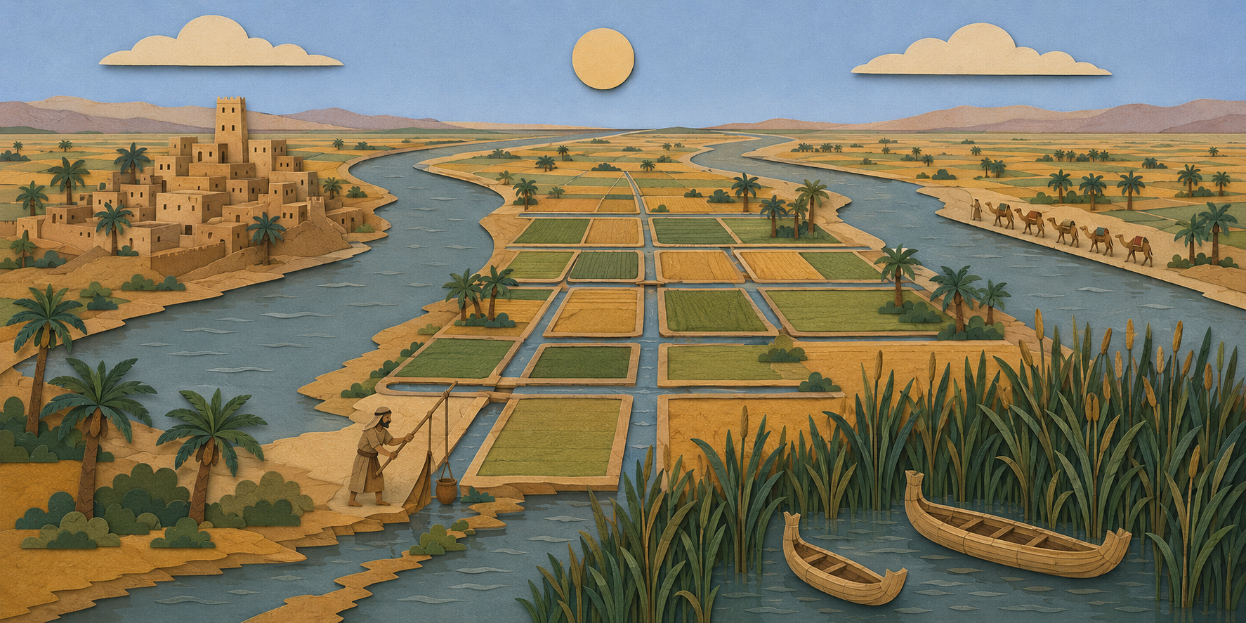
Everything in Mesopotamia depended on the rivers — but the rivers could not be depended on. Egypt’s Nile flooded with almost calendar regularity, leaving behind a fresh layer of fertile soil at just the right season. The Tigris and Euphrates played by no such rules. They flood in late spring, swollen by snowmelt in the mountains of Anatolia, after the winter crops are already standing in the field, and before the summer heat. A strong flood at the wrong moment could drown a year’s harvest. A weak one could starve it.
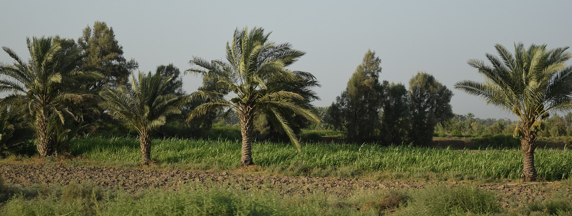
The two rivers also have different personalities. The Tigris is faster, deeper, and more violent: harder to navigate and harder to tame. The Euphrates is slower and shallower. In its lower course it runs slightly higher than the surrounding plain, which makes it ideal for gravity-fed irrigation: the water simply flows downhill into the fields. This is why nearly all the great cities of the south (Ur, Uruk, Nippur, Kish, and Babylon itself) grew up along the Euphrates and its branches rather than the Tigris.
A civilization of canals: Because the floods were untrustworthy, Mesopotamian agriculture ran on irrigation — a vast network of canals, dikes, levees, and reservoirs, all of which had to be dredged, repaired, and policed every single year. That took enormous amounts of labor. Scholars have long noted that this is one reason strong central authority emerged so early here. Somebody had to organize the canal work. Somebody had to settle disputes over water rights and store the surplus grain. The god-king with his granaries and his corvée labor gangs (unpaid labor owed to the state) was, among other things, an answer to an engineering problem.
The reward for all that labor was staggering fertility. Ancient sources describe barley yields on the southern plain that astonished visitors from stonier lands. That surplus fed the first true cities the world had ever seen — and once city dwellers no longer had to farm, they could become priests, scribes, potters, weavers, merchants, and soldiers.
A Land With Everything Missing
The southern plain was rich in grain and poor in almost everything else. That poverty in raw materials shaped Babylonian civilization just as deeply as the fertility did:
| What was missing | The Mesopotamian answer |
|---|---|
| Stone | Build with mudbrick — sun-dried for ordinary walls, kiln-fired and bitumen-mortared for temples, palaces, and city walls. This is why Genesis notes, precisely, “they had brick for stone, and slime had they for morter” (Genesis 11:3). |
| Timber | Import cedar from Lebanon and the Amanus mountains — a trade (and later a conquest route) that pulled Mesopotamian power westward toward the Mediterranean again and again. |
| Metal ore | Import copper from Anatolia and the Gulf, tin from far to the east, iron (later) from the north — paid for with grain, wool, and finished textiles. |
| Defensible borders | There are none. The plain is open steppe and marsh — open to the mountain peoples of the east (Elamites, Kassites, Medes, Persians), the desert tribes of the west (Amorites, Arameans, Chaldeans), and armies moving along the rivers. Mesopotamian history is a rhythm of newcomers arriving, conquering, and becoming Babylonian. |
The result was a civilization that was outward-facing by necessity. Babylon had to trade. And what it traded best, besides grain and wool, was administration itself: writing, accounting, contracts, weights and measures, mathematics, and law. (For how those exports shaped the whole ancient world, including Israel, see Section 05: Writing & Learning.)

Sumer and Akkad, North and South
Mesopotamia was never one thing. The ancient scribes themselves split the southern plain in two: Sumer, the far south toward the Gulf, and Akkad, the region around and above Babylon. Those names outlived their politics. Long after both had faded from the map of power, Babylonian kings still styled themselves “king of Sumer and Akkad” — a claim to the whole ancient inheritance. Northern Mesopotamia, up the Tigris, was Assyria: Babylon’s cultural sibling and political rival for a thousand years. The two shared a language (Akkadian, in different dialects), a script, and most of a pantheon. They fought like siblings, too. (The full story of that rivalry runs through Section 02: Timeline & Empires.)
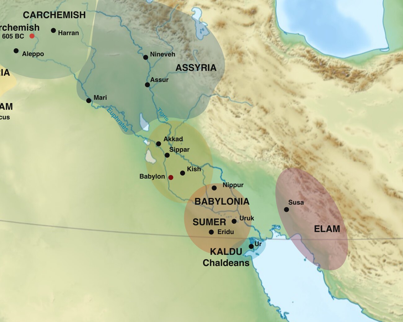
South of Babylon, the rivers dissolve into reed marshes on their way to the Gulf. This was the Sealand: a wetland world of fishermen, reed houses, and water buffalo, and a place nearly impossible for armies to control. It was in and around these marshes, in the early first millennium BC, that the tribes called the Chaldeans (Kaldu in Akkadian; Hebrew kaśdîm, כַּשְׂדִּים) settled and grew powerful. Chaldean chieftains spent a century leading resistance to Assyria. One of them, Merodach-baladan, will matter enormously to the story of Hezekiah. And it was a dynasty of Chaldean stock that finally made Babylon the master of the Near East. By the Bible’s era, “Chaldean” and “Babylonian” had become interchangeable (2 Kings 25:4). Centuries later still, the word had drifted to mean “astrologer” — a tribute to Babylon’s scholarly reputation (Daniel 2:2).
Babylon’s Address
The city of Babylon had a superb address. It sat on the Euphrates in the narrow central plain, where the Tigris and Euphrates run within about fifty kilometers of each other. That made it a natural crossroads, commanding both the river traffic and the overland routes between the Gulf, the Iranian plateau, Anatolia, and the Mediterranean. Its Akkadian name, Bāb-ili, was understood by its own people to mean “Gate of the God,” strictly a singular, though more often rendered in the grander plural, “Gate of the Gods.” The Hebrew prophets heard a different pun in it. To them, Babel recalls the Hebrew root bālal (בָּלַל), “to confuse, to mix” — “because the LORD did there confound the language of all the earth” (Genesis 11:9). Gate of the god, or the place where human pretension was scattered: those two readings of the city’s name are, in miniature, the two ways the ancient world saw Babylon.
For most of its early history, Babylon was unremarkable — one middling town among many. Its rise begins in the era after 2000 BC, and its glory belongs to two dynasties separated by a thousand years: Hammurabi’s (18th century BC) and Nebuchadnezzar’s (7th–6th centuries BC). What carried the city through the long stretch in between was not political power. It was prestige. Babylon became the Near East’s holy city and university town: the seat of Marduk’s great temple and of scribal learning, the place even foreign conquerors needed to be crowned. Assyrian kings who burned other cities knelt at Babylon. And when one of them, Sennacherib, finally destroyed it, his son Esarhaddon rebuilt it. (See Section 06: The City Itself for what the city looked like at its height.)
Why the Bible Says Babylon Is “North”
Look at a modern map and something seems off. Babylon lies almost due east of Jerusalem — about 880 kilometers (550 miles) as the crow flies. Yet Jeremiah insists, “Out of the north an evil shall break forth upon all the inhabitants of the land” (Jeremiah 1:14), and the prophets consistently describe the Babylonian threat as a northern one.
The reason is simple: the crow could not carry an army. Between Jerusalem and Babylon lies the Syrian Desert: hundreds of kilometers of waterless waste that no ancient army could cross. So every soldier, merchant, and exile took the long way around, following the Fertile Crescent: up the Euphrates past Carchemish, through Syria via Riblah and Hamath, and down into Canaan from Damascus — entering the land, always, from the north. The march was roughly 1,400 kilometers (900 miles), and it took a caravan around three to four months. This is the road Abraham’s family took out of Mesopotamia in one direction, and Judah’s exiles took in the other. It is also why Riblah in Syria, not some eastern outpost, is where Nebuchadnezzar sat in judgment on Zedekiah (2 Kings 25:6).
The geography of the whole story: Judah sat on the land bridge between Mesopotamia and Egypt — the only road connecting the ancient world’s two great river civilizations. Every northern empire that wanted Egypt had to march through or beside the hill country of Judah. So did every Egyptian army that wanted to check a northern empire. That single geographic fact sits underneath the entire last century of the kingdom: Assyria, then Egypt, then Babylon, each in turn demanding Judah’s loyalty, because Judah lay on everyone’s way to everyone else. The prophets kept insisting that safety lay in covenant faithfulness rather than in alliances (Isaiah 31:1). Among everything else, that was a clear-eyed reading of the map: a small state between empires could not ally its way out of its position.
The Landscape in Israel’s Memory
Mesopotamia frames Israel’s story at both ends. Abraham came out of it, from Ur by way of Haran (Genesis 11:31), carrying with him the memory of its cities, its ziggurats, and its moon-god worship (Joshua 24:2: “your fathers dwelt on the other side of the flood in old time… and they served other gods”). The earliest chapters of Genesis are set on this same plain. Eden’s rivers include the Hiddekel (Tigris) and Euphrates (Genesis 2:14). The ark grounds in the mountains to the plain’s north. Nimrod’s kingdom begins at “Babel, and Erech, and Accad, and Calneh, in the land of Shinar” (Genesis 10:10): Babylon, Uruk, and Akkad, named in order. And the tower “whose top may reach unto heaven” (Genesis 11:4) rises from the same plain where real brick towers rose. Then, at the story’s other end, Judah is carried back — to canal-side settlements in that same landscape, “by the rivers of Babylon” (Psalm 137:1). The exiles’ new addresses were literally named for the waterworks: Ezekiel’s community lived “by the river of Chebar” (Ezekiel 1:1), the Kabaru canal near Nippur, known from Babylonian records. (The exiles’ world is the subject of Section 07: The Exile Experience.)
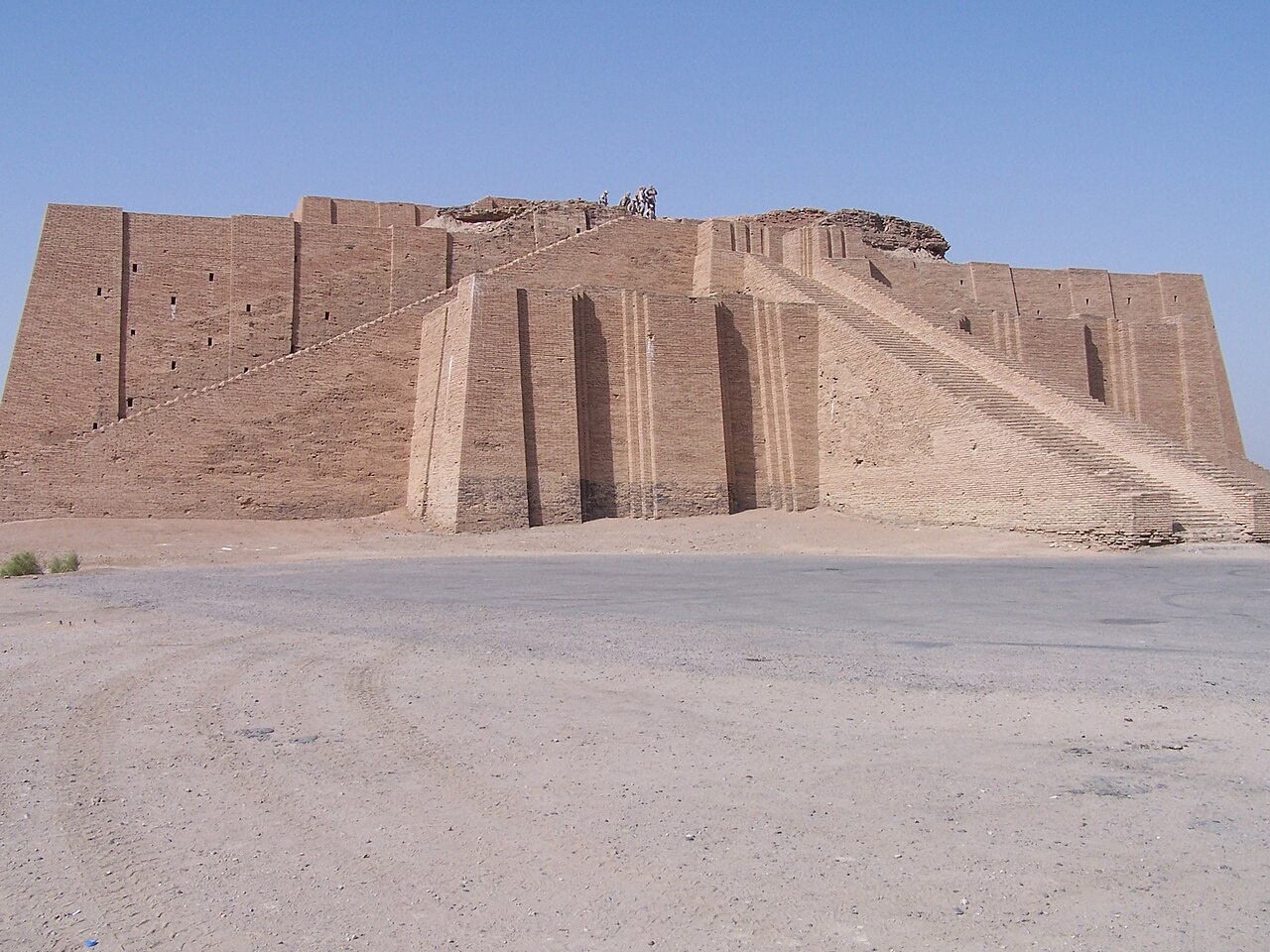
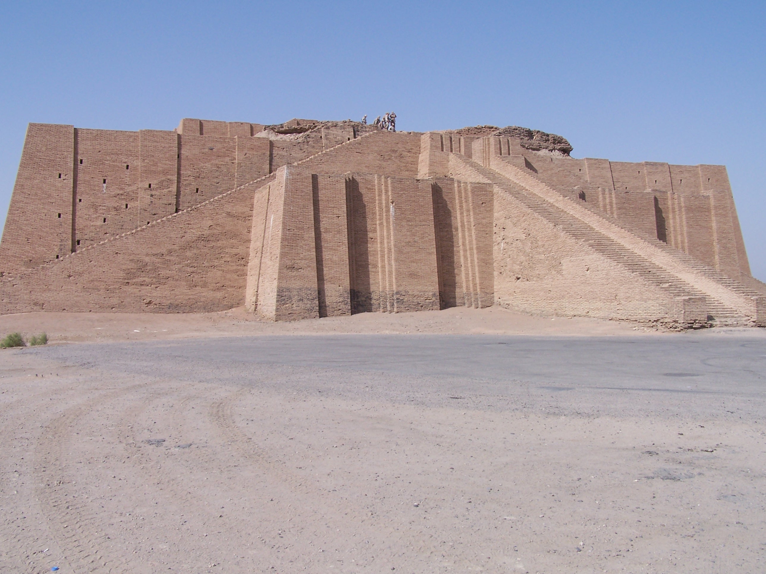
In other words, Scripture’s story is bracketed by this land between the rivers. A covenant family is called out of Mesopotamia at the beginning. A covenant nation is carried back into it at the end — so that the return from Babylon could become the Bible’s great image of every redemption after it.
Sources and Further Reading
- Marc Van De Mieroop, A History of the Ancient Near East, ca. 3000–323 BC (Wiley-Blackwell, 3rd ed. 2016) — The standard one-volume survey; excellent on geography, irrigation, and the rhythm of newcomers becoming Babylonian.
- A. Leo Oppenheim, Ancient Mesopotamia: Portrait of a Dead Civilization (University of Chicago Press, rev. ed. 1977) — The classic interpretive portrait of Mesopotamian civilization and its material constraints.
- Paul-Alain Beaulieu, A History of Babylon, 2200 BC–AD 75 (Wiley-Blackwell, 2018) — The most current scholarly history of Babylon specifically, from first mention to final cuneiform tablet.
- Amélie Kuhrt, The Ancient Near East, c. 3000–330 BC (Routledge, 1995) — Detailed two-volume treatment with careful attention to sources.
- Marc Van De Mieroop, The Ancient Mesopotamian City (Oxford University Press, 1997) — How Mesopotamian urbanism actually worked — temples, neighborhoods, canals, and markets.
- Joan Oates, Babylon (Thames & Hudson, rev. ed. 1986) — Accessible illustrated overview of the city and its civilization.
Online Resources:
- WHE — Mesopotamia (CC BY-NC-SA 4.0)
- WHE — Babylon
- WHE — Fertile Crescent
- Bible Odyssey — Society of Biblical Literature articles on Babylon and the exile.