The Assyrian Heartland
The rain-fed highland that raised the world’s first empire — and why it could never rest
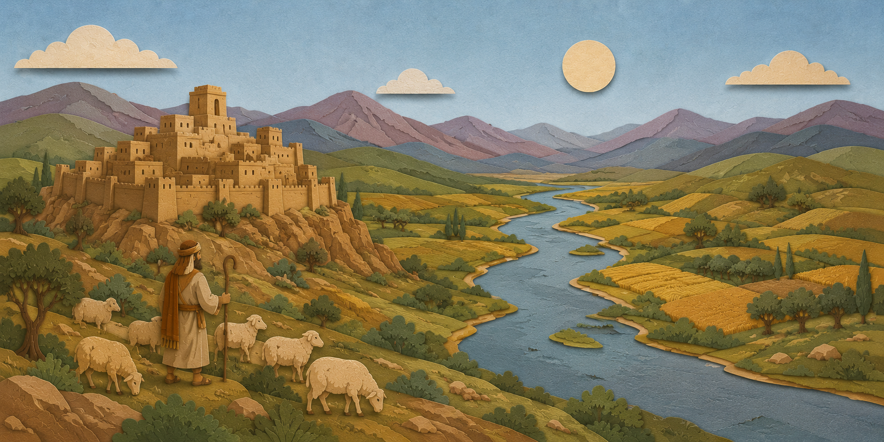
Assyria was born on the upper reaches of a single river. Babylonia spread across the flat, irrigated floodplain of the far south. The Assyrian homeland was a different world. It lay hundreds of kilometers to the north, along the Tigris as it runs down out of the hills onto the rolling plains of what is now northern Iraq. This was rougher, higher, cooler country — the northern edge of the Fertile Crescent, where the mountains of the Zagros and the Armenian highlands begin to rise. It was a good land to farm and a hard land to hold. Both facts left their fingerprints on everything Assyria became.
This landscape is the first step to understanding the empire. It explains why Assyria’s farms were secure while its borders never were. It explains why a kingdom that began as a single trading city ended up conquering from Egypt to Iran. And it explains why the Bible met Assyria before it met Babylon — always coming down the same road from the north. Geography did not make Assyria cruel. But it did make Assyria anxious, and an anxious power on an open frontier is a dangerous thing.

The Rain That Made a Different Kingdom
The single most important fact about the Assyrian heartland is this: it did not depend on irrigation. Southern Mesopotamia lies below the line where rainfall alone can raise a crop. Down there, as the Babylon guide describes, farming meant an endless labor of canals, dikes, and dredging, and the whole civilization organized itself around controlling water. The Assyrian core sat above that line. Its belt of hills and plains catches enough winter and spring rain — roughly the 250-millimeter threshold that separates dry-farming country from desert — to grow barley and wheat straight from the sky.
This is rain-fed highland agriculture, and it changed the character of the state. An Assyrian farmer was not chained to a canal schedule or a god-king’s water rights. The land was more forgiving. The harvests were more secure. The population was healthier and denser than the marsh edges to the south could easily sustain. But there was a trade-off. Rain-fed land could still fail in a dry year, and the whole region sat far closer to the mountains — and to the mountain peoples — than comfortable Babylon ever did. Assyria enjoyed a fuller granary and a thinner shield.
Two Mesopotamias, one river system: it is easy to speak of “Mesopotamia” as a single place. But the north and the south were as different as highland and lowland can be. The south was irrigated, hot, and flat, its cities strung along the sluggish lower Euphrates. The north was rain-watered, cooler, and rolling, its cities set on the swifter Tigris where it leaves the hills. The two shared a script, a literature, and most of a pantheon — and quarreled like the siblings they were, for the better part of two thousand years. The Tigris even runs through the Bible’s map of Eden — the third of its four rivers: “the name of the third river is Hiddekel: that is it which goeth toward the east of Assyria” (Genesis 2:14) — the Tigris, Assyria’s own river, already fixing the land’s address in the second chapter of scripture.
The Four Corners of the Homeland
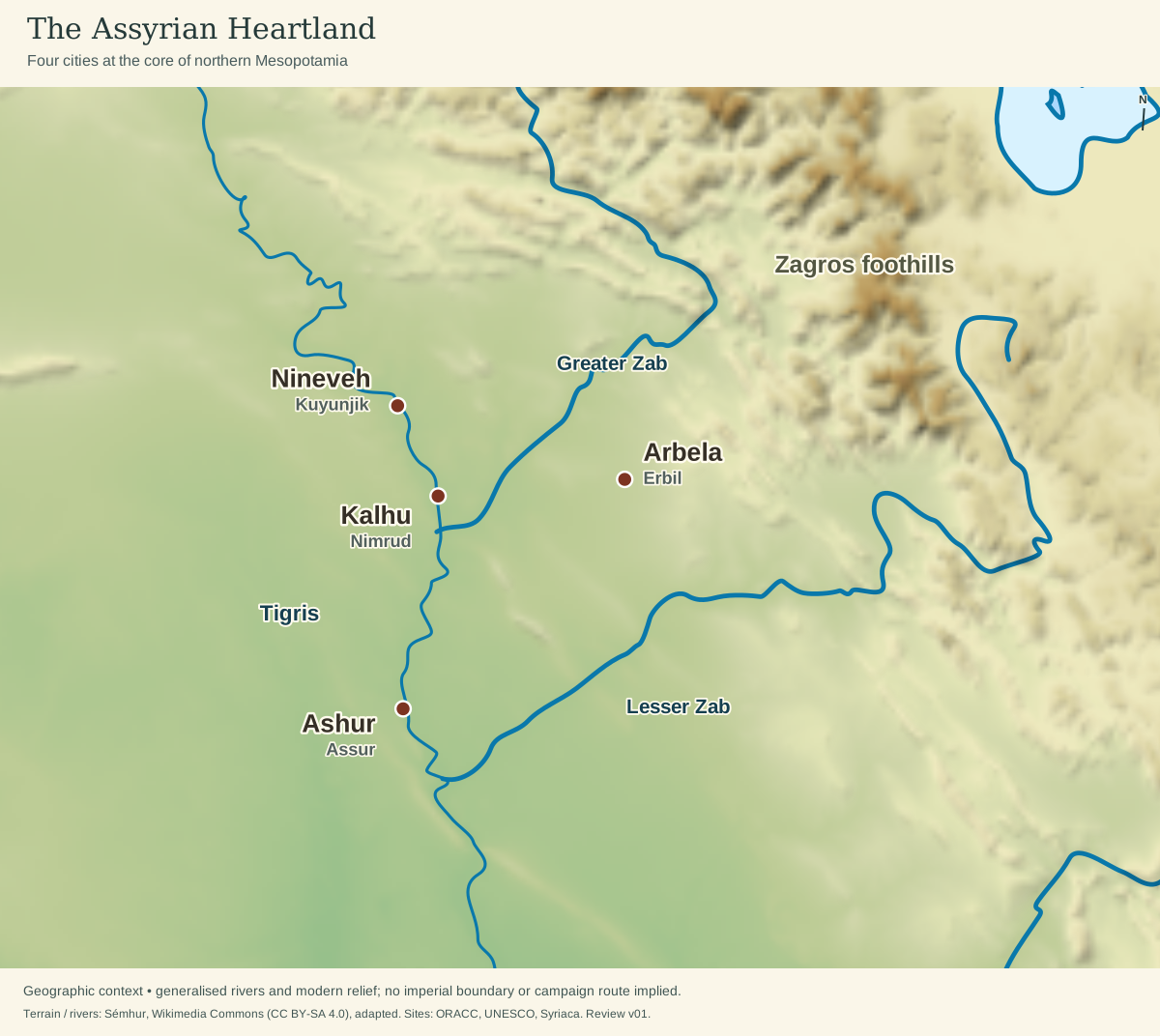
Map adapted from Sémhur, Wikimedia Commons · CC BY-SA 4.0. Cropped and relabeled; modern relief and generalized rivers provide geographic context.

Site sources: Nineveh · Kalhu · Ashur · Arbela.
The Assyrian heartland was small — a compact core of plains east of the Tigris that a good marcher could cross in a matter of days. Four great cities anchored it. Connect the four and you have outlined the heartland itself: a holy city, a royal capital, a great metropolis, and an eastern watchtower.
Ashur — the city that gave everything its name
On a rocky bluff over the Tigris, at the southern tip of the homeland, stood Ashur (Assur). It was the oldest of the cities — and the source of the name that the god, the land, the people, and the empire would all share. This was the holy city: the seat of the national god, and for centuries the place where kings were crowned and buried even after the court had moved on. Assyria did not take its name from a dynasty or a conqueror. It took it from this one small, ancient, sacred town. (The cities in full — Ashur, Kalhu, Khorsabad, and Nineveh — are toured in The Great Cities.)
Kalhu — the biblical Calah
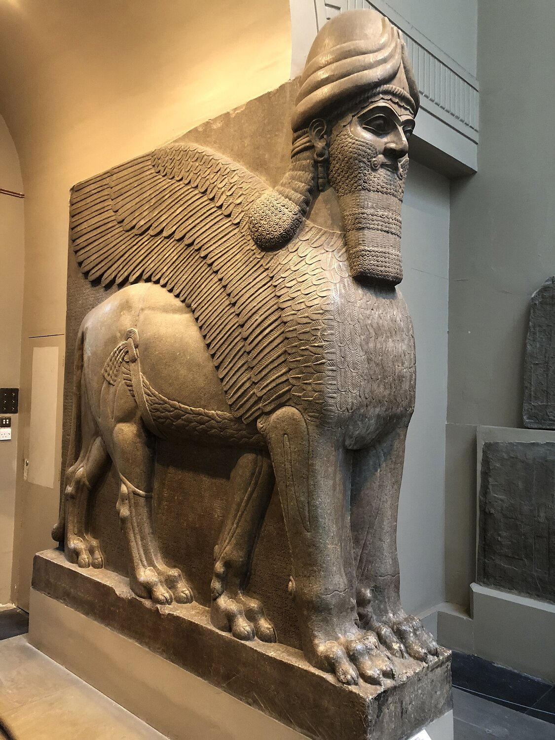
Upriver from Ashur, near where the Great Zab pours into the Tigris, lay Kalhu (the Calah of the Bible; today the mound is called Nimrud). In the ninth century BC, Kalhu was rebuilt into an imperial capital of winged bulls and palace reliefs. Even its names tie it to the primeval hunter-king of scripture: Nimrud, Calah, Nimrod. It was here, and in the cities around it, that the machinery of empire took its recognizable shape.
Nineveh — the city the Bible knew best
Farther north still, opposite modern Mosul, rose Nineveh — the largest and most famous of the capitals. This is the “exceeding great city” of Jonah (Jonah 3:3) and the doomed “bloody city” of Nahum (Nahum 3:1). To the biblical writers, Nineveh simply was Assyria — the face the empire turned toward Israel and Judah, and the name they reached for when they meant the whole northern power.
Arbela — the eastern anchor
Out on the plain between the Great and Little Zab, toward the foothills of the Zagros, stood Arbela (modern Erbil, one of the longest continuously inhabited cities on earth). Arbela does not appear in the Genesis city-list, and it was never a royal capital. But in Assyrian eyes it was indispensable. It was the cult center of Ishtar of Arbela, the fierce war-goddess whose oracles steadied kings on the eve of battle. And it was the empire’s watchtower on its most exposed frontier. Ashur, Kalhu, Nineveh, Arbela — god, throne, army, and the mountain edge — the four corners of a heartland barely a hundred kilometers across.
A Land Without a Moat
For all its fertile plains, the Assyrian core had one incurable weakness: it lay open. Babylon, far to the south, was buffered by deserts and marshes, and by the whole length of Mesopotamia between itself and the mountains. Assyria had no such cushion. Its heartland pressed right up against the highlands, and it was ringed on nearly every side by peoples who wanted what it had — or wanted a road through it.
To the east and north reared the Zagros ranges and the Armenian highlands — home to the tough mountain peoples the Assyrians fought for centuries (Gutians and Lullubi in the old days; later the kingdom of Urartu around Lake Van, and the Medes gathering on the Iranian plateau). To the west spread the open steppe of the Jazira, across which Aramean tribes drifted and raided. To the south lay the constant rival, Babylonia. There were no natural walls. There were no defensible chokepoints sealing the homeland off — only the cities themselves, and the armies that sortied out from them. An Assyrian king could lose his heartland in a single bad campaign season.
A state in that position learns one lesson early and never forgets it: the best defense is a frontier pushed as far away as possible. Assyria’s answer to its exposure was not higher walls but distance. Campaign outward, year after year. Drive the threat back from the plains. Seize the mountain passes and the western trade roads. Turn neighbors into tribute-payers before they can turn into invaders. The relentless, annual, almost ritual warfare that would terrify the ancient world was, at its root, a frightened highland kingdom refusing to wait for the next attack. That militarized reflex — and the extraordinary army it produced — is the subject of The War Machine. It was also, in the prophets’ reading, exactly the pride that would one day bring the empire down (Timeline & the Rise of Empire).
“Out of That Land Went Forth Asshur”
The Bible plants Assyria’s roots in its opening chapters. In the Table of Nations — the list of the world’s peoples in Genesis 10 — Asshur is one of the sons of Shem (Genesis 10:22). Ancestor, land, and city are all folded into that one name, exactly as in the Assyrians’ own usage. And in the account of Nimrod’s kingdom, scripture names the founding cities of the north in a single breath: “Out of that land went forth Asshur, and builded Nineveh, and the city Rehoboth, and Calah, And Resen between Nineveh and Calah: the same is a great city” (Genesis 10:11–12). Nineveh and Calah — two of our four corners — stand in the text at the very origin of the world’s nations.
Scripture ties the land to Nimrod again through the prophet Micah. In a single line, he lays the two names side by side. The defenders Israel raises up “shall waste the land of Assyria with the sword, and the land of Nimrod in the entrances thereof” — and “thus shall he deliver us from the Assyrian, when he cometh into our land” (Micah 5:5–6). “The land of Assyria” and “the land of Nimrod” are one and the same country — the northern highland whose cities Genesis had already named.
A verse with two readings: the Hebrew of Genesis 10:11 is genuinely ambiguous, and translators have long divided over it. The King James Version makes Asshur the one who “went forth… and builded Nineveh” — the patriarch founding his own land. Many later versions, following an equally old reading, make the subject Nimrod instead: “out of that land he went into Assyria, and built Nineveh” — the Babel-builder of the previous verse extending his reach northward. Micah’s pairing of Assyria with “the land of Nimrod” is why that second reading appeals to so many. Either way, the geography is the same. In the Bible’s telling, the great cities of the north trace their beginnings back to the first age of kingship on the Mesopotamian plain.
Why the Rod Always Came from the North
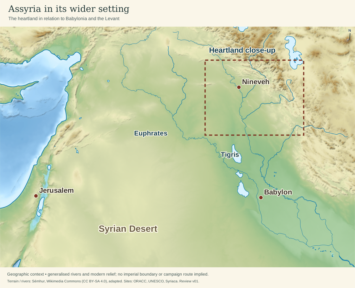
Map adapted from Sémhur, Wikimedia Commons · CC BY-SA 4.0. Cropped and relabeled; modern relief and generalized rivers provide geographic context.
Site sources: Babylon · Jerusalem.
Look at a map, and the Assyrian heartland lies well to the east and north of Jerusalem. But an army could not travel as the crow flies. Between Assyria and the land of Israel stretched the waterless Syrian Desert — uncrossable for a marching host. So every Assyrian campaign, like every Babylonian one after it, had to swing up and around the top of the Fertile Crescent: northwest along the Tigris and across the Jazira, then down through Syria toward Damascus. Every invasion entered the land of Israel from the north. This is the same geographic arc the Babylon guide traces; Assyria is simply the empire that made that road famous first.
So when the prophets speak of judgment breaking “out of the north” (Jeremiah 1:14), they are reading the map as much as the heavens. Isaiah pictures the Assyrian threat as the great river itself rising and overflowing its banks — “the waters of the river, strong and many, even the king of Assyria… and he shall come up over all his channels, and go over all his banks” (Isaiah 8:7) — the flood of the north pouring down onto Israel. It was down that northern road that Tiglath-pileser came to strip Galilee (2 Kings 15:29). And it was down that road that Israel was carried away “into Assyria, and placed… in Halah and in Habor by the river of Gozan, and in the cities of the Medes” (2 Kings 17:6) — back up the same road, into the highland heartland this section has traced. (That deportation, and the fate of the northern tribes, is the story of The Fall of the North.)
The heartland, then, is the key that unlocks the whole empire. A rain-fed breadbasket gave Assyria the strength to rise. An exposed frontier gave it the fear that turned it outward. And the geography of the crescent aimed that outward force, again and again, straight down the northern road toward the covenant people — who first learned the name of a world empire from the mountain kingdom that always came from the north.
Sources and Further Reading
- Eckart Frahm, Assyria: The Rise and Fall of the World’s First Empire (Basic Books, 2023) — The current authoritative narrative history; excellent on the heartland, its cities, and the making of empire.
- Karen Radner, Ancient Assyria: A Very Short Introduction (Oxford University Press, 2015) — A concise, reliable overview of the land, the cities, and the institutions of the empire.
- Marc Van De Mieroop, A History of the Ancient Near East, ca. 3000–323 BC (Wiley-Blackwell, 3rd ed. 2016) — The standard one-volume survey; clear on the difference between rain-fed north and irrigated south.
- Amélie Kuhrt, The Ancient Near East, c. 3000–330 BC (Routledge, 1995) — Detailed two-volume treatment with careful attention to geography and sources.
- Bill T. Arnold, Who Were the Babylonians? and the companion literature on the north — helpful on the biblical geography of Mesopotamia and the Table of Nations.
- K. Lawson Younger Jr., A Political History of the Arameans (SBL Press, 2016) — On the peoples of the Jazira steppe who pressed on Assyria’s western frontier.
Online Resources:
- WHE — Assyria (CC BY-NC-SA 4.0)
- Livius.org — Assyria — overview of the land, cities, and history.
- British Museum — the Assyrian galleries — home of the reliefs and colossi from the heartland’s great cities.